
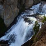
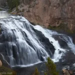
Moose Falls would be a tourist stop if it was a little more popular. Actually, it already brings in plenty of people who don’t want to hike very much but who do want to see a waterfall. The trail is a little more rugged than most of them anticipate, but there is a place where you can see the falls from above, so many people stop there. If you’re intrepid (am I saying something about myself here?), you can scramble down the steep path to the bottom of the falls – and the view is even better!
Quick Stats
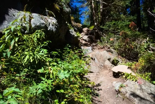
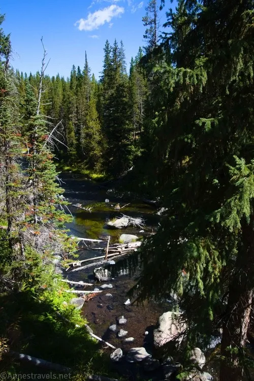
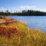
The parking area for Moose Falls is unassuming, just a large pulloff a few miles north of the southern entrance to Yellowstone National Park. The trail is just as unassuming, little more than a dirt singletrack through the woods. Don’t worry; the view gets better!
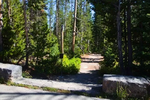
After about 350ft., the trail exits the forest. Head right over to a small viewing area where you can peek over the edge and see Moose Falls.
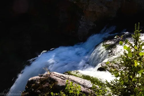
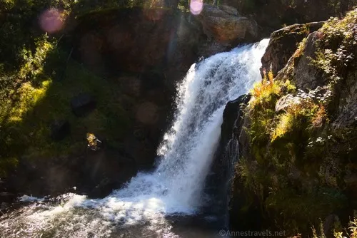
The view from here is nice. And if you’re not in the mood for a slippery trail, or if you’re not wearing good shoes, stay up here.
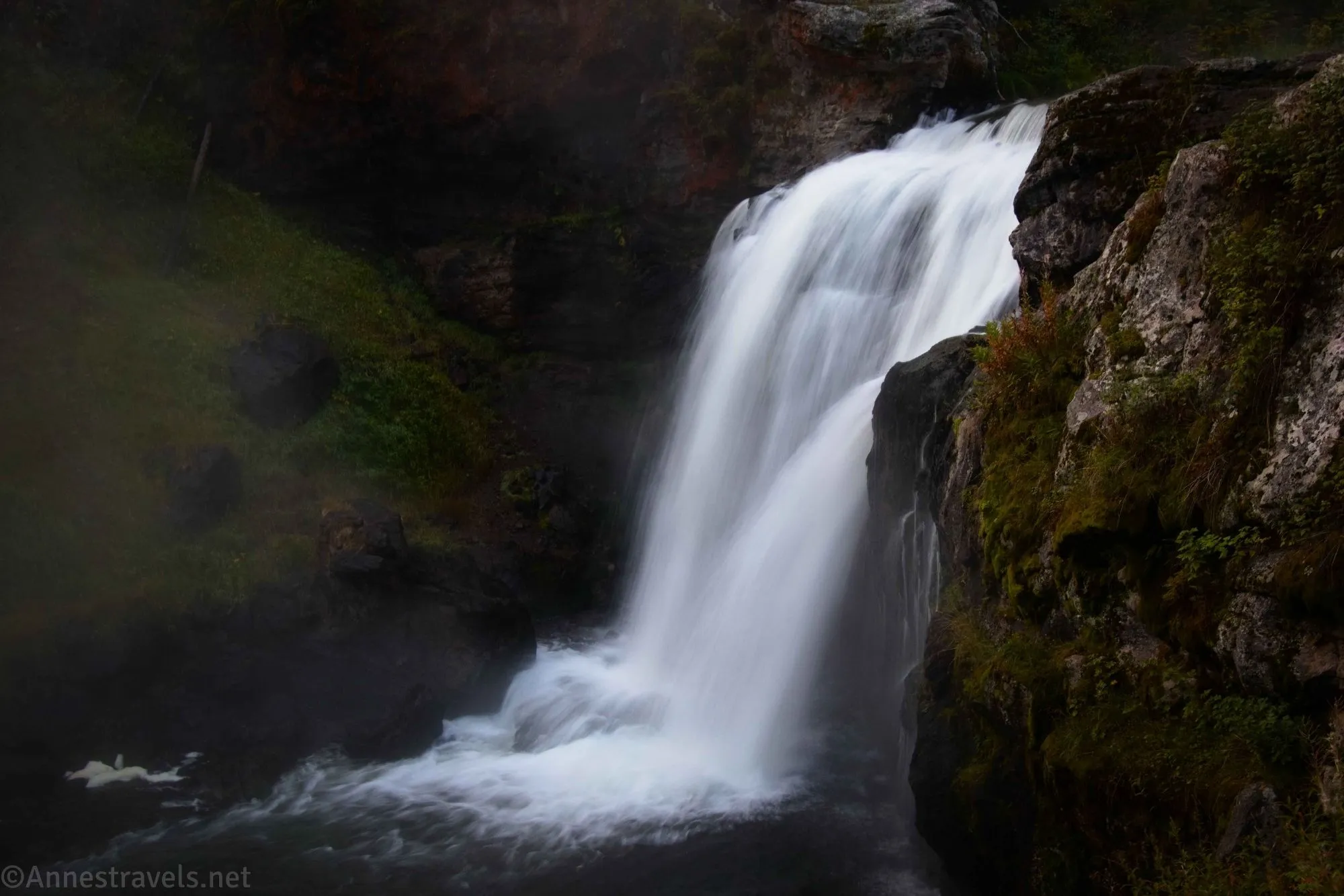
However, if you want a better view (I was highly disappointed by the first overlook), follow the official trail (or as close to the official trail as you can – there are multiple social paths) down toward the river.
The view from here is much better!
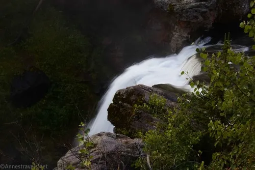
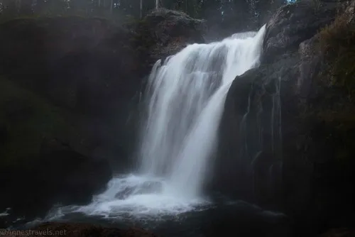
Actually, I visited in the early afternoon, and the sun was at totally the wrong angle for good photos. I knew there must be a good time of day; a friend had posted about Moose Falls on MeWe, which was part of why I really wanted to stop at the falls (his picture was lovely!) So I stopped again on my way into Yellowstone the next day, and the early morning mist and darkness was the perfect combination to get those silky waterfall shots.
When you’re finished enjoying the falls, climb back up and to your vehicle. It’s not long, it’s harder than it looks, and it is a pretty little falls if you happen to have time in the southern part of Yellowstone!
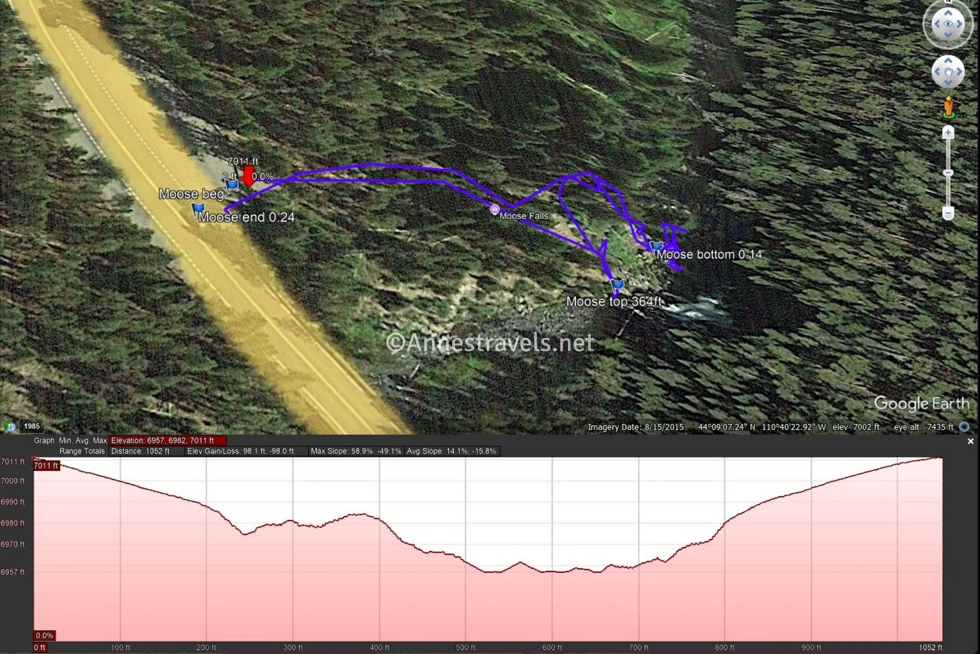
Round Trip Trail Length: I went 0.25 miles total
Elevation Gain: 98ft. (7,011ft. to 6,957ft.)
Facilities: None
Fees: $35/vehicle, valid 7 days. America the Beautiful National Parks & Federal Public Lands Passes and Yellowstone Annual Passes are accepted
Trail Notes: Wear good shoes on this trail, as it’s rougher than it looks at the start. Use care near the edge and especially when descending to the river. I saw people fishing downstream from the falls (permit required). The sun might shine at a better angle in the morning than in the afternoon, though it was so far south (the sun, that is) in September that I’m not sure if the morning sunshine would help or not. I preferred photographing the falls in the early morning, though the evening would also probably be fine since the waterfall will be in shadow by then.
Trail 
![]()
![]()
![]()
Road
Signs ![]()
![]()
![]()
Scenery ![]()
![]()
Would I go 100 miles out of my way for this? ![]()
![]()
Overall Rating: ![]()
![]()
GPS Coordinates for Moose Falls
TH: 44.1520210°, -110.6736090° (44°09.12126′, -110°40.41654′ / 44°09’07.2756″, -110°40’24.9924″) (7,003ft.) (0.0)
Top of Moose Falls: 44.1518910°, -110.6727430° (44°09.11346′, -110°40.36458′ / 44°09’06.8076″, -110°40’21.8748″) (6,973ft.) (364ft.)
Bottom of Moose Falls: 44.1519910°, -110.6726300° (44°09.11946′, -110°40.35780′ / 44°09’07.1676″, -110°40’21.4680″) (6,966ft.) (0.14)
End at TH: 44.1519760°, -110.6736720° (44°09.11856′, -110°40.42032′ / 44°09’07.1136″, -110°40’25.2192″) (7,003ft.) (0.24)
The gpx file for Moose Falls can be downloaded – please note that this and the GPS Coordinates are for reference only and should not be used as a sole resource when hiking this trail.
Download GPX File size: 7.6 KB Downloaded 28 times
(Note: I do my best to ensure that all downloads, the webpage, etc. are virus-free and accurate; however, I cannot be held responsible for any damage that might result, including but not limited to loss of data, damages to hardware, harm to users, from use of files, information, etc. from this website. Thanks!)
Getting to the Moose Falls Trailhead
From the southern entrance to Yellowstone National Park, drive 1.2 miles north from the entrance station. The pulloff for Moose Falls will be on the right.
From West Thumb Junction (north of Grant Village), drive south toward Grand Teton National Park for 20.0 miles. The pulloff for Moose Falls will be on the left.
More Hikes in Yellowstone
Take the ranger’s advice with this book! An honest-to-goodness park ranger in Yellowstone put together his best trails for you to discover. Buy your copy here.


Pingback: An Itinerary to Hike All the Trails in Arches National Park! – Anne's Travels
Pingback: How I Hiked 100 Miles in Yellowstone National Park in 11 Days – Anne's Travels