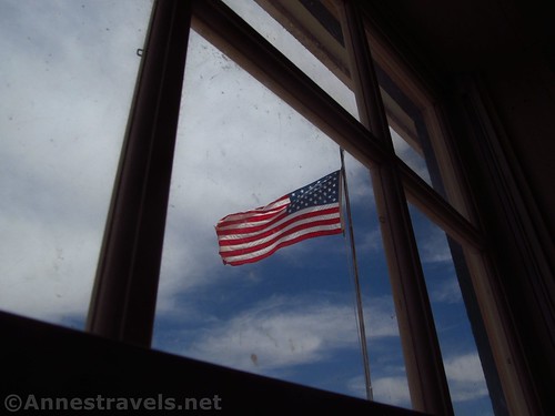
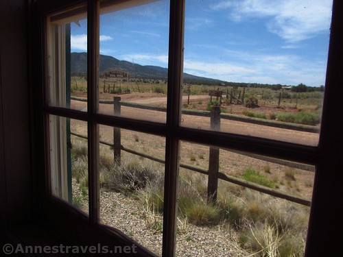
You’d better be up for an adventure if you want to see the historic Mount Trumbull Schoolhouse – it’s at least 60 miles of questionable dirt roads to get there. We certainly had a good time visiting, but we were en route back from not quite finishing the Whitmore Trail and heading back to the Toroweap area to fail at the Lava Falls Trail the next day (we were having quite the time trying to enjoy Grand Canyon-Parashant National Monument!) The schoolhouse was a nice respite in the middle of the extremely remote area, so I’d highly recommend at least a five minute stop to use the restroom (BYOTP) and peek inside the schoolhouse.
Quick Stats
There’s actually more than just a restroom and the schoolhouse. The parking area is large enough for a dozen or more vehicles (which is good; most people who take the roads out here are jeeping with friends, so there might be a half dozen vehicles in each caravan – note that all vehicles must be street legal). There’s an old basketball hoop in the parking area along with a picnic pavilion. On another side of the parking area are an old truck (yes, we climbed inside), some other odd equipment, and the restrooms.
But much more exciting – or at least, much more fun – was the swing set and see-saws behind the schoolhouse. We all took turns on the swings (which work quite well) and the see-saws (which look like someone had too much fun with a welder, but are quite fun to use – they’re still the dangerous kind, so watch your feet). After hours of intense driving on the Whitmore Trail, it was great to let off a little steam on the adult-worthy play equipment.
I also spent quite a bit of time inside the Mount Trumbull Schoolhouse. The original schoolhouse (well, really the second one – the first was too small for the thriving town) was built in 1922. Generations of children (most of whom seemed to have the last name of Bundy) went to the school until the population of 250 in the 1930s dwindled into the 1960s. In 1968, there were too few children attending the school to warrant paying a teacher, and the remaining children were bussed to larger schools. The last full-time resident of Mount Trumbull moved away in 1984.
Sadly, the original schoolhouse was burned in the early 2000s. The residents pulled together and rebuilt the schoolhouse, which is the building we visited. It’s very nice inside – wooden floors and walls, a blackboard, the teacher’s desk, bookcases, a piano (which is not even close to being in tune, or I would have played it), and historic photos on most of the walls. There are also time-period schoolbooks on some of the shelves. I didn’t look at them too closely, but the older members of my group did, and they remembered using some of the same books in their studies.
There is also an exhibit of Grand Canyon-Parashant National Monument; there may also be maps of the area – I found this helpful since I hadn’t found a map like this anywhere else. On some of the shelves, specimens of local animals were interesting.
Overall, you aren’t going to spend an entire day here (unless you really like to relax). But it was a fun place to hang out for about an hour (we took our good ol’ time) and take a break after some crazy roads!
Facilities: Picnic tables and a primitive restroom (no toilet paper, but we come prepared)
Fees: None
Notes: Use respect here. Also, be aware that it’s dozens of miles of dirt roads to get to the schoolhouse. The roads we took were fine for high-clearance (no 4×4) when dry (drive slow – there are rocks!)
Trivia: The Bundy families here are related to the man of the same last name in Nevada who made international news a few years back when he “defied” the national government regarding grazing fees/rights. There’s also a fairly modern gate just east of the schoolhouse with the family name of Bundy on it. So they’re still around!
Bonus Trivia: The Mt. Trumbull Schoolhouse is almost exactly 1 mile above sea level!
Road 


Signs 


Scenery 


Interest 


Fun Factor 


Exhibits 


Would I go 100 miles out of my way for this? 


Overall Rating: 


Mount Trumbull Schoolhouse GPS Coordinates
Mount Trumbull Schoolhouse: 36.4121000°, -113.3262667° (N36° 24.726′ W113° 19.576′ / 36°24’43.5600″, -113°19’34.5600″) (5,283ft.)
Getting to the Mount Trumbull Schoolhouse
From St. George, drive south on I-15. Take Exit 2 toward UT-7; stay in the left lane on the exit to stay left to cross the bridge and then continue straight on UT-7 West. After 3.1 miles, take the exit (on right) toward River Road. Turn right at the end of the exit ramp to immediately cross the state line into Arizona. The road becomes dirt. Drive south about 38.5 miles, staying right when a road to a radio tower diverges left after about 14.3 miles. Stay right for another 8.1 miles and stay right again for another 3.1 miles to the Mt. Trumbull Schoolhouse.
From a more easterly direction, take the road to Toroweap southward (the road is along AZ-389 and is 5.1 miles east of the road to Pipe Springs National Monument and 8.3 miles west from the US-89A / AZ-389 junction in Fredonia). Drive south toward Toroweap about 27 miles (take it slow, about 30mph or less, to avoid flat tires). Right about the national monument border, turn right onto another road, following the sign for the Whitmore Trail, Mt. Trumbull, etc. (This turn may be 18 miles later than the 27 miles – follow the signs!) After about 3 miles, a road will go off on the left to the Nampoweap Petroglyphs. Continue another 15 miles or so to the Mount Trumbull Schoolhouse (don’t confuse Mount Trumbull with the Mount Trumbull Schoolhouse – you’ll pass the trailhead for the mountain high up the in mountains before descending back down to the schoolhouse in the next valley).
Zoom map out to browse nearby hikes & places of interest
This Week’s Featured Product!
Despite its title as a hiking guide to Arizona, the book is actually a travel guide to points of interest in northern and central Arizona, southern Utah, and Valley of Fire in Nevada. Trails are explored, but so are worthy destinations without hiking trails.


