
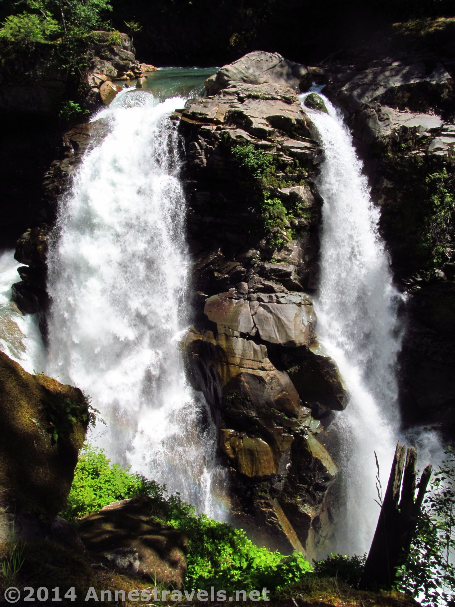
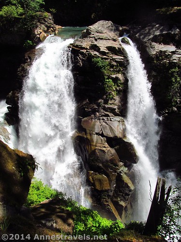
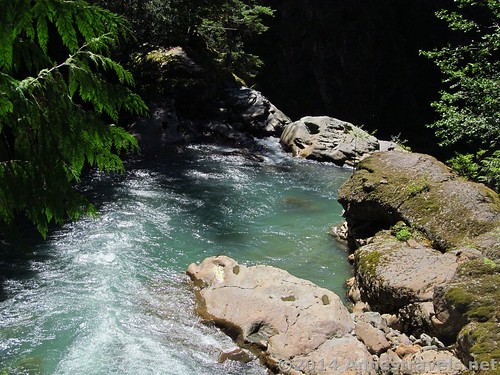
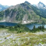
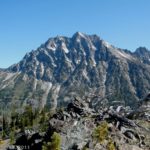
We wanted a place to eat lunch. Really, that’s all we were looking for. A convenient dirt side road appeared as we drove along the Mt. Baker Highway, so we took it, figuring we could, at the very least, pull over in the pines and make sandwiches (not to mention get the homemade jelly out of the cooler – yum!) That’s how we stumbled into the parking area for Nooksack Falls. After lunch we couldn’t very well just leave, so we took the short trail to see the falls.
Quick Stats
(Affiliate links are present on this page.)
In all, I think the “walk” was about 0.3 miles, so it’s not a difficult trail. However, it can be difficult to get a good view of the falls, not only because it’s just plain difficult, but because it’s fairly popular with the locals, so there was a crowd in the small viewing area.
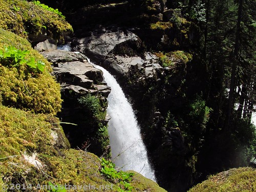
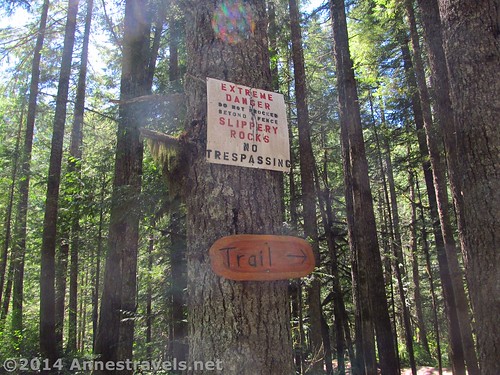
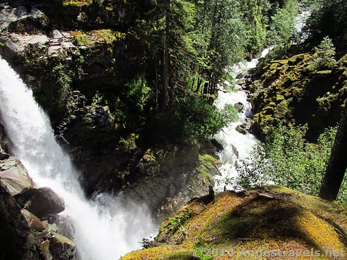
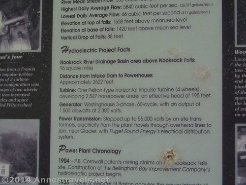
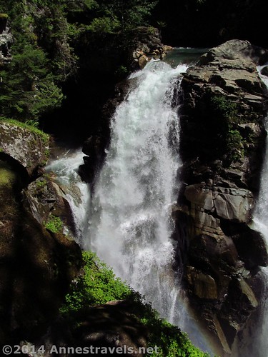
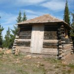
The trail begins next to the sign board (which is very interesting, by the way) across the road from the parking area. The trail itself is pretty self-explanatory, so enjoy the pictures!
Overall? It’s probably worth a side trip off the Mt. Baker Highway to see. But only if you have the time or are looking for easy trails.
Round Trip Trail Length: 0.3 miles
Highest Elevation: 1,708 ft.
Lowest Elevation: 1,446 ft.
Net Elevation Change: 262 ft.
Facilities: None
Fees: $5 per day per vehicle…
Trail 
![]()
![]()
Road ![]()
![]()
Signs ![]()
![]()
Scenery ![]()
![]()
Would I go 100 miles out of my way for this? ![]()
![]()
![]()
Overall Rating: ![]()
![]()
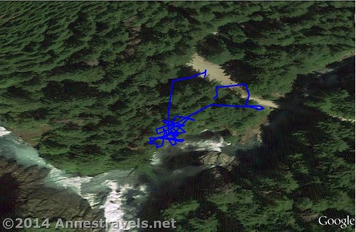
Key GPS Coordinates
Parking: 48.90561N / -121.80898W (48° 54′ 20.196″ / -121° 48′ 32.328″) (1,446ft.)
Trail beginning: 48.90577N / -121.80904W (48° 54′ 20.7714″ / -121° 48′ 32.5434″) (1,708ft.) (ended 0.2 or 0.3)
Viewing area: 48.90538N / -121.80920W (48° 54′ 19.368″ / -121° 48′ 33.12″) (1,677ft.)
Brink View: 48.90549N / -121.80878W (48° 54′ 19.764″ / -121° 48′ 31.6074″) (1,536ft.)
The gpx file for the Nooksack Falls Trail can be downloaded – please note that this and the GPS Coordinates are for reference only and should not be used as a sole resource when hiking this trail.
Nooksack Falls GPX File size: 9.0 KB Downloaded 492 times
(Note: I do my best to ensure that all downloads, the webpage, etc. are virus-free and accurate; however, I cannot be held responsible for any damage that might result, including but not limited to loss of data, damages to hardware, harm to users, from use of files, information, etc. from this website. Thanks!)
Getting to the Parking Area
From the Glacier, WA ranger station, drive 7.0 miles east on WA-542 (Mt. Baker Highway). Turn right onto NF-33 (dirt road) following the signs for Noioksack Falls (If there isn’t a sign, don’t worry). Continue 0.5 miles to the parking area, on left. The trail begins on the right.
Zoom map out to browse nearby hikes & places of interest
This Week’s Featured Product!
For more hikes in the Mt. Baker area – as well as other parts of Washington – check out this book.
2 responses to “(Accidentally) Visiting Nooksack Falls”
[…] Nooksack Falls along the Mt. Baker Highway in Washington is a very short little trail through a pleasant pine forest […]
[…] Nooksack Falls, Mount Baker-Snoqualmie National Forest, Washington. This has got to be one of Mt. Baker’s hidden gems. Sure, there aren’t views of the mountain, but the waterfall is still a great short side hike away from the higher elevation hikes. 3 miles RT […]