Last summer, I happened to be driving north along the coast of California (it’s a lot cooler than driving I-5, that’s for sure!) The day after our little adventure in Prairie Creek Redwoods State Park (the Ossagon Trail down to Fern Canyon), we headed up to Samuel H. Boardman State Park. I felt we hadn’t done the park justice back in 2016, when we visited only some natural bridges and the Arch Rock Picnic Area, so it seemed natural to follow a guide I found on the internet about the nicest section of the Oregon Coast Trail in the park. It’s up for debate whether this is the nicest section (I simply don’t know), and it certainly wasn’t what I was expecting, but it had some beautiful places and lots of rain forest along the way. I ended up hiking between Whaleshead Beach and China Beach – including across the tallest bridge in Oregon!
Quick Stats
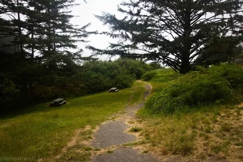
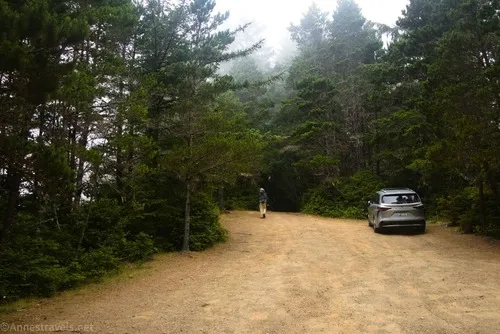
We parked at the Whaleshead Picnic Area. What we should have done was to park at the top of the hill… the road down to the picnic area is exceedingly steep, 4×4 is rightly recommended, and we were a little nervous about getting back up! But we haven’t driven dirt roads before for nothing, and we made it back up that evening without incident (thankfully!) So I’ll start by telling you about the part of the trail you should skip, or at least how I’d do it differently were I to do this hike again.
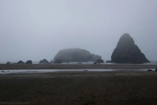
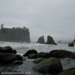
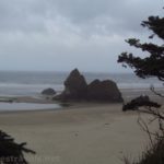
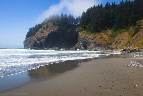
From the parking area, we headed down the rough paved trail to the beach. It was a misty, gray, miserable morning, but I took some pictures of the beach anyway.
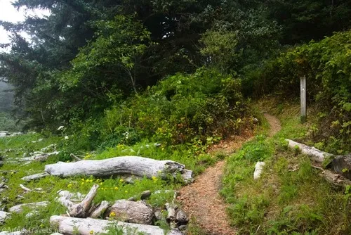
We crossed over the creek (not too hard, thankfully – it’s very shallow) and finally located a footpath that would take us up to the Oregon Coast Trail, which is just inside the fringe of the trees. We turned left (north on the trail), and were happy to finally be on the route… until it dumped us out behind the restroom we had used 10 minutes earlier right next to the parking area. Well, that was a bit of a waste of time and energy!
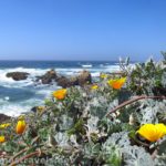
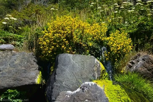
The Oregon Coast Trail makes a hard right at the bathroom (right as though you’re facing the parking area/ocean) and fairly quickly exits the trees in a meadow. The path here is overgrown and not much fun to climb steeply, though there were some nice wildflowers.

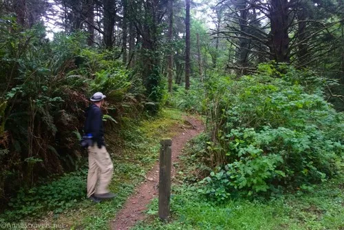
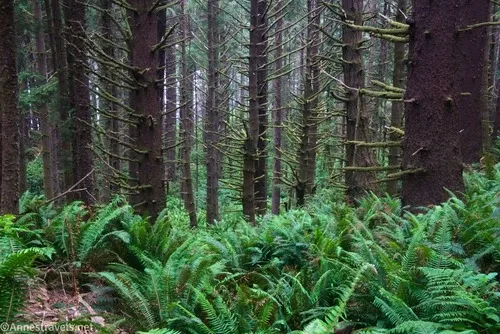
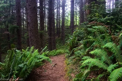
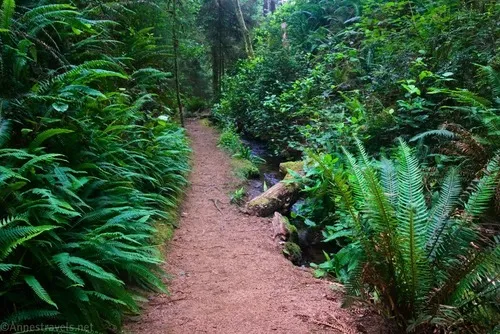
Cross the dirt access road to Whaleshead Beach to the parking area where we should have parked (it would have cut 0.6 miles OW off of our hike). The Oregon Coast Trail reenters the trees and begins a meandering, wandering adventure along the side of the hill through the rainforest.
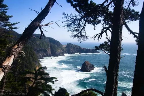
There were supposedly a couple of viewpoints between here and Indian Sands, but they’re not marked, so I just enjoyed the infrequent peek-a-boo views, including one about 0.6 miles after we entered the trees from the upper parking lot.
About 0.3 miles beyond the viewpoint, the trail pops out at the highway again at a small parking area. Walk up the access road to continue on the Oregon Coast Trail, which again wends its way through the rainforest. The Oregon Coast Trail seems to be amazing at not going in a straight line!
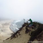
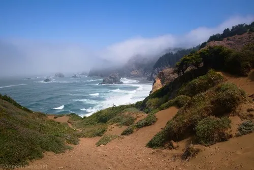
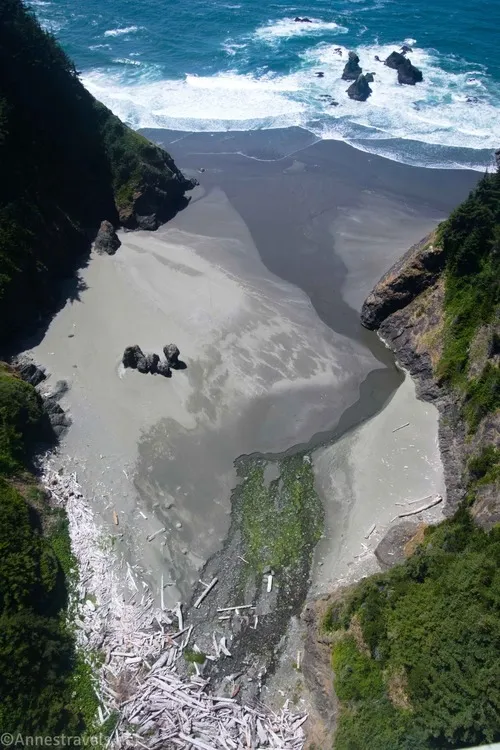
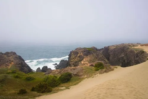
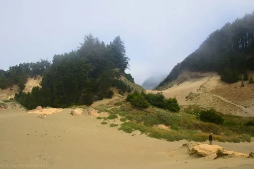
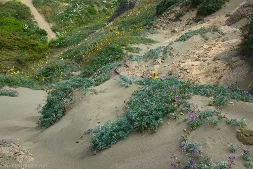
About 2 miles from where we started (about 0.5 miles from the parking area), a trail on the right goes up to the parking area for Indian Sands. This is actually exciting because it means you’re coming to a beautiful part of the hike! The trail gets sandier and finally pops out of the trees on top of giant sand dunes, high above the Pacific Ocean. Wow!
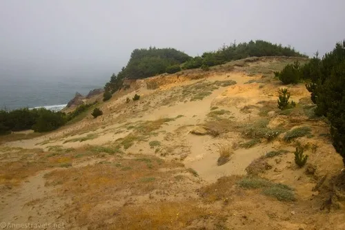
The mist was just beginning to lift, which make the sands even more ethereal.
The path may be a little hard to locate in this section, but it’s not too hard to figure out where people have walked. This was probably my favorite part of our hike and well worth exploring on its own, even if you don’t do some or all of the rest of the trek.
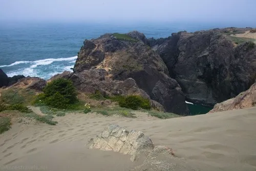
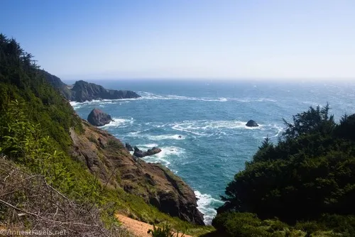
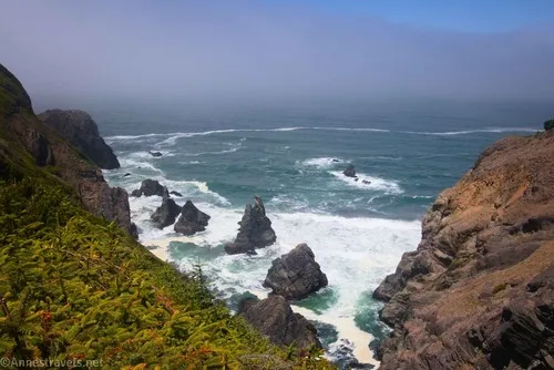
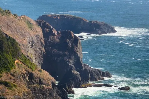
On the other side of the sands, the trail picks up again. For a bit, you’re out of the forest, and it’s beautiful to be able to look down on the seastacks in the ocean below.
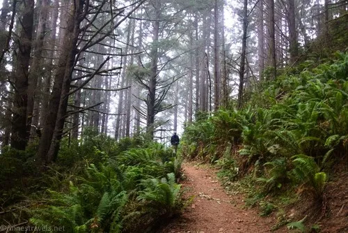
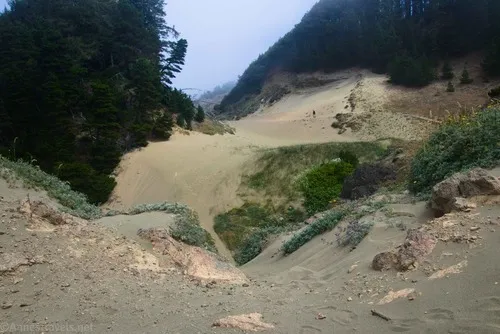
All too quickly, the trail enters the woods again to meander past two trail junctions. The first (mile 2.6 for me) would take you up to the Indian Sands Parking Area (so you could hike it as a loop) and the second (mile 3.3 for me) would bring you up to the parking for the Thomas Creek Bridge Viewpoint. Now, I have no idea where the viewpoint is. Maybe you walk along the highway to the old parking area? (Which we’ll get to in a minute.) Wherever the viewpoint is at, I’m pretty sure I never found it, and I’m certain it’s not along the Oregon Coast Trail.
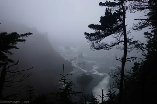
We continued through the rain forest, passing by a trail on the right that is actually the Coast Trail and would have taken us up to the bridge. Instead, we followed a well-worn path that began descending alarmingly on the headland. I don’t know where it ends, or if it takes you to a cliff. We found a viewpoint about mile 3.6 and decided we’d gone far enough.
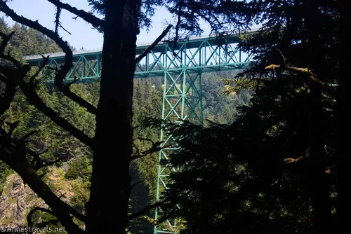
So we climbed back up that alarming trail and then up to the level of the highway. You’ll come out of the woods into what was obviously once a parking area but now is separated from the highway by a hefty guardrail. Views of the bridge were pretty good from here.
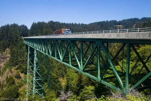
The Oregon Coast Trail follows the shoulder of the highway across the Thomas Creek Bridge, which also happens to be the highest bridge in Oregon (some would say the highest highway bridge, but I’ll let them debate that one) at 345ft.. Hop over the guardrail and turn left to cross the bridge.
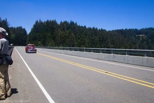
The shoulder is wide, the barriers are high, and I didn’t feel especially unsafe (not that I didn’t hug the guardrail to stay away from traffic). And the views from up here were amazing!
On the other side of the bridge, hop over the guardrail and walk along it until the trail ducks back into the forest, which is almost immediately. We missed this turn, so we just walked along the edge of the road to the North Island Trailhead at mile 4.3, then took the trail down toward China Beach.

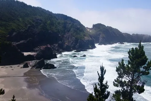
I can’t say that the trail is easy to follow down to China Beach, but we figured it out (basically, continue downhill but don’t take any trail that looks crazy). About mile 5, we finally dropped down onto the beach and heaved a sigh of relief. Not much about the Oregon Coast Trail had lived up to the expectations created by the map, but at least this was here, real and firm under our feet!
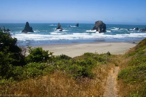
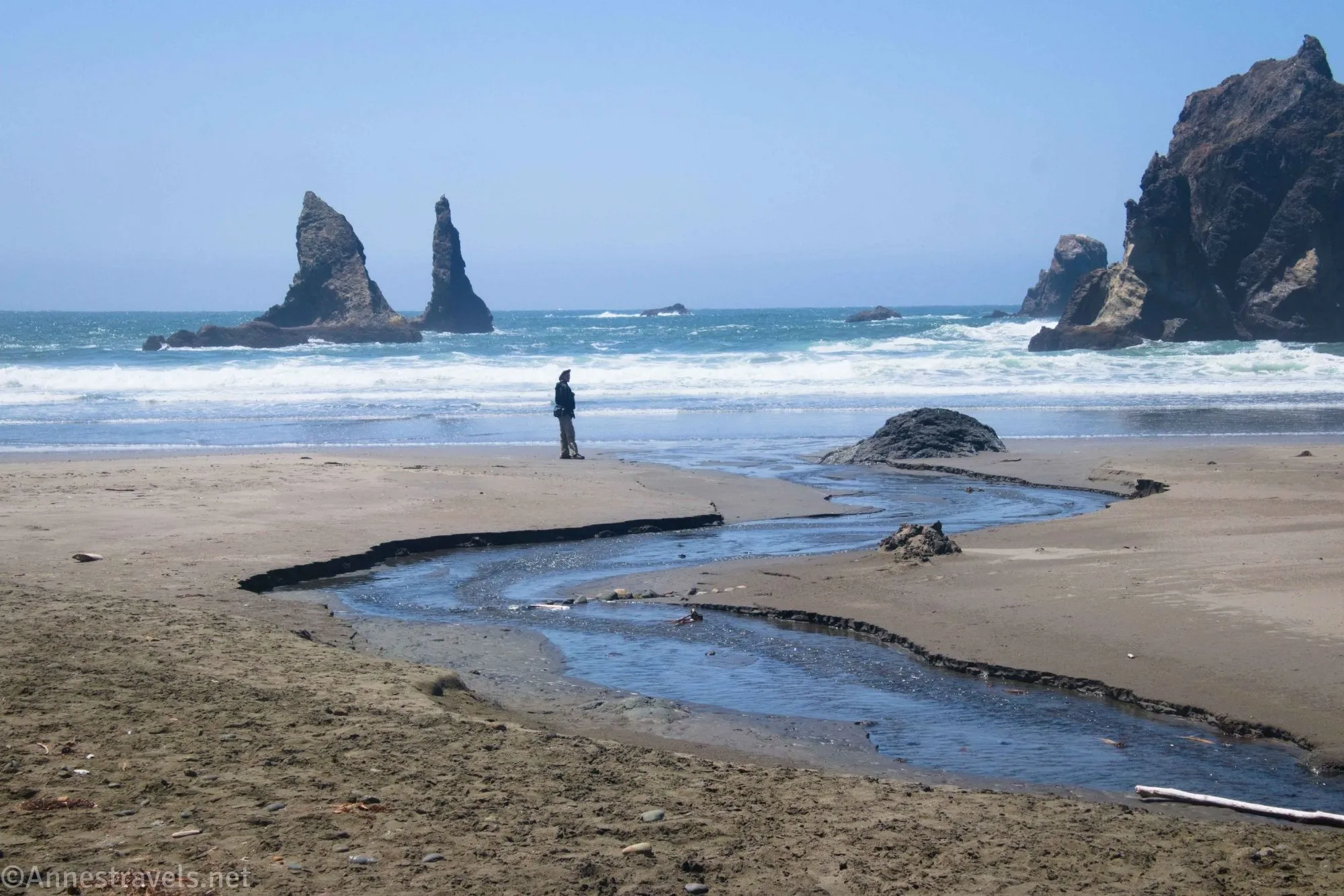
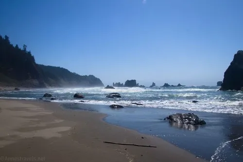
We wanered further north first. There is a small creek to cross and a number of sea stacks, which make the beach quite scenic.
Most of my group went the 0.4 miles to where the Oregon Coast Trail heads back up toward the highway. I continued on almost to the cliff at the end of the beach.
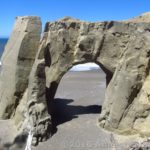
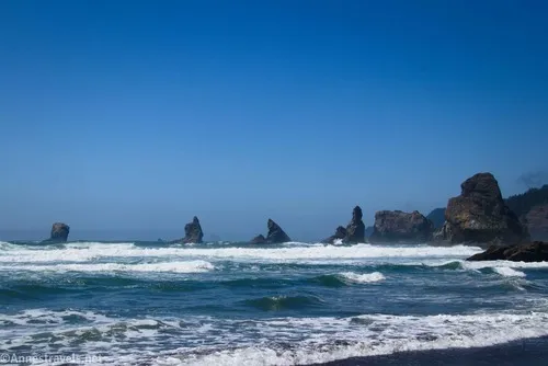
Then we retraced our steps and headed south, almost to the end of the beach. Again, there were more sea stacks, including one with an arch through it (though it was a little hard to see).
From there, we headed back up the trail toward the North Island Trailhead, but instead of walking along the highway, we took the Coast Trail, including out to a couple of viewpoints. One was official (North Viewpoint; mile 7.75 for me)…
…and the second was much less official but had a great view (mile 8.0). (The spur to this viewpoint begins about 42.1684610°, -124.3617270°).
Then it was back up to the Thomas Creek Bridge! At this point, we decided we were tired of the endlessly wandering Oregon Coast Trail, so we walked along the edge of the highway back to the Indian Sands Parking Area. We followed the trail down through the forest, and picked up the Coast Trail back to the next parking area. Then it was the road back to the top of the access road for Whalehead Beach. The rest of my group decided to hike down the access road (they were thinking about trying to get the van back up to the highway!), but I opted to take the Oregon Coast Trail back down – and we met up at the restrooms right next to the parking area!

Would I take this hike again? I’d do some of it, especially the parts around Indian Sands, the Thomas Creek Bridge, and China Beach. But I’d also walk into the hike a little more prepared for the ways of the sparsely-marked, ever wandering, usually forested Oregon Coast Trail!
Round Trip Trail Length: I went 10.4 miles; there are many ways to make it shorter, and my preferred path would probably be only about 8 miles.
Elevation Gain: Around 2,300ft., though I expect that’s a bit high (my GPS doesn’t like hiking on the edge of cliffs) (383ft. to 4ft.)
Facilities: Primitive restrooms and picnic tables at the Whaleshead Picnic Area
Fees: None

Trail Notes: I think I’ve already made it abundantly clear that the Oregon Coast Trail is not my favorite. For a walk through the woods that goes nowhere quickly, it’s great. If I had to do it again, I’d probably start at the parking area just south of Indian Sands or else at the Indian Sands Parking Area and head north from there. I truly enjoyed the Indian Sands, walking across the Thomas Creek Bridge, China Beach, and all of the sea stacks along the way. Be ready for some elevation change on this hike, especially down to China Beach (and back up again!)

Road 
![]()
Signs ![]()
![]()
Scenery ![]()
Would I go 100 miles out of my way for this? ![]()


GPS Coordinates for the Oregon Coast Trail between Whaleshead Beach and China Beach
Whale Beach TH: 42.1443650°, -124.3543140° (42°08.66190′, -124°21.25884′ / 42°08’39.7140″, -124°21’15.5304″) (35ft.) (0.0)
Whale Beach: 42.1438620°, -124.3557970° (42°08.63172′, -124°21.34782′ / 42°08’37.9032″, -124°21’20.8692″) (31ft.) (526ft.)
Up to the Coast Trail: 42.1428690°, -124.3554220° (42°08.57214′, -124°21.32532′ / 42°08’34.3284″, -124°21’19.5192″) (34ft.) (0.19)
Beginning of Oregon Coast Trail (behind the restrooms): 42.1446200°, -124.3539200° (42°08.67720′, -124°21.23520′ / 42°08’40.6320″, -124°21’14.1120″) (41ft.) (0.40)
Upper parking TH: 42.1470490°, -124.3556050° (42°08.82294′, -124°21.33630′ / 42°08’49.3764″, -124°21’20.1780″) (251ft.) (0.62)
Viewpoint: 42.1472980°, -124.3578000° (42°08.83788′, -124°21.46800′ / 42°08’50.2728″, -124°21’28.0800″) (212ft.) (1.20)
Parking area: 42.1492930°, -124.3587270° (42°08.95758′, -124°21.52362′ / 42°08’57.4548″, -124°21’31.4172″) (279ft.) (1.48)
Indian Sands Parking: 42.1548720°, -124.3627410° (42°09.29232′, -124°21.76446′ / 42°09’17.5392″, -124°21’45.8676″) (254ft.) (2.08)
Trail Junction: 42.1581160°, -124.3603460° (42°09.48696′, -124°21.62076′ / 42°09’29.2176″, -124°21’37.2456″) (289ft.) (2.63)
Trail Junction: 42.1625250°, -124.3585680° (42°09.75150′, -124°21.51408′ / 42°09’45.0900″, -124°21’30.8448″) (281ft.) (3.32)
Viewpoint: 42.1642300°, -124.3614430° (42°09.85380′, -124°21.68658′ / 42°09’51.2280″, -124°21’41.1948″) (128ft.) (3.60)
Bridge parking: 42.1641940°, -124.3587410° (42°09.85164′, -124°21.52446′ / 42°09’51.0984″, -124°21’31.4676″) (316ft.) (3.87)
North TH: 42.1698490°, -124.3598770° (42°10.19094′, -124°21.59262′ / 42°10’11.4564″, -124°21’35.5572″) (366ft.) (4.33)
China Beach: 42.1752420°, -124.3616250° (42°10.51452′, -124°21.69750′ / 42°10’30.8712″, -124°21’41.8500″) (30ft.) (5.03)

Trail up: 42.1795080°, -124.3610730° (42°10.77048′, -124°21.66438′ / 42°10’46.2288″, -124°21’39.8628″) (23ft.) (5.43)
North Viewpoint: 42.1693550°, -124.3627740° (42°10.16130′, -124°21.76644′ / 42°10’09.6780″, -124°21’45.9864″) (216ft.) (7.77)
Viewpoint: 42.1674750°, -124.3617700° (42°10.04850′, -124°21.70620′ / 42°10’02.9100″, -124°21’42.3720″) (254ft.) (8.02)
Trail Junction: 42.1684610°, -124.3617270° (42°10.10766′, -124°21.70362′ / 42°10’06.4596″, -124°21’42.2172″) (276ft.) (8.11)
Bridge: 42.1669490°, -124.3598080° (42°10.01694′, -124°21.58848′ / 42°10’01.0164″, -124°21’35.3088″) (346ft.) (8.33)
End: 42.1445620°, -124.3542350° (42°08.67372′, -124°21.25410′ / 42°08’40.4232″, -124°21’15.2460″) (40ft.) (10.46)

The gpx file for the Oregon Coast Trail between Whaleshead Beach and China Beach can be downloaded – please note that this and the GPS Coordinates are for reference only and should not be used as a sole resource when hiking this trail.
Download GPX File size: 120.4 KB Downloaded 254 times
(Note: I do my best to ensure that all downloads, the webpage, etc. are virus-free and accurate; however, I cannot be held responsible for any damage that might result, including but not limited to loss of data, damages to hardware, harm to users, from use of files, information, etc. from this website. Thanks!)

Getting to Whaleshead Beach Parking Area
From Brookings, OR, drive north on US-101 7.7 miles to the dirt road on left (west) that is signed for Whaleshead Beach. (The road is 19.3 miles south of Gold Beach.)
More about Hiking the Oregon Coast Trail!
Learn more about hiking the Oregon Coast Trail, including detailed descriptions about what you’ll see along the way, resupply options, itineraries, camping and lodging, and much more. Buy your copy here!