
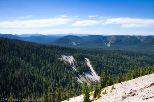
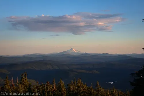
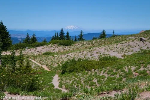
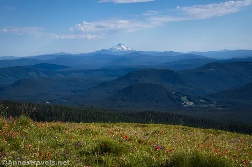
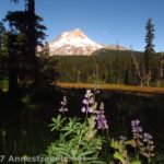
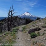
Paradise Park has been on my bucket list for hiking every time I visit Mt. Hood, and every time, we don’t do it. That’s mostly due to poor weather (why hike to views of the volcano when the volcano is hiding behind clouds?), but all I can say is that we left a truly great (and hard) hike for a sunny day. Along the way, you’ll pass the Zigzag Overlook (a worthy destination in its own right, and much easier than trying to get to Paradise Park) and be treated to a few very good views out toward Mt. Jefferson and the Three Sisters. Then there’s Mt. Hood, spectacular and (in the later summer) set off by thousands of wildflowers. Wow!
Quick Stats

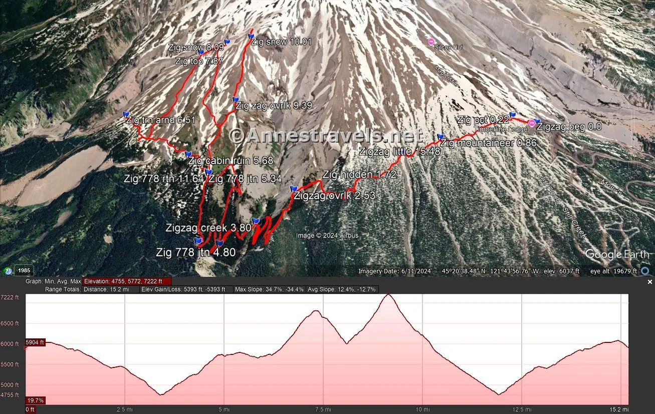
While Paradise Park is spectacular in its own right, it’s even better if you take the social trails (yes, they’re really trails) up higher on the mountain. I ended up hiking a total of 16.7 miles in a day (much longer than I typically try to plan for, but, well, it just sort of happened), but it was worth every extra mile, even if I was a little too early (in mid-July) for most of the wildflowers.
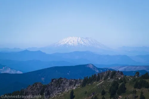
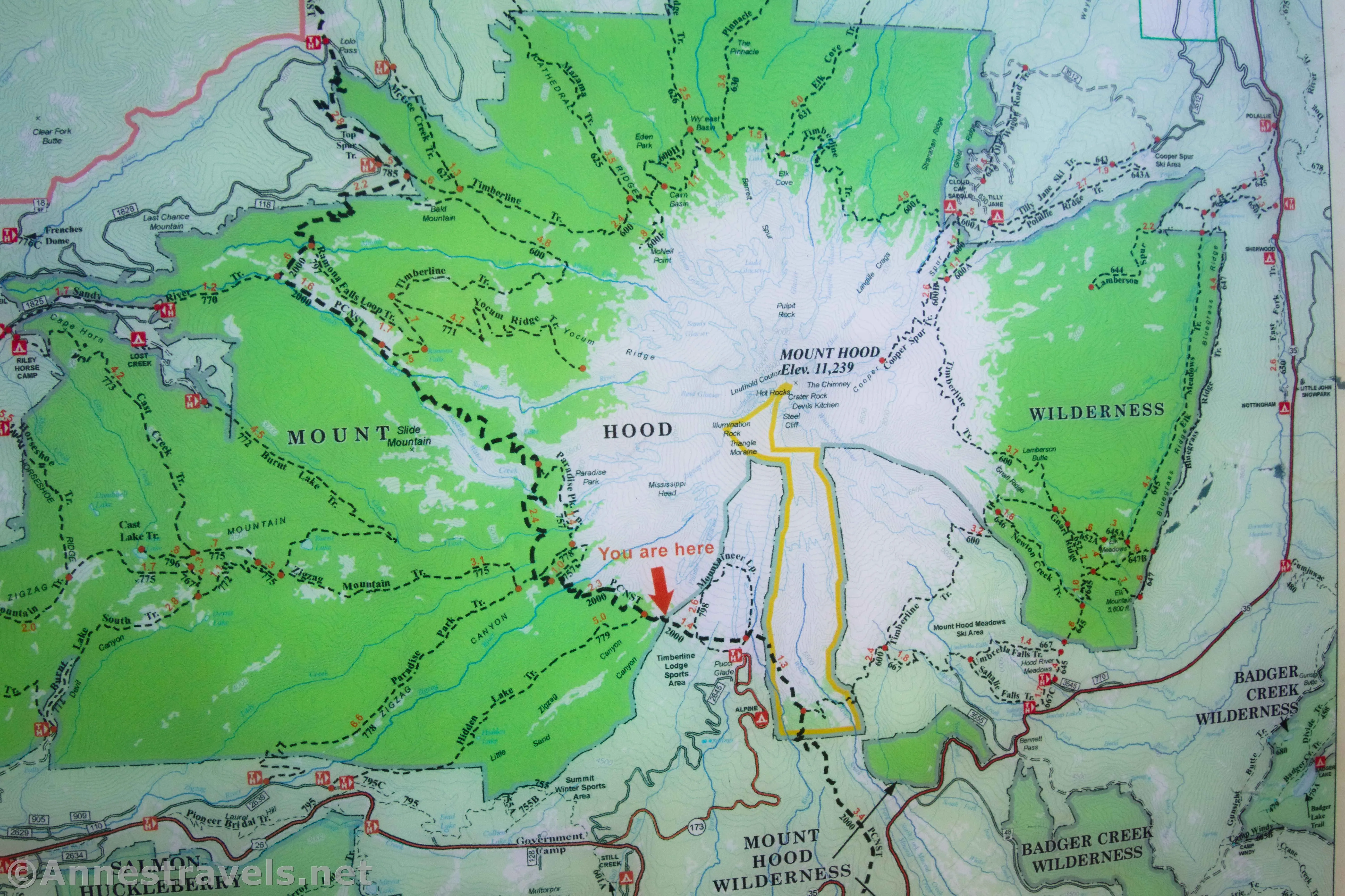
Most of the Paradise Park Trail follows the Pacific Crest Trail, which at this point is also part of the Timberline Trail. I detailed exactly how to get from the trailhead to the Zigzag Overlook in another post, so I won’t go into too much detail here. I’ll just say to find the PCT on the right side of Timberline Lodge, follow it straight up the stairs, up the trail, and then up the road, and turn left at a well-marked junction to leave the road and start down the trail. Continue on the PCT until you arrive at the Zigzag Overlook. You won’t miss it; the views from this ridgeline are spectacular up Zigzag Canyon to Mt. Hood.
When you’ve had your fill of the views from the overlook, continue down the trail – and down it is! You’ll pass by a small viewpoint on the right, then you’ll come to the end of the first switchback. Enter the trees… and begin downhill. And downhill. And downhill. The switchbacks just don’t seem to end, and they’re steep to boot and occasionally muddy! You’re actually dropping all of the way down to Zigzag Creek at the bottom of Zigzag Canyon – that’s a lot of elevation loss!
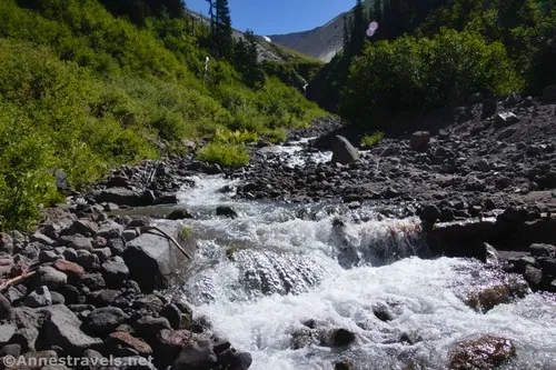
At the bottom of Zigzag Canyon, you’ll need to cross over Zigzag Creek – no easy feat, at least in mid-July. If you don’t mind getting your feet wet, it’s not that hard; the crossing was fairly shallow. But since I like dry feet and to not remove my boots, it took a little more scouting around. I made it, and I even got my group across, one way or another, with dry feet. Yay!
Scramble up the opposite bank and then begin the long climb up the other side. About 0.4 miles beyond the creek crossing, there will be a major intersection, with the Paradise Loop Trail No 757 turning right and the PCT going straight. I opted to go straight and then take the Paradise Park Trail No. 778. I did come back via the Loop Trail, and honestly, you don’t gain a whole lot one way or the other. So I do recommend the PCT route.
About 0.6 miles after this major junction, the Paradise Park Trail No. 778 goes off on the right – actually, supposedly, the trail goes both right and left, but I saw very little evidence of a trail to the left (south). There was a nice little view near the junction, though.

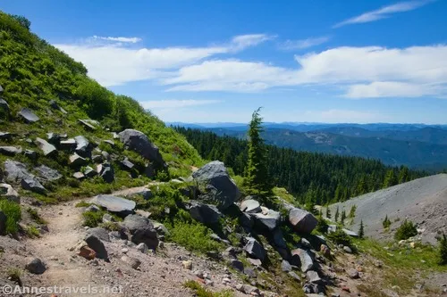
Turn right up Trail No.778. The PCT was climbing, and Trail No. 778 climbs for pretty much its entire length! It’s mostly trees with occasional small meadows – very pretty, even if there weren’t many views of Mt. Hood.

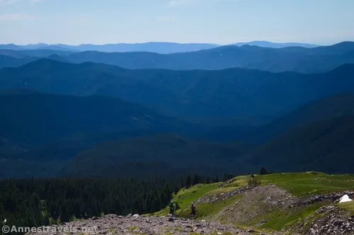
Half a mile later, Trail No. 778 supposedly dead-ends in the Paradise Loop Trail No. 757. In reality, it continues as a social trail. And if you’re running low on time, I highly recommend that you keep going straight up, up, up toward Mt. Hood. It’s a fantastic trail, and – per me – prettier than Paradise Park, itself. But you’ll have to wait for the photos of that, because this was the route we took down after all of our adventures – so I’ll talk about it later.
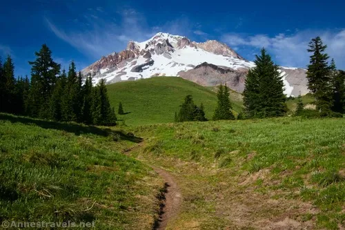
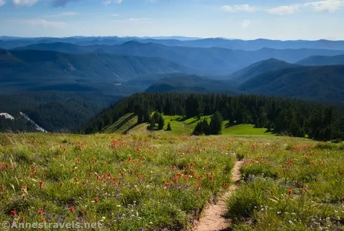
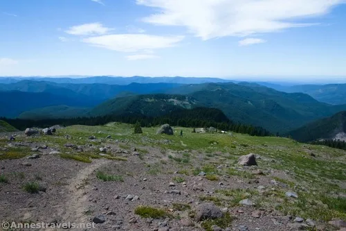
Instead, we turned left on the Paradise Loop Trail. The path winds its way along the edge of the treeline and through meadows, rising and falling with the terrain. Along the way are the ruins of an old stone shelter – I hear a tree fell on it, but all I can say is that there isn’t much left. The views to Mt. Hood from the meadows are good if not quite epic.
The path crosses a ravine with a small stream and finally begins its descent back to the PCT. I didn’t want to go back down into the trees, so I turned around here (mile 6.5 per my GPS) and wandered back through the meadows. A trail on the Mt. Hood side of the trail headed up to a big rock, so I followed it. The rock has a memorial to two men who explored or at least enjoyed Mt. Hood – both died in the 1940s, so the memorial isn’t exactly new.

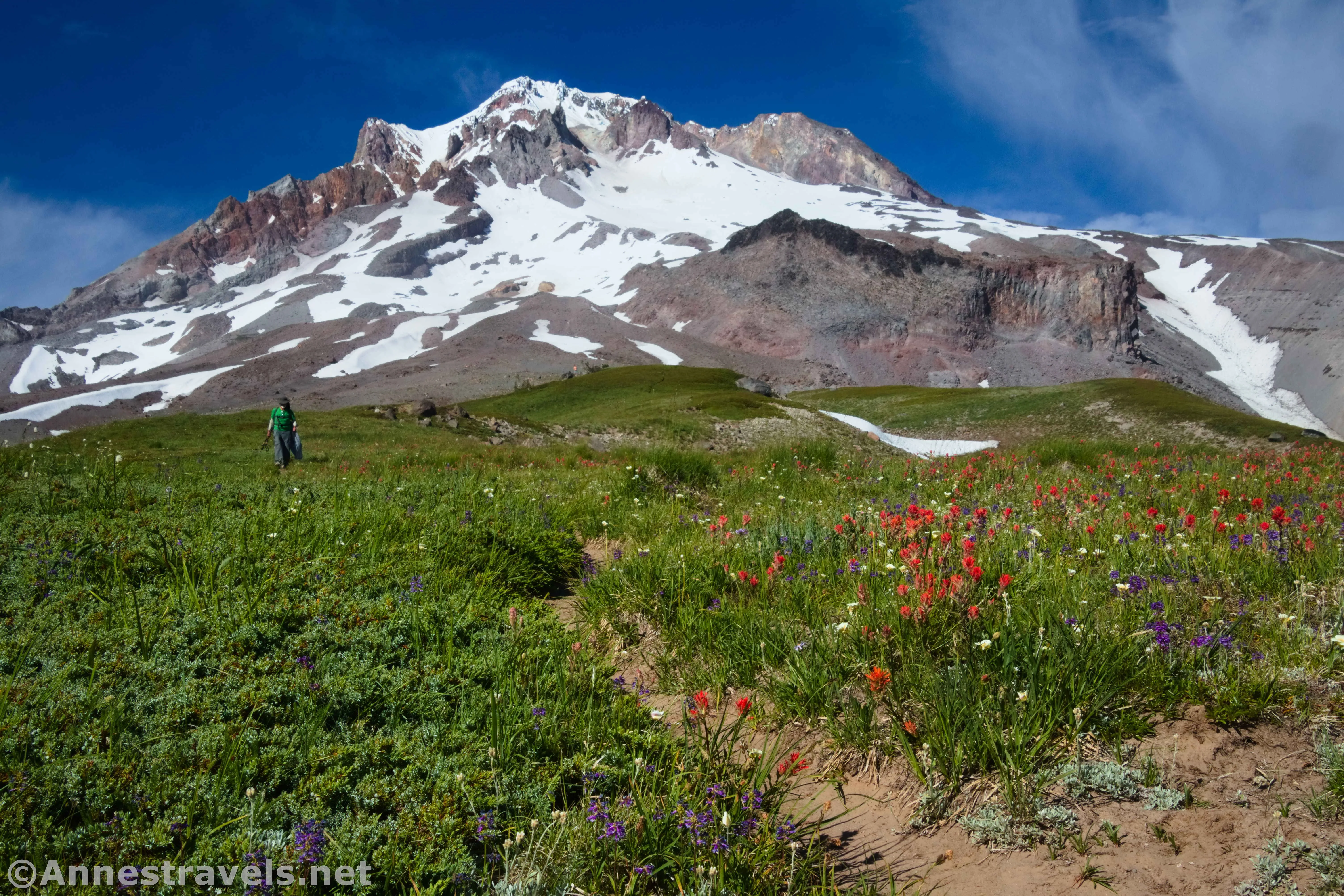
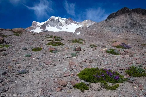
I was feeling a little disappointed with Paradise Park. It was very nice, but the amazing wildflower displays that I’d read about hadn’t materialized (it was too early in the season). And even the views of Mt. Hood didn’t live up to the hype. So I headed pretty much straight up the hillside from the big rock, following vague trails. I finally picked up a better trail along the ridgeline.
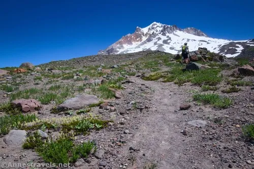
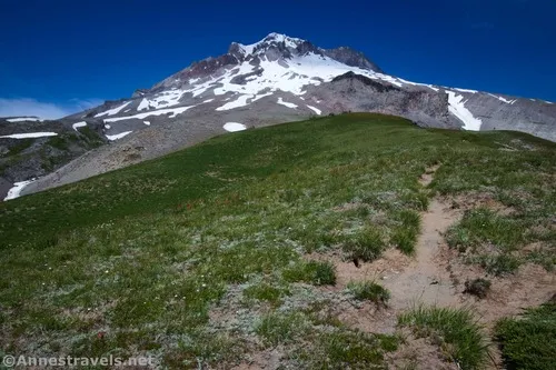
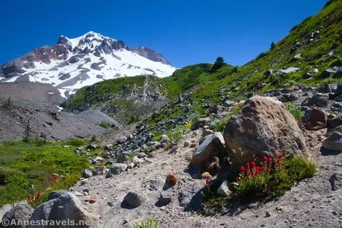
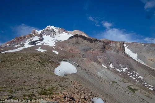
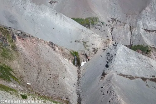
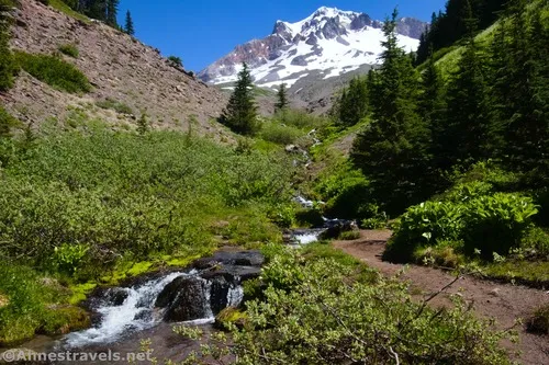
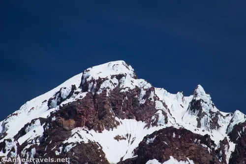
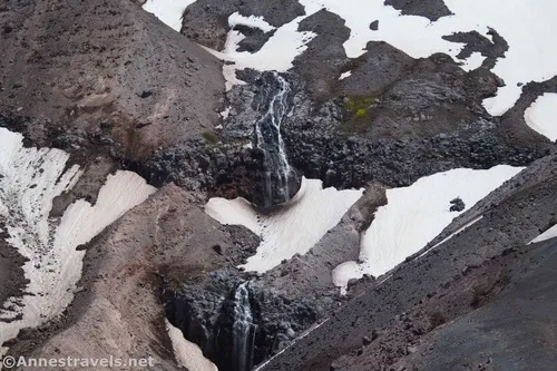
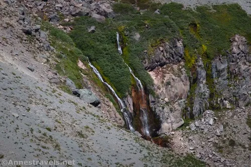
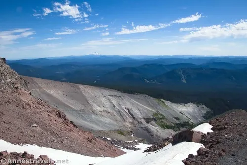
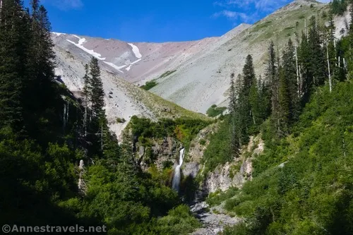
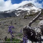
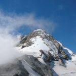
The views improved dramatically the higher I climbed. The crags of Mt. Hood, from closer up, are spectacular. I finally reached what seemed to be the top of the ridge, even though the terrain continued upward. There were views of waterfalls on the left and so many crazy awesome views!
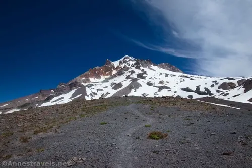
I kept hiking (try to Leave No Trace – some of the ground is pretty soft beneath the gravel) all of the way up to the snow. I’ve heard horror stories about snow on Mt. Hood, so that was the end of my upward travel on this ridgeline.
I believe from here that you should be able to head right (southeast) over toward Mississippi Head, then turn down the ridgeline to take you along the rim of Zigzag Canyon. You’d be able to pick up the trail pretty quickly that will take you back to – you guessed it – the Trail No. 778 and Paradise Loop Trail Junction (remember, the one I talked about earlier and said that I’d talk more about the trail later).
However, as I said, I’m not much on snow because I don’t know what sort of hole might be underneath it, and I wasn’t prepared for snow travel. So instead of being sane and logical and dropping back down the ridge the way I’d come, I headed southwest and then south, trying to get to the meadows below while not actually stepping on the meadows (which you’re not supposed to do).
It wasn’t the easiest hiking, even if we were able to Leave No Trace in most places. There was one steep hillside that was extremely crumbly, and I was very thankful for hiking poles (four limbs on the ground are better than two some days.)
At last, I met up with the trail that would have taken me down to the Paradise Loop Trail (remember that trail I said I’d talk about more later? Well, later has arrived). The curious part of me wanted to see down into Zigzag Canyon from this angle, so instead of turning right to go downhill, I went left, uphill. It was a great decision!
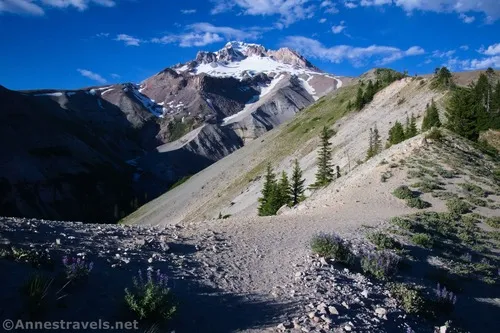
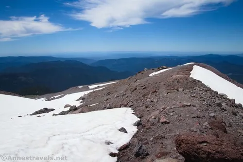
I arrived at what I’ll call the Zigzag Canyon Overlook at mile 9.4 (via my GPS, which has now been up and over and around the side of Mt. Hood above Paradise Park – the overlook is about 0.7 miles above the Paradise Loop Trail). The views from here are well worth the extra mileage, though I’d recommend coming up the trail from the Paradise Loop Trail rather than my off-trail method.
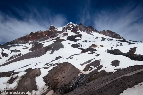
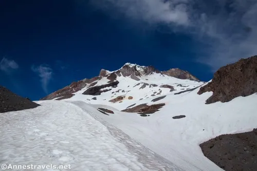
And then I kept climbing. And climbing. And climbing. Yes, I’d already hiked 100+ miles on that trip, but my legs and lungs were wearing out. We were topping out above 7,000ft. on this hike! Mississippi Head loomed above us on our right.
One of my companions came to the snow and kept right on going. So I followed. It seemed safe enough, even though I wouldn’t recommend it. We came to the more or less end of Mississippi Head and decided we’d gone far enough. To do more, we would have had to ascend or descend a steep slope, and that didn’t seem very safe. We could have climbed Mississippi Head from here by turning right and ascending a steep slope. If it was climbable without snow it would have been safe enough, but with snow, and very late in the afternoon, I wasn’t comfortable with another adventure.
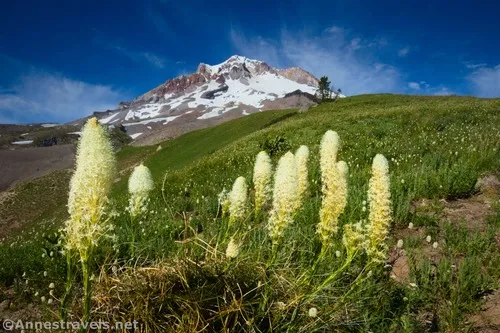
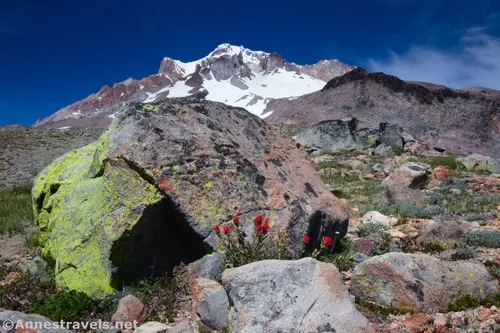
And so we headed back down. The lower slopes of the social trail were filled with wildflowers, just like I’d read about online. Add to that views of Zigzag Canyon, Mt. Hood, and Mt. Jefferson, and – well, let’s just say that this social trail had some of the best views we saw all day!
Back on the Paradise Loop Trail No. 757, we opted to turn left and take it back to the PCT instead of continuing straight down Trail No. 778. This wasn’t a bad option, even if I preferred our route up. The Loop Trail doesn’t have much in the way of views below this junction. Turn left at the “major junction” on the PCT to descend back to Zigzag Creek and begin the endless climb back up to the Zigzag Overlook.

We finally staggered (not really, lol) back into the parking area at almost 8pm, 16.7 miles after we’d started. That’s some pretty crazy mileage, but it was so worth it!
Round Trip Trail Length: I went 16.7 miles, but there are many ways to shorten it. Only the Paradise Park out-and-back would be 13.0 miles. Taking the social trail instead of going to Paradise Park would be upwards of 11 miles.
Elevation Gain: I did 5,393ft. (4,755ft. to 7,222ft.). Paradise Park itself (staying on the trail) is 3,211ft. (4,755ft. to 6,090ft.). Just going up to the Zigzag Canyon Overlook (11-ish+ miles) would be closer to 3,350ft.
Facilities: Restrooms at the snow lodge along with a snack bar and other amenities (open when we left in the morning and closed by the time we got back at night)
Fees: None
Trail Notes: The Paradise Park section is pretty benign other than steep slopes and the river crossing. The part above the park… well… just realize that we have a lot of experience going off-trail and doing things that probably aren’t the safest. So you should want an adventure to try this stuff! Remember to Leave No Trace and to stay on the trails, especially in the meadows.
Trail 
![]()
![]()
Road
Signs ![]()
![]()
Scenery
Would I go 100 miles out of my way for this?
Overall Rating: ![]()
GPS Coordinates for Paradise Park
TH: 45.3307610°, -121.7095770° (45°19.84566′, -121°42.57462′ / 45°19’50.7396″, -121°42’34.4772″) (5,905ft.) (0.0)
PCT: 45.3328520°, -121.7112740° (45°19.97112′, -121°42.67644′ / 45°19’58.2672″, -121°42’40.5864″) (6,043ft.) (0.22)
Mountaineering Trail: 45.3361590°, -121.7218830° (45°20.16954′, -121°43.31298′ / 45°20’10.1724″, -121°43’18.7788″) (5,984ft.) (0.86)
Hidden Lake Trail: 45.3386700°, -121.7338390° (45°20.32020′, -121°44.03034′ / 45°20’19.2120″, -121°44’01.8204″) (5,716ft.) (1.72)
Zigzag Canyon Overlook: 45.3422740°, -121.7411140° (45°20.53644′, -121°44.46684′ / 45°20’32.1864″, -121°44’28.0104″) (5,455ft.) (2.53)
Cross Zigzag Creek: 45.3431550°, -121.7467800° (45°20.58930′, -121°44.80680′ / 45°20’35.3580″, -121°44’48.4080″) (4,765ft.) (3.80)
Paradise Park Junction: 45.3430830°, -121.7524910° (45°20.58498′, -121°45.14946′ / 45°20’35.0988″, -121°45’08.9676″) (5,029ft.) (4.23)
Trail 778 Junction (south): 45.3441080°, -121.7544100° (45°20.64648′, -121°45.26460′ / 45°20’38.7888″, -121°45’15.8760″) (5,251ft.) (4.80)

Trail 778 Junction (north): 45.3488740°, -121.7474810° (45°20.93244′, -121°44.84886′ / 45°20’55.9464″, -121°44’50.9316″) (5,692ft.) (5.34)
Stone shelter ruin: 45.3520440°, -121.7474550° (45°21.12264′, -121°44.84730′ / 45°21’07.3584″, -121°44’50.8380″) (5,726ft.) (5.68)
Turn around: 45.3615580°, -121.7488230° (45°21.69348′, -121°44.92938′ / 45°21’41.6088″, -121°44’55.7628″) (5,653ft.) (6.51)
Top (1st?): 45.3615370°, -121.7347730° (45°21.69222′, -121°44.08638′ / 45°21’41.5332″, -121°44’05.1828″) (6,677ft.) (7.87)
Snow (1st?): 45.3605240°, -121.7307270° (45°21.63144′, -121°43.84362′ / 45°21’37.8864″, -121°43’50.6172″) (6,823ft.) (8.09)
Zigzag Overlook: 45.3535320°, -121.7373060° (45°21.21192′, -121°44.23836′ / 45°21’12.7152″, -121°44’14.3016″) (6,319ft.) (9.39)
Snow (2nd?): 45.3585650°, -121.7281020° (45°21.51390′, -121°43.68612′ / 45°21’30.8340″, -121°43’41.1672″) (7,115ft.) (10.01)

Return to Trail 778 Junction (north): 45.3489010°, -121.7475170° (45°20.93406′, -121°44.85102′ / 45°20’56.0436″, -121°44’51.0612″) (5,691ft.) (11.64)
Return to PCT: 45.3430560°, -121.7525080° (45°20.58336′, -121°45.15048’/ 45°20’35.0016″, -121°45’09.0288″) (5,022ft.) (12.74)
Little Zigzag Canyon: 45.3377340°, -121.7273380° (45°20.26404′, -121°43.64028′ / 45°20’15.8424″, -121°43’38.4168″) (5,828ft.) (15.48)
End: 45.3307440°, -121.7094930° (45°19.84464′, -121°42.56958′ / 45°19’50.6784″, -121°42’34.1748″) (5,904ft.) (16.71)

The gpx file for Paradise Park can be downloaded – please note that this and the GPS Coordinates are for reference only and should not be used as a sole resource when hiking this trail.
Download GPX File size: 206.9 KB Downloaded 99 times
(Note: I do my best to ensure that all downloads, the webpage, etc. are virus-free and accurate; however, I cannot be held responsible for any damage that might result, including but not limited to loss of data, damages to hardware, harm to users, from use of files, information, etc. from this website. Thanks!)
Getting to the Paradise Park Trailhead
From Government Camp, Oregon, head east on US-26. Take the first left after the rest area toward the Timberline Lodge. The road is steep but paved as it winds 4.9 miles up into the mountains. Near the lodge, turn left into the large parking area.
From the east, the turn right toward Timberline Lodge is 2.5 miles from where OR-35 merges with US-26 and/or 40.6 miles south and west (via OR-35 and US-26) of Hood River (I-84 Exit 64).
Today’s Featured Product!
With 85 hikes around Mt. Hood, there’s a trail for every season in this guide. It covers mountains, waterfalls, the Timberline Trail, and more. Buy your copy here.


Pingback: Mt. Hood Views from the Zigzag Overlook – Anne's Travels