If you’re looking for a short little hike in Yosemite with terrific views – and a slight sense of adventure – check out Pothole Dome to the west of Tuolumne Meadows along the Tioga Pass Road. The trail is only about a mile round trip with views that span Tuolumne Meadows to a number of Yosemite Peaks and the High Sierras to the north. The adventure part comes from the fact that about half the trail has no trail – you’re walking up California’s version of slickrock!
Quick Stats
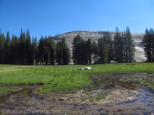
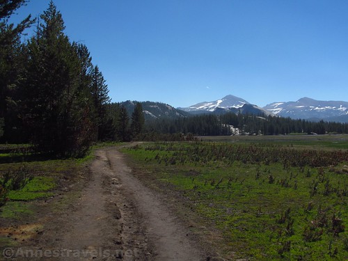
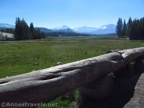
The trail begins at the far west end of Tuolumne Meadows (there is a trailhead with parking; additional shaded parking is available further east along the Tioga Pass Road; don’t park along the shoulder of the road). The meadows were pretty flooded when we visited (the Tioga Road had been open about a week), so right after the trailhead, there were a number of puddles. We scrambled down the bank of the road after the largest of the puddles, then skirted the edge of the trail as best we could until we reached higher ground and dryer trail.
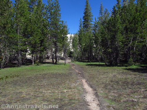
Walk along the Tuolumne Meadows Trail for about 0.4 miles; a small trail will appear on the left, through the trees. It’s just a social trail, but it will take you to the dome in a place where you won’t have to scramble straight up the rock face. I made the mistake of accessing the dome immediately after crossing a small stream. From there, the dome is very steep; going even just a little bit further along the trail, the dome is much less steep and easier to climb.
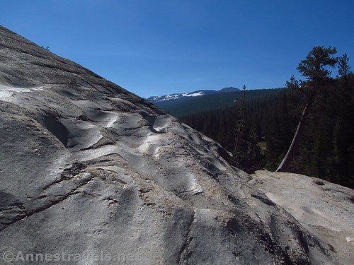
The one benefit of scaling the southern side of Pothole Dome is you get to see the potholes for which the come is named
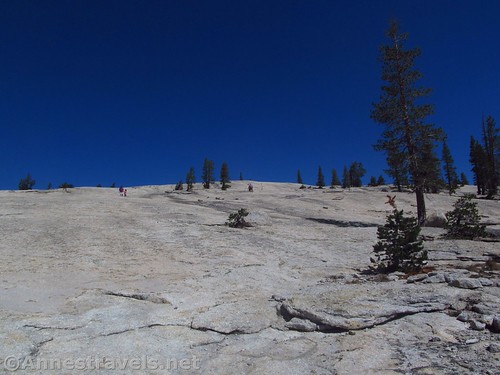
Once you work through the trees (not hard on the social trail), head towards the top of the dome by walking more or less straight up the slickrock. There’s no trail, no reliable cairns, but it’s also not too hard to figure out where the top is and where you should be heading.
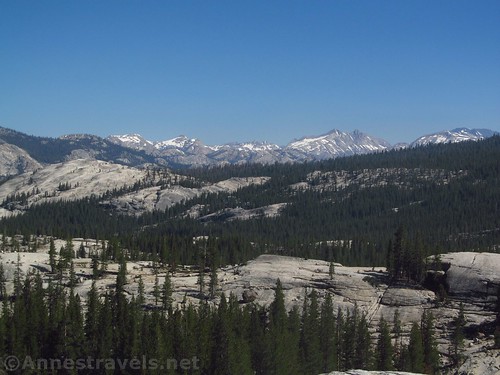
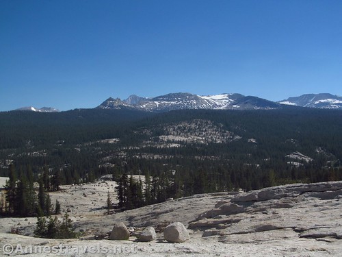
Turn around occasionally to views of Tuolumne Meadows and surrounding peaks.

Views down on (a very flooded) Tuolumne Meadows. Peaks are (L-R) Mt. Dana, Lembert Dome (below), Mt. Gibbs, Mammoth Peak, and the shoulder of another mountain
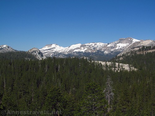
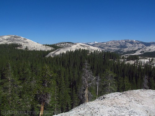
At the top, take a breather and look around. You’re surrounded by 360 views of the Sierras to the north, Unicorn and Cathedral peaks to the south, Tuolumne Meadows to the east, and to the west, other domes and peaks. It’s incredibly beautiful!
After enjoying the view for a bit, return (generally) the way you came. At the base of the dome, you can opt to walk along the western side of Tuolumne Meadows (which will take you to Tuolumne River Cascades after about another mile) or go back to your vehicle. Either way, it’s a great little hike with a reward at the top!
(I have since heard that you can do Pothole Dome and Tuolumne River Cascades as a 2.5 mile loop – since we were still recovering from a prolonged and snowy hike up Clouds Rest the day before, we just went to the top of the dome and turned around without pursuing the loop option.)
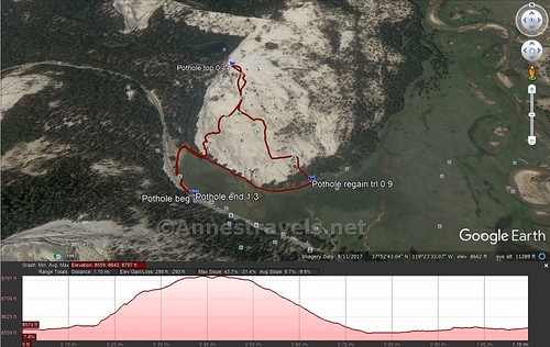
Round Trip Trail Length: 1.3 miles what was my GPS was reading at the end of the hike. However, mileages would suggest it’s closer to 1 mile.
Net Elevation Change: 223ft. 8,567ft. in the meadows to 8,790ft. at the top of Pothole Dome
Facilities: None at the trailhead; visitor center at Tuolumne Meadows about a mile to the east. When open, the visitor center offers visitor services, restrooms, etc.
Fees: $30 per vehicle, valid 7 days. Yosemite Annual and National Parks & Federal Recreational Lands Passes (Annual, Access, Senior, Military, 4th Grader, Volunteer) also accepted.
Trail Notes: This hike is very popular with families, especially those with small children. Watch your step while going up the dome; it’s not slippery, but a bit uneven. The meadow can be filled with water and mosquitos earlier in the year, but it’s also greener than in later summer. The wildflowers in the meadows are incredible!

Mt. Dana, Lembert Done (in front), Mt. Gibbs, and Mammoth Mountain over the flooded Tuolumne Meadows
Trail 


Road 


Signs 


Scenery 


Would I go 100 miles out of my way for this? 


Overall Rating: 


Key GPS Coordinates for Pothole Dome
Trailhead: 37.8768861°N, -119.3946083°W (37°52’36.79″N, -119°23’40.59″W / 37°52.61317’N, -119°23.67650’W) (8,570ft.) (0.0; ended 1.3)
Top of Dome: 37.8806028°N, -119.3938833°W (37°52’50.17″N, -119°23’37.98″W / 37°52.83617’N, -119°23.63300’W) (8,790ft.) (0.44)
Regain Tuolumne Meadows Trail: 37.8773056°N, -119.3915611°W (37°52’38.30″N, -119°23’29.62″W / 37°52.63833’N, -119°23.49367’W) (8,567ft.) (0.9)
The gpx file for Pothole Dome can be downloaded – please note that this and the GPS Coordinates are for reference only and should not be used as a sole resource when hiking this trail.
Download GPX File size: 22.7 KB Downloaded 219 times
(Note: I do my best to ensure that all downloads, the webpage, etc. are virus-free and accurate; however, I cannot be held responsible for any damage that might result, including but not limited to loss of data, damages to hardware, harm to users, from use of files, information, etc. from this website. Thanks!)
Getting to the North Dome Trailhead
From Lee Vining (US-395 on the east side of the park), turn west onto the road into Yosemite, more technically known as the Tioga Pass Road. Signs should point toward Tioga Pass and Yosemite National Park. Drive 20.2 miles to the trailhead for Pothole Dome, at the west end of Tuolumne Meadows, on right.
From the El Portal Road in the Valley or coming from El Portal, turn onto Big Flat Road toward CA-120 and Tioga Pass. After 9.5 miles, turn right in Crain Flat, following signs for Tuolumne Meadows and Tioga Pass. Drive 37.2 miles to the Pothole Dome parking area, on left just before Tuolumne Meadows.
The parking area is none too large. I recommend visiting early in the morning (except that the views to the east – over Tuolumne Meadows aren’t very good) so you can get a good parking spot. Otherwise, you can park further up the road at one of the more shaded parking areas between the Pothole Dome trailhead and the Tuolumne Meadows Visitor Center.
Zoom map out to browse nearby hikes & places of interest
This Week’s Featured Product!
I used this book to plan my trip to Yosemite – as well as on the trail – and it covers a wide variety of trails, including Pothole Dome. It’s one of the best national park hiking guides I’ve run across.
[forecast location=”Lee Vining, CA” caption=”Weather for Pothole Dome” measurement=’F’ todaylabel=”Today” datelabel=”date(‘D M d’)” highlow=’%%high%%°/%%low%%°’ numdays=”5″ iconset=”Default”]






Pingback: Sneak Peak: A California Trip through Desert and Snow - Anne's Travels