Probably one of the more memorable destinations we’ve visited on our travels is Pueblo Bonito in Chaco Culture National Historical Park. From the first time we saw a photo of it on the cover of our American Automobile Association Southwestern States map on our first visit to the American southwest, we knew we wanted to visit, and it’s never been a disappointment. It may seem smaller now that I’m older (lol), but it still holds allure – and you can actually explore the pueblo ruins (within reason). There are photo ops, history, remarkable architecture, space to wander, and even wildflowers and wildlife. It’s just a cool place to be.
Quick Stats
On our most recent visit, it was probably about 90F. But the trail from the parking area isn’t long (just make sure to take the trail left to Pueblo Bonito at the trail junction (the other trail goes to Chetro Ketl)). The trail is also paved, so it’s pretty accessible until you get to the pueblo itself, about 0.15 miles from the parking area.
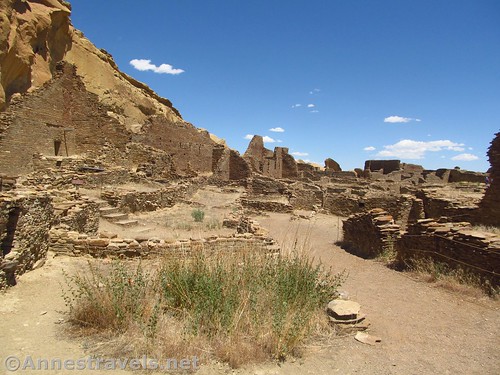
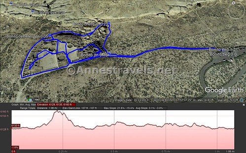
Once at the southeast corner of the pueblo, you have a few options. You can walk left a short distance to the stone stairway that will take you into the rooms of the pueblo, you can walk a bit further beyond those stone stairs to an opening in the wall that will take you into the courtyard of the pueblo, or you can walk either right or left to take the trail that goes all the way around the outside of the pueblo.
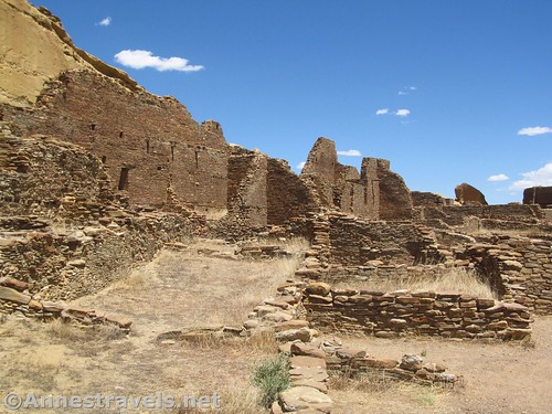
On this trip, I opted to go right and take the outside trail first. The trail winds upward about a tenth of a mile to the Petroglyph Trail Junction (going right will take you over to Chetro Ketl). Continue left to an observation area above Pueblo Bonito with signs about a large rockfall from the cliff that took out the northeast section of wall of the pueblo. From here, the trail winds back down toward the northwest curve of the pueblo. You can see the supports the park service has installed to stabilize the walls.
Shortly after this, the trail to the Wetherill Cemetery goes off on the right (about a tenth of a mile from the Petroglyph Trail). I continued left, along the wall of the pueblo, to the southern side, where I found a break in the wall that allowed me access to Pueblo Bonito. The National Park Service has put in quite a few of these breaks to allow access from multiple points of the trail around the half-moon-shaped structure – most are along the southern flat edge, but there are a few others; for example, on the northern side of the curve.
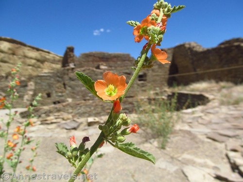
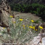
I had entered into the main courtyard, so I wandered by several kivas, took a few pictures of globemallow flowers that were blooming near one of the kivas, and wandered around the western side of the pueblo. This end definitely sees fewer visitors than the eastern side, so it’s a little wilder (minus a few drainpipes, lol!) But that also meant I missed out on the “crowds” (such as they were) for a few minutes before making my way east again to the main part of the pueblo that is in good shape or has been reconstructed (by the National Geographic Society and the Smithsonian in the 1920s).
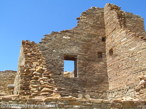
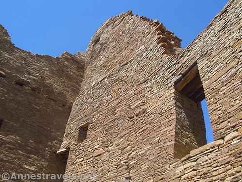
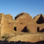
The cool thing about the eastern end of Pueblo Bonito is that you can go into the structures that used to be rooms (you can access these from the courtyard). The windows are awesome, and so are the doorways (duck low and watch your head!) There were so many fun photo ops here. I’m sure I was probably the 1,000th dozen person to take pictures of these, but I had fun, which is half the reason to take pictures in the first place.
Near the southwest corner, a room was discovered that still had the original masonry, roofing, etc. The first three times I visited Pueblo Bonito, the original masonry was still in place. This time, it had been replaced by the park service, mostly due to graffiti. The best part was that despite being in the 90s F outside, it was nice and cool in that little room. No wonder the ancient people made rooms like this!
I explored a bit more, then went back to the parking area. It was so cool to visit again, armed this time with a camera, and to see the history through an adult’s eyes. It’s almost as intriguing as it was when I was little – when the road still went almost directly beside Pueblo Bonito.
Round Trip Trail Length: I ended at 1.2 miles, but you could easily cut it down to not much more than 0.25 miles
Elevation change: About 21ft.
Facilities: Primitive restroom in the parking area
Fees: $25/vehicle/7 days. National Park & Federal Recreational Lands Passes are also accepted.
Trail Notes: Stay on the path when there is one. No climbing on the walls. Obey the signs that might close off certain areas of the pueblo. The pueblo is closed at sunset.
Trail 


Road 


Signs 


Scenery 


Would I go 100 miles out of my way for this? 


Overall Rating: 


GPS Coordinates for Pueblo Bonito
Trailhead: 36.0596000°, -107.9582333° (N36° 03.576′ W107° 57.494′ / 36°03’34.5600″, -107°57’29.6400″) (6,089ft.) (0.0) (end 1.21)
Pueblo Bonito southeast corner: 36.0602333°, -107.9606667° (N36° 03.614′ W107° 57.640′ / 36°03’36.8400″, -107°57’38.4000″) (6,096ft.) (0.16)
Pueblo Chetro Junction: 36.0610000°, -107.9603667° (N36° 03.660′ W107° 57.622′ / 36°03’39.6000″, -107°57’37.3200″) (6,110ft.) (0.23)
Cemetary Junction: 36.0611167°, -107.9618333° (N36° 03.667′ W107° 57.710′ / 36°03’40.0200″, -107°57’42.6000″) (6,095ft.) (0.35)
The gpx file for Pueblo Bonito can be downloaded – please note that this and the GPS Coordinates are for reference only and should not be used as a sole resource when hiking this trail.
Download GPX File size: 23.0 KB Downloaded 148 times
(Note: I do my best to ensure that all downloads, the webpage, etc. are virus-free and accurate; however, I cannot be held responsible for any damage that might result, including but not limited to loss of data, damages to hardware, harm to users, from use of files, information, etc. from this website. Thanks!)
Getting to Pueblo Bonito
From I-40, take Exit 53 and turn north onto NM-371N. After 28.5 miles, turn right onto NM-57 and drive 13.3 miles. Turn left (following the sign for Chaco) to stay on NM-57 (the road is now dirt, suitable for low clearance vehicles except after storms which may make washes rough until graded) for another 19.2 miles. Once in the park, turn left on the one-way Chaco Canyon Loop Road about 3.5 miles to the parking area for Pueblo del Arroyo, etc.
Alternatively, from the east (US-550) turn onto Road 7900 (signs point toward Chaco Culture National Historical Park) – the turn is on the south side of the road about 15 miles west of Counselor or 3 miles south of Nageezi. The road is now dirt, but passable to low clearance vehicles in dry weather. Continue to follow the main dirt road (signs mark any confusing junctions) for about 22 miles to the Chaco Culture Park visitor center. Continue straight a short distance, then continue straight onto the one-way Chaco Canyon Loop Road for about 3.5 miles to the parking area for Pueblo del Arroyo, etc.
Zoom map out to browse nearby hikes & places of interest
This Week’s Featured Product!
Looking for more hikes to ruins and rock art in the southwestern US? This may be the epic guide, covering more than 100 sites to visit in Arizona, New Mexico, Utah, Texas, and Colorado.







Pingback: Sneak Peak: Southwestern Variety at its Finest - Anne's Travels