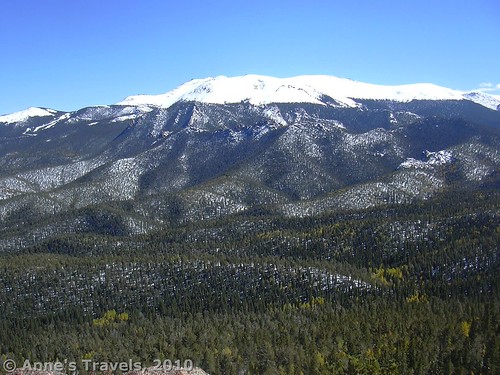
One of the things we’ve found in hiking mountains is that the pretty mountain is nicer from another nearby mountain than from the pretty mountain itself. Pike’s Peak is no exception to this, and Raspberry Mountain is an awesome place to see Pike’s Peak from. And to add to that, the hike up Raspberry Mountain is beautiful. At the top, there is also a wonderful view of the surrounding country. The mountaintop itself is bare except for a few raspberry bushes and bare rock. I highly recommend hiking the trail when there is snow around, because that’s when the view is best, although if it is too snowy you may need crampons to hike the trail. Also, if it is snowy, finding the trail if you’ve never hiked it before may be difficult. The total distance from the parking lot to the top of the mountain and back is 5.75 miles.
To get to Raspberry Mountain from the town of Divide, go south on Highway 67. Along the way you will pass the entrance of Muller State Park. After 4.25 miles or so, you will come to a sign for Crags Campground and, I think, one for Rocky Mountain Mennonite Camp. Turn onto the dirt road next to this sign and start driving up. After a little over a mile, you will come to a switchback that crosses a streambed. Here on the left side of the streambed there is a small parking area in front of a gate. Park here. If this ‘lot’ is full, you probably could park on the other side of the streambed.
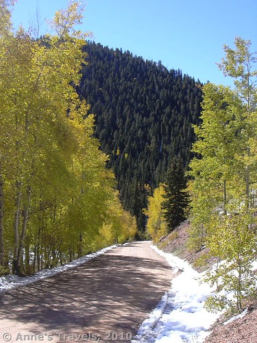
The trail starts on the two track trail behind the gate. The trail switchbacks up the hillside and into an aspen forest, which is especially beautiful in the fall, when the aspens are golden. Actually, the road is also very pretty at this time of year, as there are many aspens along it, as well as the darker fur trees. Eventually, the trail goes down to a one track trail. A few other side trails go off, but as long as you keep going up you should be all right. The first time we hiked this it was under a foot or so of snow. Previous hikers had packed a path, so it wasn’t hard to follow, but we did wish we were wearing boots!
After a while you will pass under some power lines. Don’t follow the power lines; pass underneath them and continue up. After the power lines you will finally reach the top of the ridge and hiking becomes easier because the trail is relatively flat. You will now be in an aspen/pine forest. Eventually, you will come to a place where the ridge— ends. There is a fire ring that looks as though someone had camped here. It may not be obvious where the trail goes from here. The answer is— down.
There is a trail heading down on your left when you are facing the end of the ridge. You will have to go down there and then start the really steep climb on the other side. Don’t get discouraged, this is the last push before the top. Sit down and rest a lot (the mountain air is probably thinner than what you’re used to!). Enjoy the view when there aren’t any trees in the way.
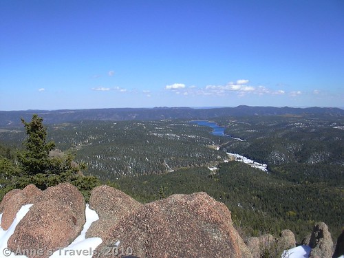
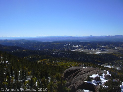
Suddenly, you find yourself climbing up out of the trees and on top of a pile of boulders. Congratulations! You made it to the top! When we hiked this last section for the first time, there was snow almost all of the way up and we wouldn’t have been able to find the trail, but many people had hiked the trail before we did and all we had to do was follow the footprints.
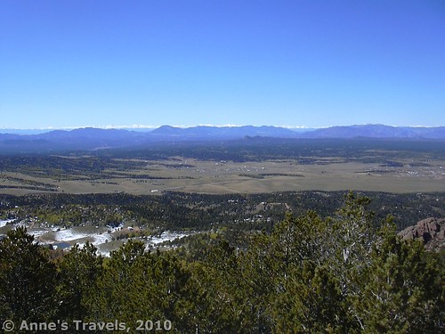
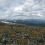
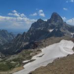
What a view is from the top! It may have been the month of September, but a few days before we arrived most of the Rockies had received a freak snowstorm, so the mountains around us were covered with snow. Wow! The view would be good any time of the year, but the snow added to the effect. You can see towns, fields, and lakes, not to mention mountains on almost all sides. Pike’s Peak is especially nice. We also hiked the trail in May when there wasn’t any snow on the trail, but the view wasn’t quite as nice because Pike’s Peak didn’t have a lot of snow on it. The view would still be nice, especially in the sunshine, but, as I said before, the snow really does add to the effect.
Return by the way that you came. Going back down that snowy, icy path wasn’t exactly a stroll in the park, but there were good strong aspen trees on either side of the path that we could hold onto. And the best part is that it is downhill for almost the entire hike back to your vehicle.
Round Trip Trail Length: 5.75 miles
Facilities: None except a small parking area
Fees: None
Trail 


Road 


Signs 


Scenery 


Would I go 100 miles out of my way for this? 


Overall Rating: 


This Week’s Featured Product!
A trail guide dedicated to serving up the best scenery? That’s amazing! This guide covers more than 30 trails, all with fantastic views.


Would you mind if I quote a several of your articles or blog posts as long as I provide credit and sources back to your weblog: https://www.annestravels.net/raspberry-mountain/. I am going to aslo be certain to give you the proper anchor text hyperlink using your website title: Anne's Travels » Awesome View of Pikes Peak. Be sure to let me know if this is okay with you. Thankyou
Yes, feel free to quote my articles or blog posts. Link back to my blog when you do so. Thanks!
Anne
Pingback: The Chapin / Chiquita / Ypsilon Loop: 3 Summits, 8 Miles!
Pingback: A Snowy Hike to Horsethief Falls - Anne's Travels
Pingback: Changing Seasons - Anne's Travels
Pingback: Epic Hiking Fail to Epic Hiking Success - Anne's Travels