In the way of explorable canyons, Resurrection Canyon near Big Water in Glen Canyon National Recreation Area is a stand-out. It’s not a slot – it’s rarely less than 20ft. wide – but it boasts a wild assortment of rock formations, arches, and side canyons, not to mention a creek if you hike all the way to the canyon mouth. Scrambling is usually just Class 2, as well, so it’s a great family adventure or half-day hike!
Quick Stats
I visited in mid-November on a sunny but chilly morning (it didn’t stay chilly with all that sunshine!) and had the canyon entirely to myself. I think most people opt for the nearby Wiregrass Canyon, which actually has a sign marking the trailhead and less off-trail wayfinding.
However, I’d personally take Resurrection Canyon any day over Wiregrass in terms of views. In terms of difficulty, Wiregrass is initially easier, while Resurrection requires some up-front trail finding across the desert. Both require one set of scramble (Wiregrass to get around the slot section; Resurrection to get into the canyon itself) and then are fairly benign as they travel down to… well, Resurrection Canyon ends at Wahweap Creek after only 2.5 miles, while it’s a much longer hike down Wiregrass Canyon to Lake Powell.
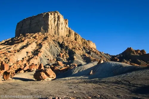
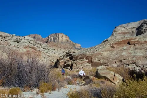
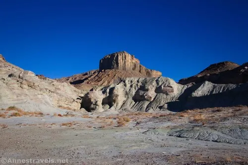
Park near the big rocks in the shadow of the mesa (you can’t miss it), then cross the road to follow what’s obviously an old road through a break in the hill. Continue to follow the road until it ends, then try to follow a social path.
I didn’t find it particularly easy to find the trail. I highly recommend downloading the GPX file at the bottom of this post and following it if possible. My GPS was refusing to show my GPX files that day (firmware issues), so I was pretty much on my own except for a few GPS coordinates.
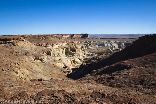
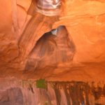
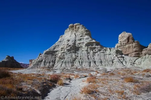
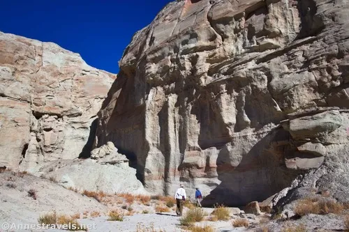
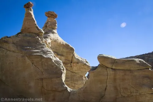
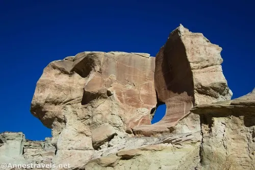
After about half a mile, the route descends into the canyon in at least two drops. Be watchful for this turn on the way back. Keep hiking downcanyon until you drop into an area of white rock spires. Wow!
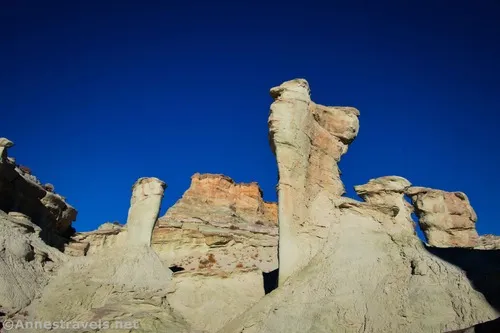
This is where most people seem to take pictures. And if you’re in this just for the “see it and leave” value, you’ll probably want to get your photos and go back the way you came for an approximately 1.8 mile hike. Otherwise, enjoy this section before continuing downcanyon.
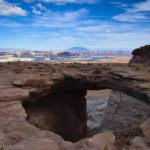
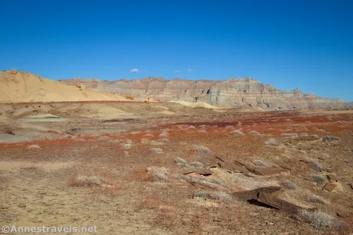
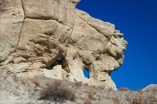
The canyon after this has a few more hoodoos or rock formations, as well as a couple of small arches, but in general, it’s not a super interesting walk. The tread is sandy but doable.

About 2.5 miles from the trailhead (about 1.6 miles since the beginning of the rock formations), stay on the left side of the canyon on a social trail. This will avoid much of the brush at the canyon mouth and take you down to Wahweap Creek a short distance downstream from the actual mouth of Resurrection Canyon.
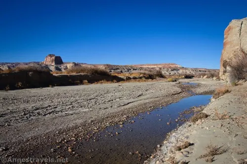
It’s a pretty little place to hang out for a while. I rock-hopped across the creek and explored a bit (not that there’s a whole lot to see). When you’re ready, retrace your steps up Resurrection Canyon.
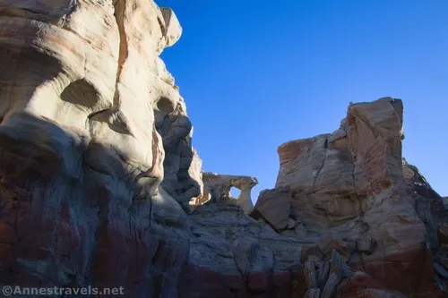
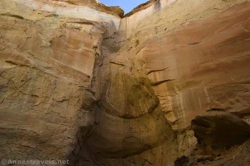
Except… you’re missing out on a lot of really fun and interesting stuff if you just go back to the trailhead. If you’re up for an adventure, there are several (well, really just two with offshoots, and even those two canyons connect) side canyons just downstream of the rock spires on the left (as you walk upcanyon) side of the main canyon. (The GPS track also shows one canyon on the right of the main canyon, but it was a nasty climb up there without much reward, so I won’t detail it.)
I had a blast exploring these side canyons. With all of my wanderings and even getting turned around once (plus hiking up one of the canyons that was very hard to get into because of the dirt and rocks at the entrance), I spent probably an hour or maybe 1.5 hours down in there. It was such fun!

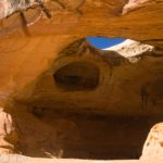
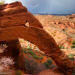
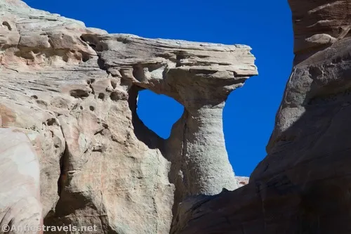
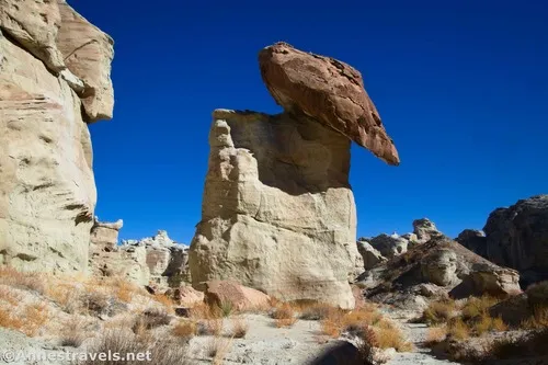
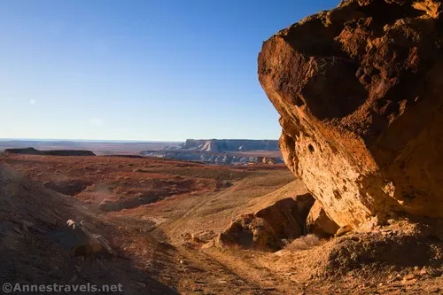
I won’t tell you exactly what I did, but I will say that there are a few small dryfalls (nothing crazy), striped rocks, a fantastic view down into the next canyon to the west, a grotto (that really is a slot), a sand dune, and a balancing rock above the canyon that gave me the shivers to walk beneath it.
Be very careful to take stock of landmarks before you explore – it’s a pretty good maze back in there. I did get turned around once, but thankfully, I just went around a small rock formation and was fine. It’s one reason I’m glad I carry a GPS with me, though.

When you’re done exploring, head back up to the parking area. Be sure to take the route out of the canyon in the proper place and then follow the social trail back to the old road!
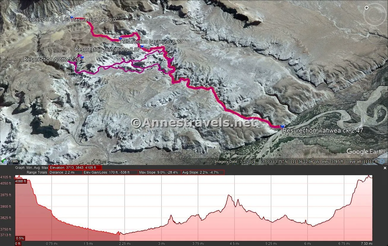
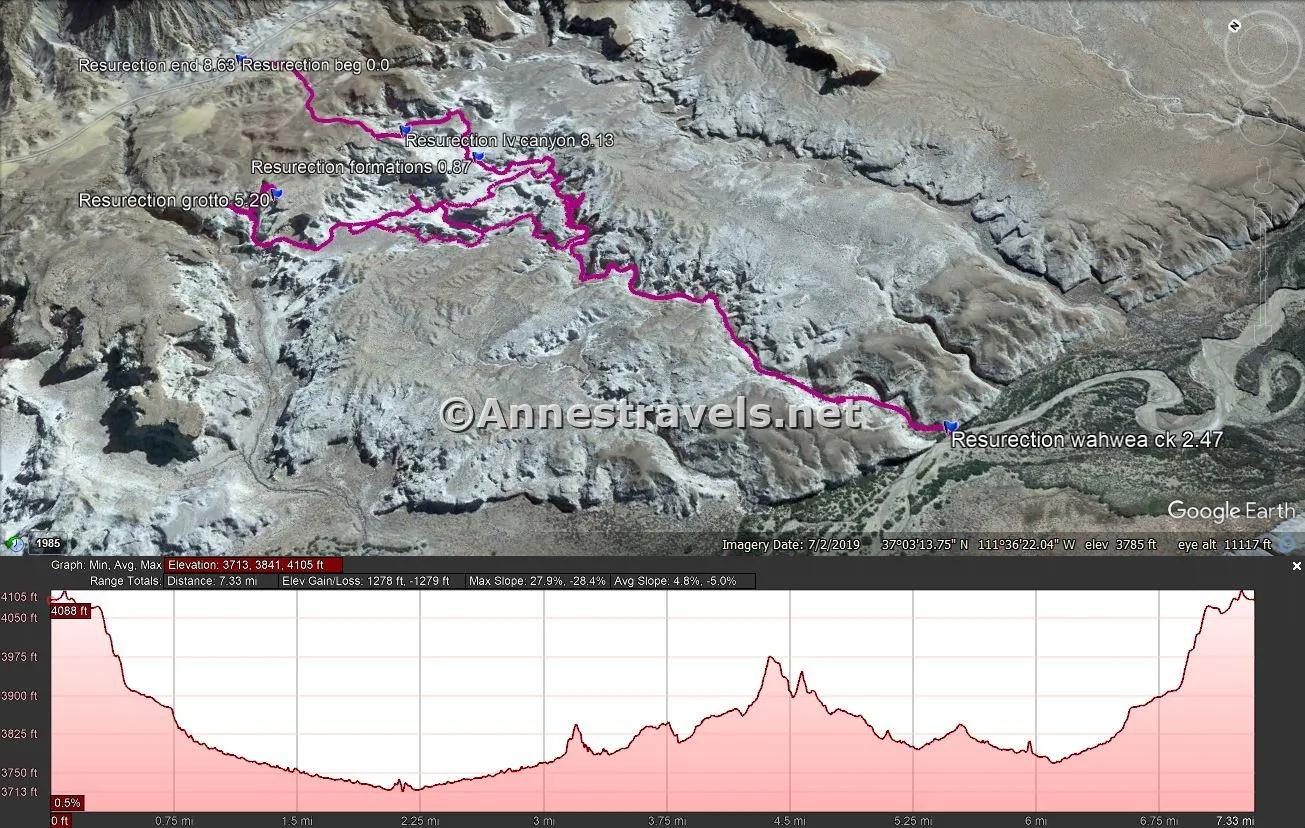
Round Trip Trail Length: To Wahweap Creek and back would be a fairly easy 5 miles. With all my exploring, I went 8.6 miles.
Elevation Gain: To Wahweap Creek and back would be 702ft. (4,105ft. to 3,713ft.). I went 1,279ft. (4,105ft. to 3,713ft.).
Facilities: None

Fees: $30/vehicle, valid 7 days. Cash – though legal tender – is not accepted by the US government at this site. You can buy a pass here, since there is no entrance station on the Smokey Mountain Road. America the Beautiful National Parks & Federal Lands Passes are accepted.
Trail Notes: Be ready to wayfind a bit on your way into the canyon and to scramble down into the canyon (it’s not hard or even all that steep, but it’s a little sandy and slick – a butt slide is acceptable, lol). I had no problem with GPS signal, but it’s still better to keep track of your surroundings than to rely on technology. This is especially true while exploring.
Trail 
![]()
![]()
![]()
Road ![]()
![]()
Signs ![]()
![]()
![]()
![]()
Scenery ![]()
![]()
Would I go 100 miles out of my way for this? ![]()
Overall Rating: 
![]()
![]()

GPS Coordinates for Resurrection Canyon
TH: 37.0673460°, -111.6080930° (37°04.04076′, -111°36.48558′ / 37°04’02.4456″, -111°36’29.1348″) (4,089ft.) (0.0)
Formations: 37.0598410°, -111.6059620° (37°03.59046′, -111°36.35772′ / 37°03’35.4276″, -111°36’21.4632″) (3,856ft.) (0.87)
Wahweap Creek: 37.0460600°, -111.6053420° (37°02.76360′, -111°36.32052′ / 37°02’45.8160″, -111°36’19.2312″) (3,709ft.) (2.47)
Grotto: 37.0625140°, -111.6114550° (37°03.75084′, -111°36.68730′ / 37°03’45.0504″, -111°36’41.2380″) (4,000ft.) (5.20)

Leave canyon: 37.0619210°, -111.6067430° (37°03.71526′, -111°36.40458′ / 37°03’42.9156″, -111°36’24.2748″) (3,942ft.) (8.13)
End: 37.0673350°, -111.6080990° (37°04.04010′, -111°36.48594′ / 37°04’02.4060″, -111°36’29.1564″) (4,088ft.) (8.63)
The gpx file for Resurrection Canyon, including all of my exploring, can be downloaded – please note that this and the GPS Coordinates are for reference only and should not be used as a sole resource when hiking this trail.
Download GPX File size: 175.8 KB Downloaded 66 times
You can also download the gpx file for Resurrection Canyon only (no exploring):
Download GPX File size: 59.6 KB Downloaded 63 times
(Note: I do my best to ensure that all downloads, the webpage, etc. are virus-free and accurate; however, I cannot be held responsible for any damage that might result, including but not limited to loss of data, damages to hardware, harm to users, from use of files, information, etc. from this website. Thanks!)

Getting to the Resurrection Canyon Trailhead
From Page, AZ, drive north on US-89. Cross over the Glen Canyon Dam and continue 14.7 miles (beyond the dam). Turn right on Ethen Allen; 0.3 miles later, turn right on E Concord Brg, more commonly known as the Smokey Mountain Road. (Mind you, there might not be street signs.) Clock off 4.0 miles to a good-sized area to park on the left beside two huge, sort-of-balanced boulders. Note that you’ll need to cross over Wahweap Creek; as long as it’s not too deep, the crossing is fairly firm. I’d still recommend high clearance, and 4×4 wouldn’t go amiss.
From Kanab, drive east (south) on US-89 for 56 miles to the town of Big Water. Turn left on Ethen Allen; 0.3 miles later, turn right on E Concord Brg. (Mind you, there might not be street signs.) Clock off 4.0 miles to a good-sized area to park on the left beside two huge, sort-of-balanced boulders. Note that you’ll need to cross over Wahweap Creek; as long as it’s not too deep, the crossing is fairly firm. I’d still recommend high clearance, and 4×4 wouldn’t go amiss. I wouldn’t try to get to the trailhead with low clearance.
Today’s Featured Product!
Almost 60 short to multi-day adventures are described in detail in this book covering Glen Canyon and nearby Grand Staircase-Escalante National Monument. The hikes cover some of the best scenery across the region between Canyonlands and Bryce Canyon/Zion. Buy your copy here!