Ever since seeing a map of the Sentinel Meadows Loop on the internet last summer, I wanted to hike it. There was no reason for it; reviewers were few and far between, and it seemed that those who hiked it didn’t find the scenery especially stunning. But we set off one misty morning to see what was there and were very pleasantly surprised to discover several geothermal areas, a very quiet, backcountry trail, and tons of bison – the last was far more exciting than we wished, but we survived!
Quick Stats
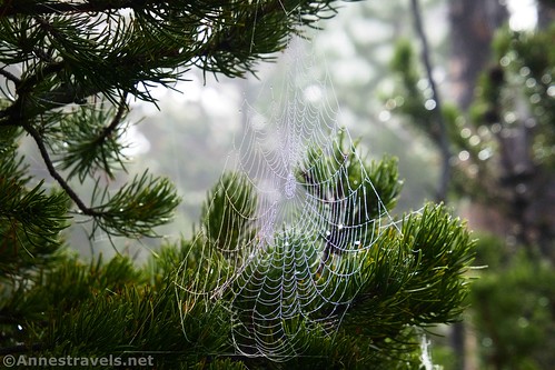
The trail begins at the Fountain Freight Road Trailhead at the end of the Fountain Flat Drive, off of the main road north of Midway Geyser Basin and the Grand Prismatic Spring. (In fact, the Fountain Freight Road passes behind the Grand Prismatic Spring – you can see those pictures here.) It was a very misty morning, so foggy that we couldn’t see more than about 20ft. in any direction.
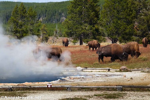
We parked in the large lot and began walking the old fright road. It’s mostly flat and extremely easy walking. Bicycles are also allowed on this section of the trail. The first real excitement happens at mile 0.3, when the short side trail to Ojo Spring strikes right. There were too many bison in the area to leave the main trail, so we continued along the Fountain Freight Road down to cross the Firehole River.
A very short distance beyond the bridge (0.4 miles from the parking area), the northern junction for the Sentinel Meadows Loop strikes right. However, there were just too many bison around. Since we had no interest in getting anywhere near one, let alone forty, we continued straight on the Fountain Freight Road.
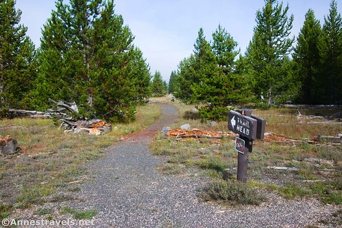
The freight road in the mist was so cool; almost other-worldly. The road was still mostly flat and easy to travel the 1 mile to the southern junction of the loop. A single bison was nearby, but he didn’t seem interested in us and he wasn’t too close to the trail. We heaved a sigh of relief and turned right down the distinct but not often-used path. (Why the trail signs at both ends of the loop point to “trail head” is beyond me. Turning off of the old freight road will not take you to a trailhead!)
The trail meanders happily through the trees and meadows for a few minutes before arriving at a signed trail junction at mile 1.6. A path leads left from here to Imperial Geyser and Fairy Falls (you can read about a shorter trail to Fairy Falls here). You want to continue right toward Queen’s Laundry and Sentinel Meadows Trailhead.
Not too long after this junction, the trail gets rather exciting. In fact, almost too exciting. Cross over Fairy Creek (it was wet and marshy even in September) to find yourself without much of the way of a trail in an active geyser basin. (I kid you not.)

It’s technically illegal to go off-trail in a geyser basin, so the NPS has helpfully installed big orange squares (or sometimes small orange squares) to show you where the trail might possibly be. Of course, you have to spot the big orange squares first. Usually, they’re on trees or on big wooden posts in the ground. But I can’t guarantee that we stayed 100% on the trail in this section (even for trying). One of my group members kept a close eye on the bison hoofprints in the soft mud… he figured that if a bison didn’t go through the crust, neither would our hiking boots. Very comforting, I’m sure!
At the far side, a drainage channel was wet and impossible to avoid. The chances of getting muddy feet were high here. We finally picked up the trail again (yay!) and heaved a sigh of relief. Be glad, the hardest part of finding the trail is over!
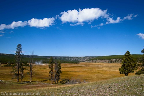
As you pass through the lovely meadow on the other side of the geyser basin, look left. You should be able to see Fairy Falls on the gray cliff.
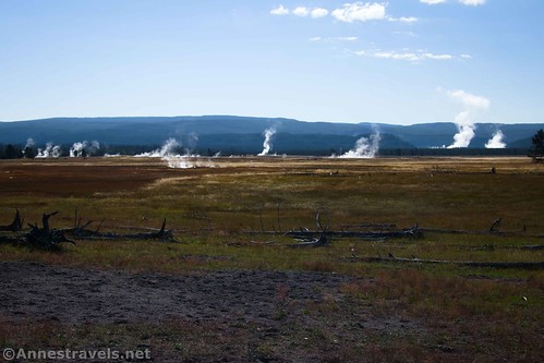
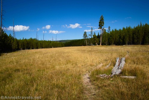
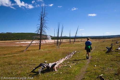
The trail passes through a line of trees, then works its way through golden meadows (in the fall; I imagine they’re green in the spring). During wetter times of the year, the path could be muddy. Keep hiking on the mostly-level path.
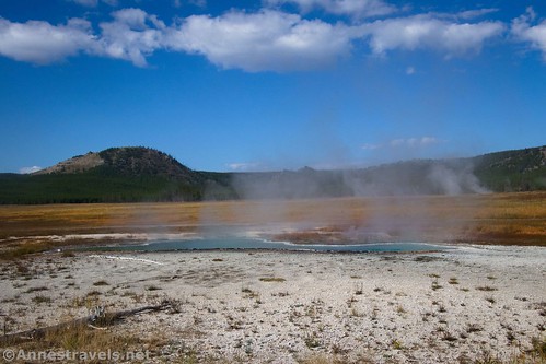
The trail turns north and then enters another geyser basin. Thankfully, the path is very defined here along the hillside. As you’re still heading north, if you look west (to the left) at a distant spring, you may be able to see the cabin of Queen’s Laundry to the right (north) of the spring. I missed it entirely, but then again, I also didn’t know what I was looking for and was totally distracted by the springs ahead of me at this point.
The history of Queen’s Laundry is interesting. Before the US Army took over the administration of Yellowstone National Park, five superintendents oversaw operations, law, and order in the area. One of these, Philetus Norris, began building a bathhouse on the site of Queen’s Laundry Spring (so-called because bathers would wash their clothes in the spring before going swimming, hanging their clean garments on nearby trees and stumps).
Before the bathhouse could be completed, Norris was replaced by Patrick H. Conger, who declined to complete the project. Even though you can’t go over to the building (it’s illegal due to the geyser basin status of the land around the cabin), it’s on the Register of Historic Places because it was the first government-funded building in a national park for public use. (Actually, they almost removed it in 1964, but decided that 1) it was so saturated with minerals that it wasn’t going to degrade much more, and 2) it was likely the oldest existing structure in the national park system.) You can read more about Queen’s Laundry here and here.
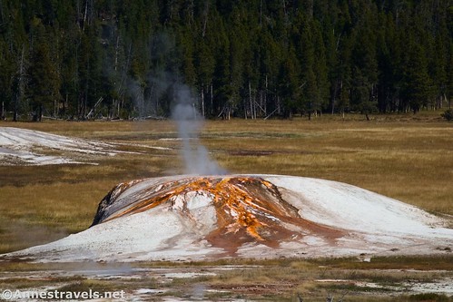
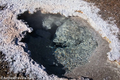
The trail goes slightly uphill to overlook the closer geyser basin (namely Mound Spring and Bath Spring (to the left and further away)). These are so cool, especially since you know that they’re in their native habitat and little has been done to alter them (there are no boardwalks, either!) When we visited, they were geysering just slightly.
Hike up a hill, then down the other side to reach a junction for the Sentinel Meadows East campsite at 4.2 miles. Turn right here and continue through meadows to descend gently back to the northern junction of the Sentinel Meadows Trail with the Fountain Freight Road. Turn left here to cross the bridge and return to the trailhead, 5.5-ish miles from your starting point.
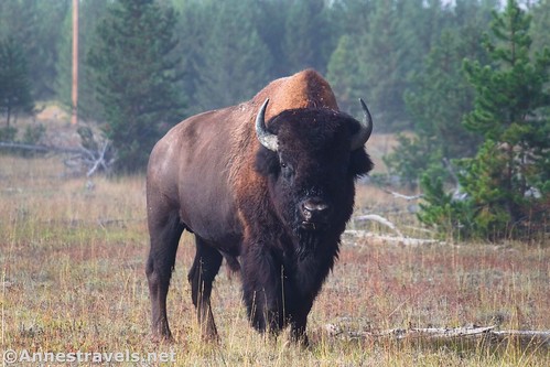
Except – when we tried to descend into the meadows to return to the Fountain Freight Road, they were filled with bison. We’re talking 50+ bison, all totally aloof to the world and not caring one fig whether you exist or not. We weren’t exactly going to walk through the herd, so we ended up off-trail, slogging across a creek, and finally back to the Fountain Freight Road. I can’t say as I recommend my route, but it was much better than getting quite that close to the bison!

Round Trip Trail Length: 5.5 miles
Elevation Gain: 346ft. (7,176ft. to 7,254ft.)
Facilities: None (there are no restrooms at the trailhead)
Fees: $35/vehicle to enter Yellowstone National Park, valid 7 days. America the Beautiful National Park & Federal Lands Passes and Yellowstone Annual Passes are accepted.
Trail Notes: Bicycles are allowed only on the freight road (no bicycles on the Sentinel Meadows portion of the trail). While you can hike the path in either direction, I like the way I did it (clockwise) for views and discoveries (though I’m sure it would be great counter-clockwise, too). Technically, the southern half of the loop is known as Imperial Meadows Trail while the northern half is Sentinel Meadows Trail. Be wary of staying on the trail in the geyser basin areas and of wildlife (especially bison), which can be quite dangerous.
Trail 


Road 


Signs 


Scenery 


Would I go 100 miles out of my way for this? 


Overall Rating: 


GPS Coordinates for Sentinel Meadows Loop
Firehole Freight Road TH: 44.5671530°, -110.8352400° (44°34.02918′, -110°50.11440′ / 44°34’01.7508″, -110°50’06.8640″) (7,193ft.) (0.0)
Ojo Spring Junction: 44.5635250°, -110.8376960° (44°33.81150′, -110°50.26176′ / 44°33’48.6900″, -110°50’15.7056″) (7,197ft.) (0.28)
Sentinel Meadow Northern Junction: 44.5621770°, -110.8386100° (44°33.73062′, -110°50.31660′ / 44°33’43.8372″, -110°50’18.9960″) (7,182ft.) (0.40)
Sentinel Meadow Southern Junction: 44.5484370°, -110.8438090° (44°32.90622′, -110°50.62854′ / 44°32’54.3732″, -110°50’37.7124″) (7,225ft.) (1.46)
Trail Junction (to Fairy Falls): 44.5490090°, -110.8471420° (44°32.94054′, -110°50.82852′ / 44°32’56.4324″, -110°50’49.7112″) (7,224ft.) (1.64)
Campsite spur trail: 44.5642150°, -110.8528540° (44°33.85290′, -110°51.17124′ / 44°33’51.1740″, -110°51’10.2744″) (7,194ft.) (4.20)
End at TH: 44.5671490°, -110.8352020° (44°34.02894′, -110°50.11212′ / 44°34’01.7364″, -110°50’06.7272″) (7,194ft.) (5.54)
The gpx file for the Sentinel Meadows Loop can be downloaded – please note that this and the GPS Coordinates are for reference only and should not be used as a sole resource when hiking this trail.
Download GPX File size: 73.2 KB Downloaded 73 times
(Note: I do my best to ensure that all downloads, the webpage, etc. are virus-free and accurate; however, I cannot be held responsible for any damage that might result, including but not limited to loss of data, damages to hardware, harm to users, from use of files, information, etc. from this website. Thanks!)
Getting to the Fountain Freight Road Trailhead
From Madison Junction, drive south on US-191 (the main park road heading for Old Faithful). After 5.6 miles, turn right onto Fountain Flat Drive. The trailhead is at the end of the road, 0.8 miles later.
From Old Faithful, drive north toward Madison on the main park road for 10.3 miles (that is, 10.3 miles from the exits onto the main park road, not from Old Faithful Lodge). Turn left onto Fountain Flat Drive. The trailhead is at the end of the road, 0.8 miles later. (Fountain Flat Drive is 4.4 miles north of the Grand Prismatic Spring/Midway Geyser Basin.)
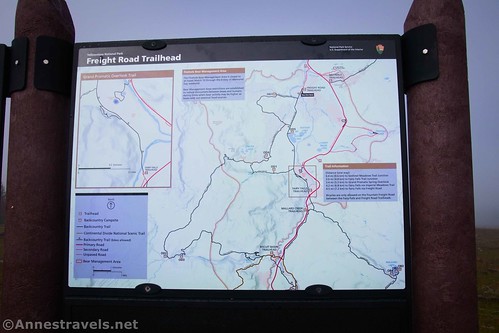
The parking area is large, but it’s also fairly popular. There is also quite a bit of turnover; wait a few minutes and you should be able to get a parking space.
Today’s Featured Product!
Ever wished you could get away from the crowds into the Yellowstone backcountry? Here’s the guide for you! Covering more than 300 trails (including a few that are abandoned or unmaintained), this is a unique and yet fascinating guide to the trails in the park. Buy your copy here!












Pingback: Hiking to Yellowstone’s Natural Bridge – Anne's Travels