I’ve discovered something: Sinks Canyon – where the river literally disappears underground and reappears, two hours and about a quarter mile later – is much more interesting in August than in June.
Quick Stats
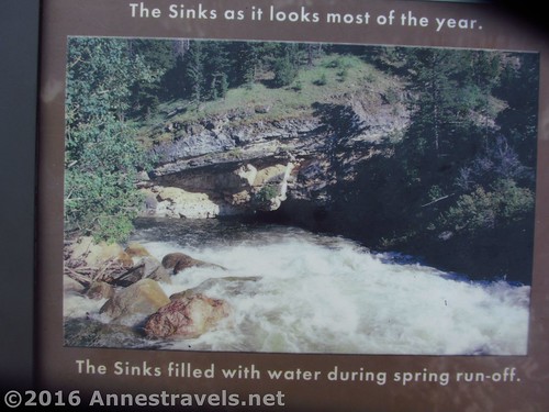
‘Way back in June 2003, we stopped at Sinks Canyon State Park, on the very edge of the Wind River Range of Wyoming, not too far from the town of Lander. To say it wasn’t my favorite stop on the trip would have been a bit of an understatement; I really did not enjoy standing next to a raging, boiling river with a whole bunch of little kids, and the river disappearing into a cave not 20ft. away. In fact, I was just a wee bit terrified.
Fast forward to August 2015, and we were driving toward Lander after hiking Roaring Fork Mountain. In the very early morning sunlight, we saw the signs for the state park – visiting was going to be as easy as pulling off the highway into the visitor center parking lot. It seemed a pity to waste such a good opportunity, so we did just that (pulled off the highway into the parking lot – the visitor center wasn’t open yet, but the trails and parking areas were all open and nearly deserted).
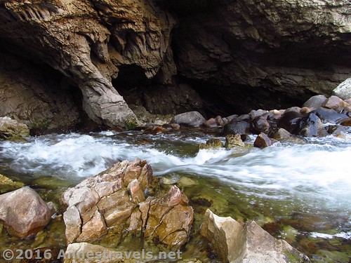
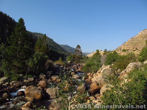
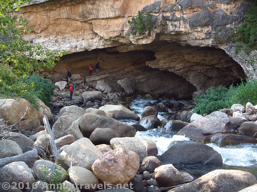
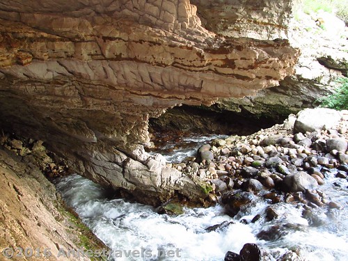
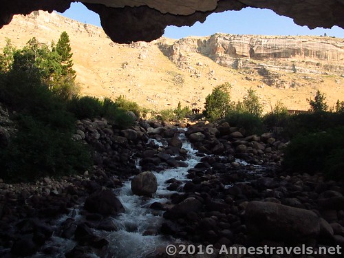
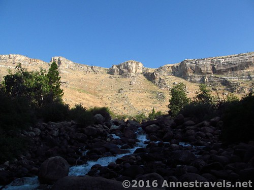
I’m so glad we stopped. Because what was a boiling river in June was a hurrying creek in August, and what was a little hole in the wall of the canyon in June was now an impressive, almost pretty cave with a river literally disappearing into it. Much more spectacular, and nowhere near as scary!
If you have time for only one thing in the park, I highly recommend taking the two (very short) trails from visitor center parking area to “The Falls” (better known now as “The Sink”). Head up the trail that is sort of next to or behind the visitor center. About 150ft. from the beginning of the trail, it will split; go right to the overlook first (the overlook is fully accessible). Here you can see the river as it tumbles straight down over rocks into the canyon wall – and disappears into a cave. Pretty impressive!
The left fork goes downhill to the place where the river goes into the canyon wall (cave). In June, the noise of the water was defining, and the waterflow was so high, the cave was all but invisible. (Except I think that if it was really invisible, it would have been more impressive – water simply flowing into a sheer cliff!) In August, it was much safer to get closer to the river, and the waterflow was low enough to actually be able to see the cave in all its impressive beauty. Safer as it may be, still use caution – those rocks are slippery!
All told, I walked 0.3 miles around The Sinks area.
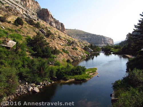
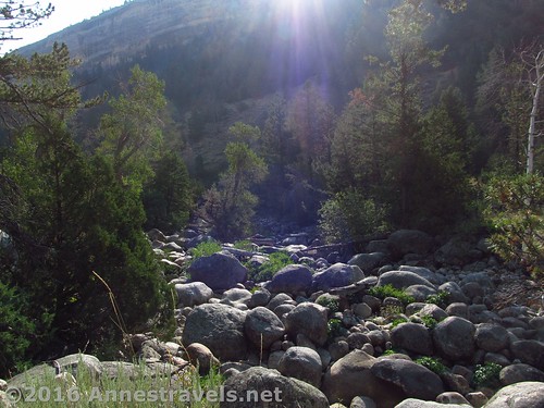
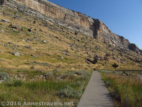
If you have time, I highly recommend walking down the “Rise Trail”. This 0.5 miles trail leaves from the opposite side of the parking area than the trail to The Falls. It wanders through the canyon, close enough to the road to never really be in the wilderness, but still impressive with canyon walls, canyon foliage, and a view into the overflow channel that takes water around the Sink Cave in extremely high flow conditions. There are a couple trail junctions – it really doesn’t matter which one you take, as all end up at The Rise sooner or later (generally sooner!) Just stay left on The Rise Trail and not the North Slope Trail, as this heads back upcanyon.
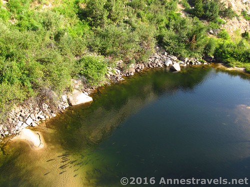
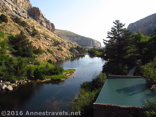
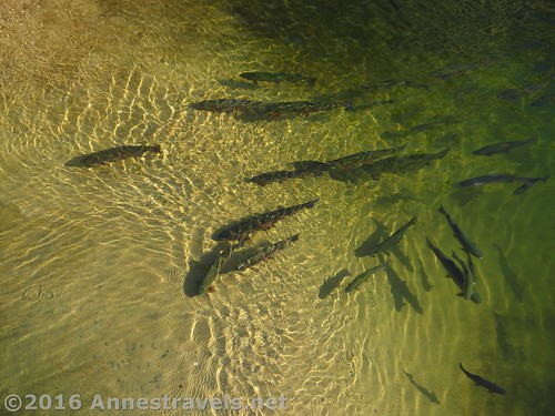
The Rise Trail crosses the highway (careful of traffic!) and then works its way 0.05 miles to the parking area for The Rise. (Some members of the group decided they’d rather drive, so they brought the van down while the rest of us stretched our legs.) Continue along the sidewalk to the end of the parking area and follow the 0.1 mile trail left past the fish food dispensing machine and to the platform overlooking “The Rise” – the place where the water comes back out of the ground. I’m not sure if this wasn’t more impressive during the spring runoff, but the fish were easier to see in August, and some of the younger members of the group had a terrific time feeding the fish!
Overall: I wouldn’t go 100s of miles out of my way for it. But it’s a pretty cool stop if you happen to be in the area and the flow isn’t too high.
Round Trip Trail Length: As little as 0.5; doing what I did (Sinks Area, Rise Trail, Rise Area) was 1.0 miles.
Net Elevation Gain / Loss: 119ft.
Facilities: Visitor center near The Falls; restrooms at the visitor center and the Rise (if I remember correctly!); campground nearby.
Fees: None!
Trail Notes: Dye tests have shown that the water at the Sinks takes 2 hours or more to work its way ¼ mile down the canyon to The Rise. No one has ever explored the cave, as it narrows down to thin cracks in the rock, so scientists speculate that there must be winding passages the water goes through before resurfacing. Also, more water surfaces than goes down The Sink – leading scientists to suggest there are other, smaller “sinks” in the area.
Trail 


Road 


Signs 


Scenery 


Would I go 100 miles out of my way for this? 


Overall Rating: 


Key GPS Coordiantes
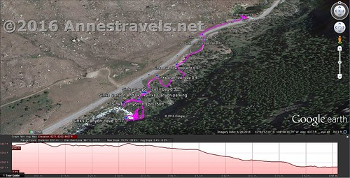
Parking: 42.74813N / -108.80937W (42° 44′ 53.268″ / -108° 48′ 33.732″) (6,375ft.)
Falls Trail Beginning: 42.74812N / -108.80944W (42° 44′ 53.232″ / -108° 48′ 33.9834″) (6,385ft.) (0.0; ended 0.3)
Falls Trail Split: 42.74789N / -108.80952W (42° 44′ 52.4034″ / -108° 48′ 34.272″) (6,385ft.) (150ft.) (Right to overlook, Left to cave)
Falls Overlook: 42.74777N / -108.80991W (42° 44′ 51.972″ / -108° 48′ 35.676″) (6,389ft.) (275ft.)
Falls Cave: 42.74738N / -108.80977W (42° 44′ 50.5674″ / -108° 48′ 35.172″) (6,352ft.) (0.2)
Beginning of Trail to Rise: 42.74825N / -108.80926W (42° 44′ 53.6994″ / -108° 48′ 33.3354″) (6,380ft.) (0.3)
Overflow Loop Beginning: 42.74875N / -108.80909W (42° 44′ 55.5″ / -108° 48′ 32.7234″) (6,373ft.) (0.4)
Overflow Loop End Junction: 42.74926N / -108.80850W (42° 44′ 57.3354″ / -108° 48′ 30.5994″) (6,354ft.) (0.5)
North Slope Trail Junction: 42.75067N / -108.80746W (42° 45′ 2.4114″ / -108° 48′ 26.856″) (6,315ft.) (0.7)
Crosswalk to Cross Road: 42.75266N / -108.80557W (42° 45′ 9.5754″ / -108° 48′ 20.052″) (6,313ft.) (0.75)
Rise Parking: 42.75215N / -108.80598W (42° 45′ 7.74″ / -108° 48′ 21.528″) (6,278ft.) (0.8)
Rise Overlook: 42.75266N / -108.80557W (42° 45′ 9.5754″ / -108° 48′ 20.052″) (6,270ft.) (0.9)
End: 42.75235N / -108.80559W (42° 45′ 8.4594″ / -108° 48′ 20.1234″) (6,286ft.) (1.0)
The gpx file for Sinks Canyon State Park can be downloaded – please note that this and the GPS Coordinates are for reference only and should not be used as a sole resource when hiking this trail.
Download GPX File size: 25.3 KB Downloaded 158 times
(Note: I do my best to ensure that all downloads, the webpage, etc. are virus-free and accurate; however, I cannot be held responsible for any damage that might result, including but not limited to loss of data, damages to hardware, harm to users, from use of files, information, etc. from this website. Thanks!)
Getting to Sinks Canyon State Park
In the town of Lander, WY, from Main Street (US-287), turn south onto S 5th Street (this will be a left turn if coming from the south and I-80, a right turn if coming from the north and Fort Washakie). After 0.7 miles, S 5th Street turns right and becomes WY-131S / Fremont Street. Continue on WY-131S for 6.9 miles to the visitor center, on left. You’ll pass The Rise on your way to the visitor center.
If you’re coming from I-80: Take Exit 215 to Rawlins, following the signs for I-80 Business Loop. Stay on I-80 Business Loop for 0.5 miles, then turn right onto US-287 Bypass for 1.5 miles. Turn right onto US-287N, signed for Casper and Lander; continue on US-287N for over 120 miles to the town of Lander. Follow the directions above.
If you’re coming from the Roaring Fork Mountain parking area, the route is simple: Take Forest Rd 302 (the only road around) back out from Worthen Meadow Reservoir. Turn left onto Lois Lake Road, following the signs for Lander (also following the paved road, since the road to the right is definitely not paved). After 10 miles, the visitor center parking area will be on your right!
Zoom map out to browse nearby hikes & places of interest
This Week’s Featured Product!
This is a great little book with dozens of trails to choose from across Wyoming. Sinks Canyon State Park is included, as well as the Wind Rivers, Bighorn Mountains, Washakie Wilderness, Grand Tetons, and so much more!


Pingback: "I am the vastness..." - Anne's Travels
Pingback: 9 Terrific Day Hikes in the Wind Rivers - Anne's Travels