Yesterday, I posted about all of the trails in Arches National Park. Today, I’ll tell you the rest of the story – everything else we did while exploring the area around Moab on my most recent visit to the area. This post will include quite a few places in Arches that aren’t official trails, plus destinations in Island in the Sky and on BLM land. Enjoy!
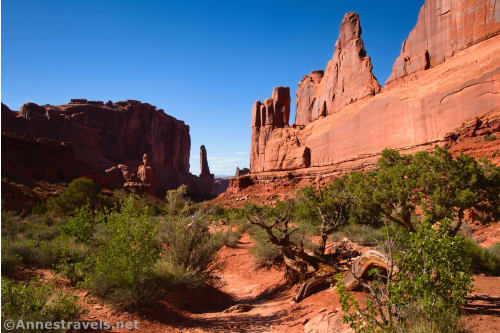
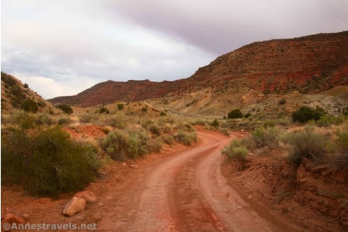
We started out our time in Arches on the Willow Springs Road. This is a 4×4 road, but both ends are 2WD friendly. We entered from US-191 through the new UtahRaptor State Park (a UtahRaptor is a kind of dinosaur – several fossils have been found in the area) and drove nearly to the entry gate to Arches. A very rough slickrock section right before the gate convinced us that we would rather walk the last tenth of a mile.
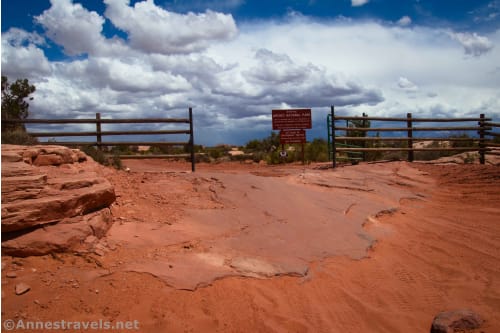
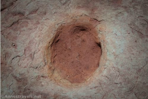
But before we stopped driving, we took a quick break at the Willow Springs Dinosaur Track Site.
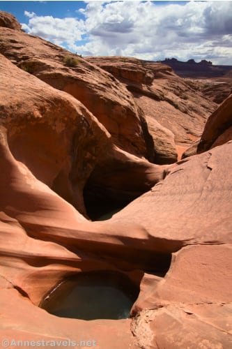
Then, after we parked the van, we walked down the road to Willow Springs Canyon. It was great fun to scramble down the canyon, especially since the potholes had water in them.
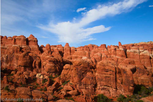
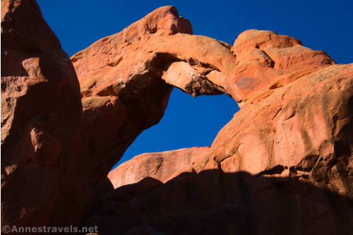
On our way back, we tried to find a few arches, but the GPS coordinates I’d printed off the internet were hopelessly wrong. We did find one arch (Slanted Eye Arch), but that was it for all of our scrambling and wash-hiking. Oh well. We headed into the park early the next morning (think 5:30am – we weren’t going to risk being turned away for not having a timed entry ticket after 7am!) to hike Devils Garden.
Unfortunately, the weather wasn’t great. But we still had a grand time and did a bit more exploring. I pretty quickly decided that the people who had given me these GPS coordinates for the off-trail arches hadn’t a clue where the arches truly were. But we did see a couple of nice ones from other internet sources, so that was fun.
The next day, we hiked down the Kane Creek Road to Moonflower Canyon…
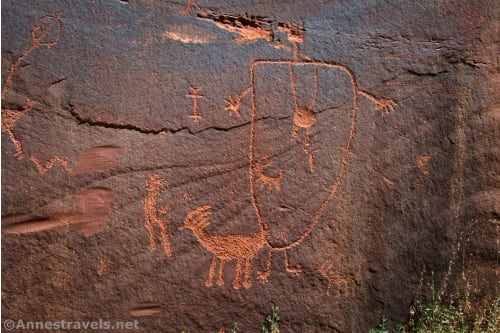
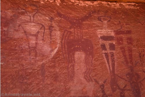
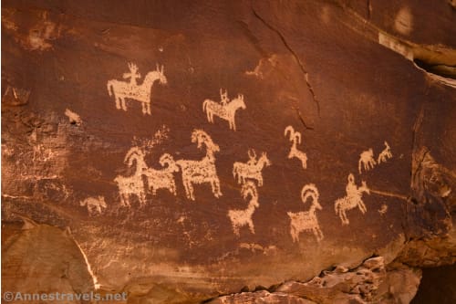
…and then continued hiking down the road past several rock art sites. These are on private property, but you can see them from the road fairly well. We ended up following a closed mining road (on BLM land) up to a viewpoint down on the canyon.
We hiked up to Courthouse Panel the next day, and I also made a quick trek up the bottom of Lower Courthouse Wash.
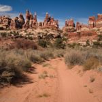
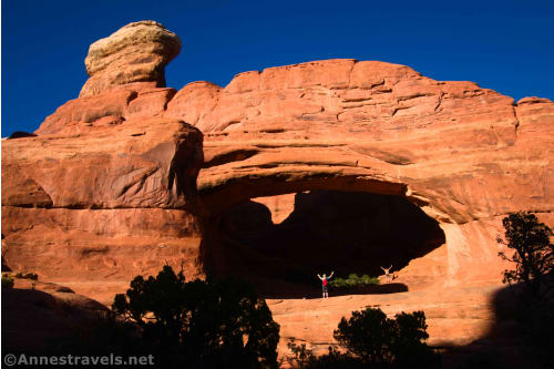
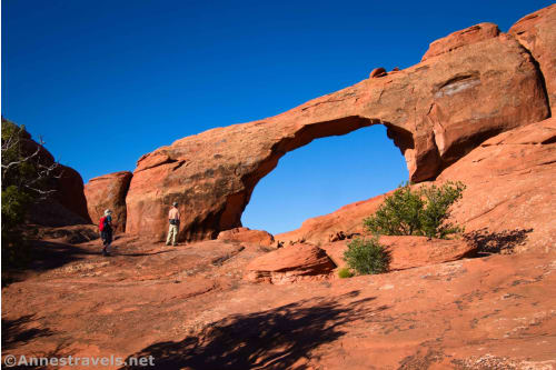
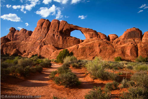
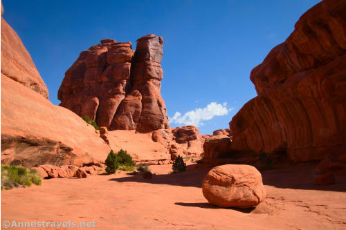
In the evening, we hiked Tower Arch. Talk about a hidden gem! The trail is strenuous, but the views were outstanding. Plus the arch was cool, too!
Eagle Park was my next destination. I’d read credible reviews online that said you could follow an old road to this extremely remote area in the northwest corner of the park. However, just to be on the safe side, I made up a GPX track for my GPS. Between that and the road, we had a fabulous, gorgeous hike through the area.
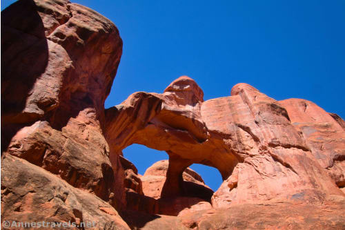
It rained as we drove back into the main part of the park, but I still got out in the evening to see Blocked Arch and Crystal Arch. They’re off the Devils Garden Trail, so we had to be careful where we walked to LNT.
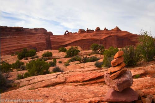
One of my dreams for this trip was to enjoy sunrise at the Windows. I’d visited in the late afternoon back in 2020, but I wanted that classic shot of Turret Arch through the North Window. To be fair, we didn’t quite make sunrise, and we had to sit around for an hour or so, waiting for the sun to rise high enough to shed light on Turret Arch. But it was worth the wait!

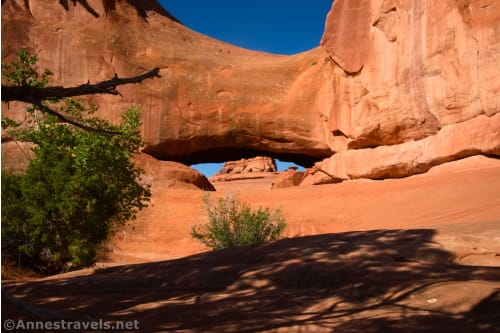
After breakfast, we headed out past Christmas Tree Arch to Ribbon Arch…

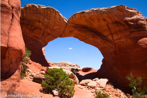
…then down to Double Arch and through a nearby saddle to the Cove of Caves and Cave Arch.

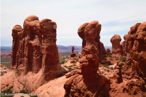
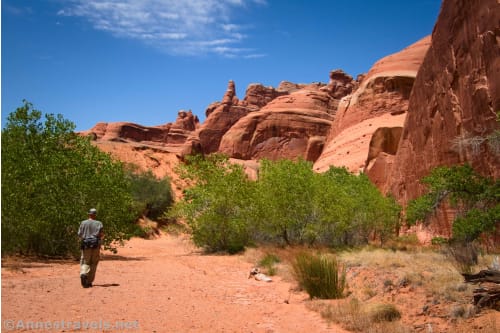
For the most part, we took off afternoons on this trip, as they were too hot and sunny to want to be out hiking. But this afternoon had a very nice breeze. So we explored (literally – there’s no trail) the Garden of Eden.
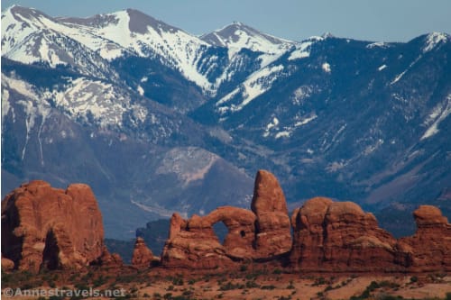
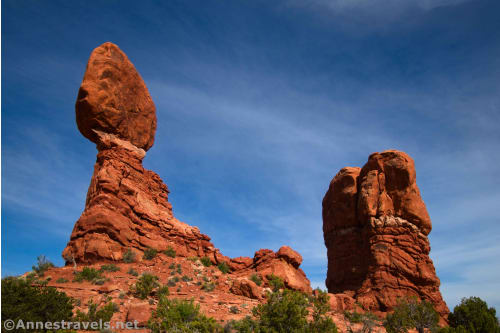
In the evening, we were in for another gorgeous surprise. I’d always thought the Balanced Rock would be better from afar. It’s actually quite impressive close up, and the views out to Turret Arch and the La Sal Mountains were spectacular!
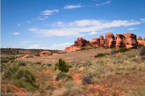
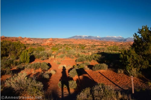
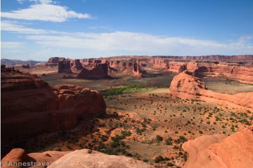
We decided to finish off the day with overlooks: Panorama Point, Cache Valley Overlook, and Salt Valley Overlook.
Plus the Fiery Furnace Overlook (which is the only one of these that you have to hike to see).
And since I’m the curious sort, I had found directions to Roadside Arch and Swanky Arch. Neither was really worth visiting, though I’d take Roadside over Swanky, personally.
We were thoroughly exhausted after that! But morning dawns a new day, and it found us hiking the “back side” (north side) of Skyline Arch.
Then it was long, arduous, and totally spectacular loop. We started out hiking through the campground on the Broken Arch Loop to Sand Dune Arch.
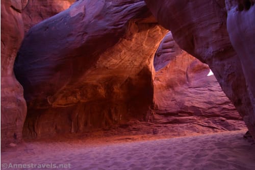
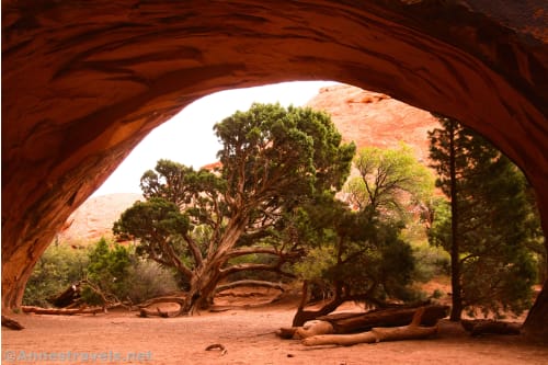
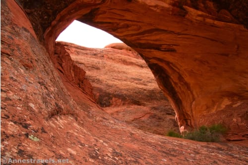
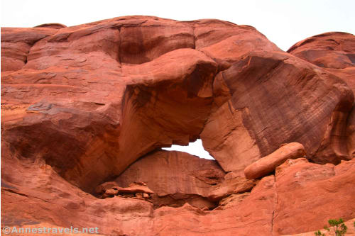
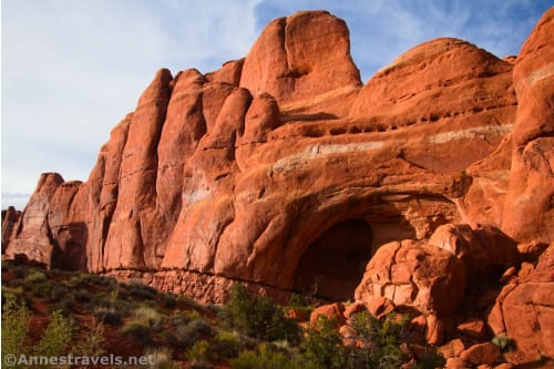
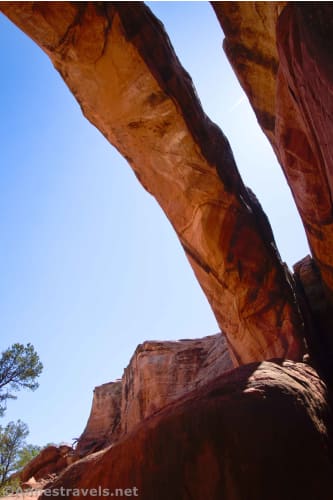
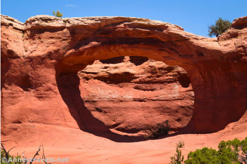
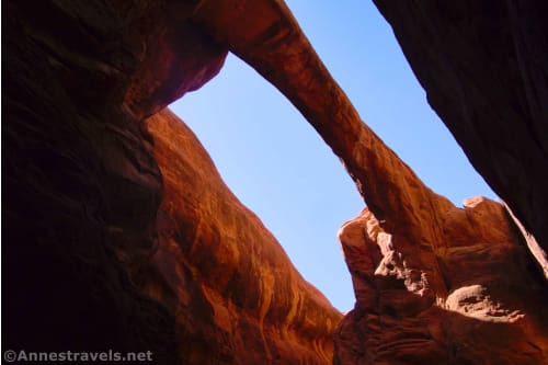
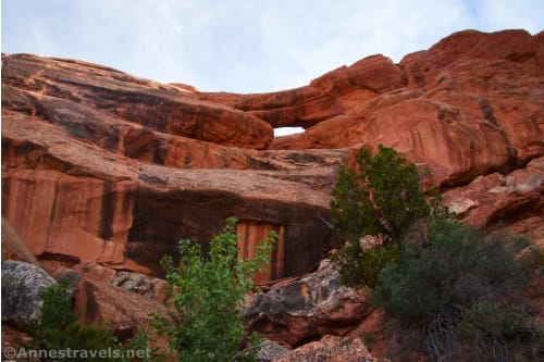
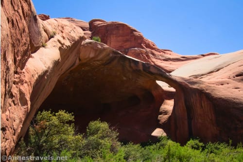
From there, we followed the gas pipeline (and quite a bit of off-trail scrambling) to Magic Mystery Bridge. Talk about impressive!
Social trails led from there over to Broken Arch.
We finished off that loop by taking the spur to Tapestry Arch.
In the afternoon, we drove down to the visitor center. I’d purchased reservations for the Fiery Furnace the week before. (We’re at the time of year where you wait for 8am, then try to add tickets to your cart as fast as you can in the hopes of snagging them before they’re sold out. The first time, I missed; the second, while driving I-70 across Colorado, it worked! Yay!) We had the reservations, but you still have to go to the visitor center the day before your hike to watch a video and pick up your permits. It was a good way to spend the heat of the day.
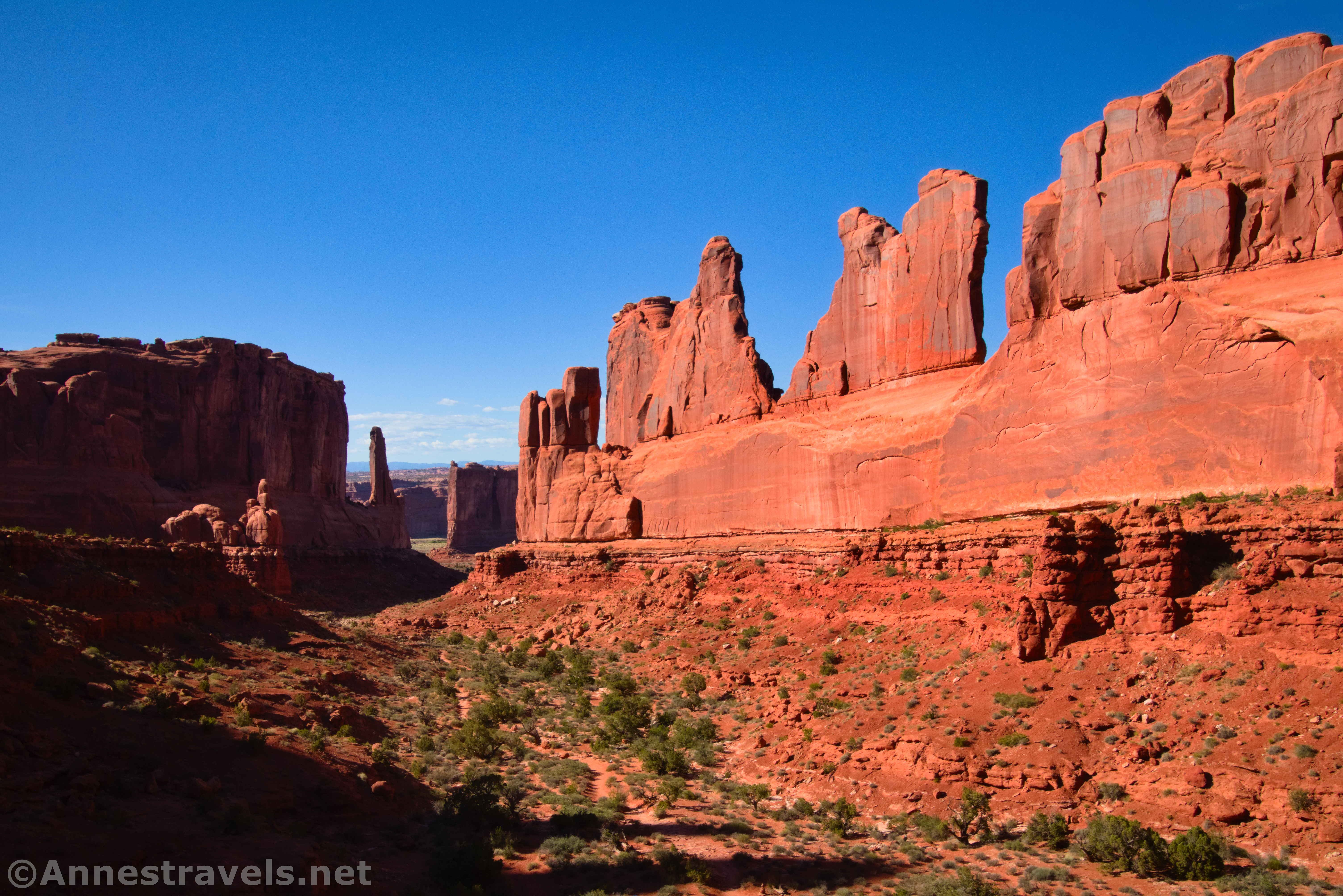
In the evening, we stopped at the Moab Fault Overlook and then hiked the Park Avenue Trail. It was gorgeous!
The La Sal Mountains Overlook and the Petrified Dunes Overlook finished off the evening.
We woke up early so that we could beat the heat in the Fiery Furnace. But at breakfast, we discovered that the ice in our cooler had melted dramatically the day before and was almost gone. Noooooo!!! So it was off to Maverick in Moab for ice and gas. Thankfully, our Fiery Furnace permits allowed us back into the park even though it was after 7am.
Despite our late start (almost 8am!), we had a blast in the Fiery Furnace. They say it usually takes people 2-4 hours to do the 2-ish mile loop, but we spent 8 hours scrambling, canyoneering (without ropes), discovering hidden arches, and much more. I’m not sure I’ve ever successfully taken one of my group members on quite that crazy a trail before, but she did fantastic! And as another group member said at the end of the day, “We came out of the Fiery Furnace, and we don’t even smell like smoke!”
My group convinced me that we should take the quick hike up to Skyline Arch before heading to our campsite. I’m glad they did, even if I was feeling a bit tired after all of that scrambling!
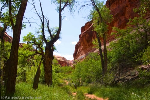
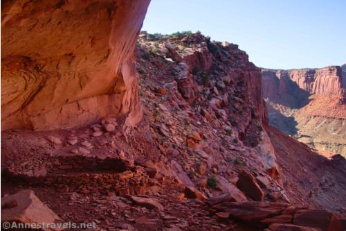
The next day was supposed to be cloudy, which was true. So we took an off-trail route up to the Tunnel and then on a crazy scramble up to the top of the Great Wall. The views from up there blew my mind! We walked to the top of Forget-Me-Not Canyon and then headed back (more or less) the way we’d come. The biggest surprise of the day was that there’s now a good social trail leading to the Tunnel – but I missed it on our way there, and we had quite the willow bushwack up Courthouse Wash. Oh well!
I traipsed a short distance down the top of Lower Courthouse Wash, then we waited out an afternoon thundershower. The sun came out in the evening to allow us to see Pothole Arch (which is better from the pulloff)…
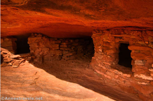
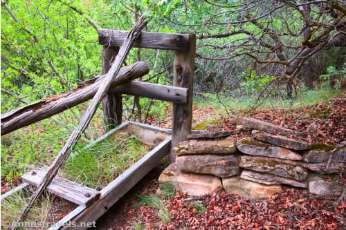
…as well as Wolfe Ranch and the nearby petroglyphs.
Then it was up to the Upper Delicate Arch Viewpoint. I had hiked this back in 2013, but I needed a more reliable GPS track. It was so much fun to see Delicate Arch, even if we didn’t get to go up the official trail on this trip.
I ended the evening by dashing down the Cache Valley Road to the park boundary. Despite what others online have reported, the road is closed to camping. But you can still get a good view of Delicate Arch from it!
I had only one more adventure planned in the main part of Arches National Park: Eye of the Whale Arch and Whale Canyon. We started out by hiking the “Rough 4×4 Road” to Leaping Arch…
…then backtracked to Eye of the Whale Arch.
From there, we scrambled to the head of Whale Canyon and then down its length. That was fun, especially when we saw bobcat tracks in the soft sand of the canyon floor!
We drove up to Island in the Sky (you knew I’d have to visit Canyonlands while I was in the area!) in time to explore Aztec Butte. If the number of blog posts is to be believed, it’s not a popular hike. But it’s actually quite interesting and beautiful.
Before sunset, I hurried down to the alcove on the Alcove Spring Trail and back, enjoying views down into Lathrop Canyon.

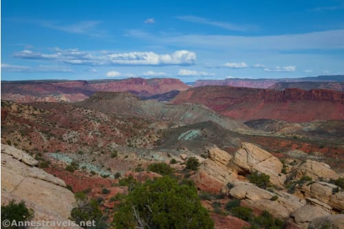
The next morning started out at the Holeman Spring Canyon Overlook (unmarked, and therefore I’d never done it before).
Then it was down to False Kiva (another unmarked, unofficial trail).
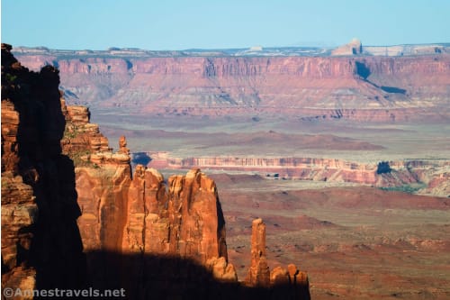
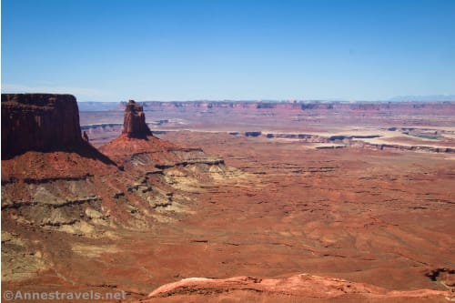
We decided to hike the Wilhite Trail to the point where it goes down into the canyon. We did, and then on our way back, we walked out onto what I’ll call Wilhite Point. The views from the canyon rim were jaw-dropping – just so spectacular. In the way of “views,” this was the best hike of the entire trip!
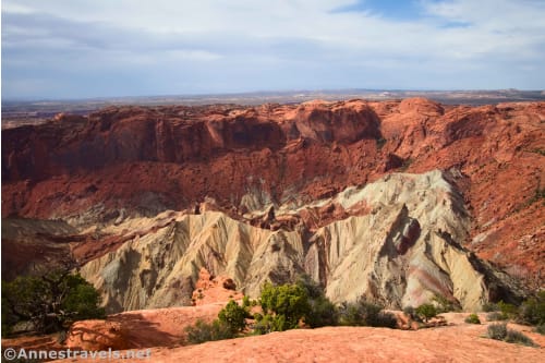
I did a short portion of the Syncline Trail, then we hiked Upheaval Dome. The end was sketchy (I think they were missing signs), but it was still beautiful.
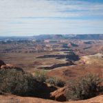
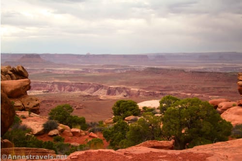
We finished off the night with Grand View Point, but since the clouds had rolled in, it wasn’t super impressive.
It was still cloudy the next morning as we hiked the Neck Spring Trail. It was interesting and more scenic than I’d anticipated, but it was still too long for what you got to see in my opinion.
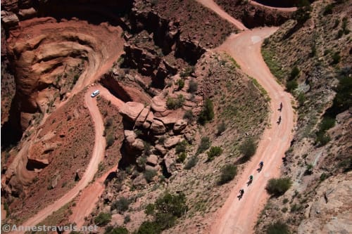
We spent quite some time watching vehicles and bicycles on the Schafer Trail on our way back to the parking area.
There was only two more hike to go, so we used the afternoon to drive out to Yellowcat Flat. I wanted to hike to the arches near Covert Arch, but the Winter Camp Ridge Road was too sandy, and we turned around rather than risk getting stuck (2WD does have its disadvantages some days). Instead, we headed for the Lost Spring Canyon Trailhead. And what a hike it turned out to be! The views of the La Sal Mountains were great, but the hike really took off once we turned up a side canyon. We saw Covert Arch from below along with several other arches. Plus the rock formations around the canyon were amazing. Not to mention the towering canyon walls in one of the canyon forks. Just wow!!
We got back to the van, ate hot dogs, and headed for home… but what a great trip! I hiked a total of 136 miles in 13 days. Maybe that’s why I took a few naps on the way home?
Today’s Featured Product!
Explore some of the best trails that Canyonlands and Arches National Parks have to offer with this book! It covers 64 trails and includes good trail descriptions, maps, photos, and more. Buy your copy here!