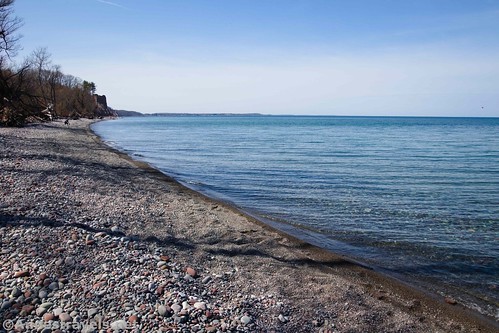
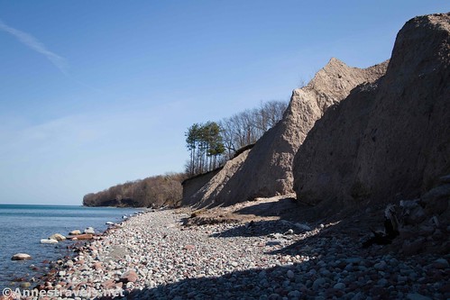
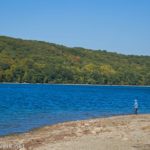
Did you know that you can walk for several miles along the shore of Lake Ontario north of Fair Haven State Park? It’s not exactly easy walking (lake stones are rough footing), but it’s doable. You’ll also get to see some bluffs and formations similar to Chimney Bluffs State Park. There are also a couple of ponds that offer great bird-watching and an alternate trail through the woods. And if you park at the Sterling Nature Center, there’s no fee to park!
Quick Stats
Begin at the Sterling Nature Center parking area. A kiosk has a map (and possibly brochures). Go to the diagonally opposite end of the parking area from the kiosk and you’ll find a path marked Lake Trail (this is Trail #3 on the map). Take this trail down to the lakeshore, 0.15 miles from the parking area.
You can turn right or left along the shore of Lake Ontario. For this hike, you want to turn left. I found that after walking for about 10 minutes, the crowds thinned down to nothing and we had almost the entire hike to ourselves.
The first set of bluffs (sometimes called the McIntyres Bluffs) is about a quarter mile down the lakeshore. These are not as nice as Chimney Bluffs, but they’re still pretty cool. Keep walking west for about another 0.4 miles; then pass some houses.
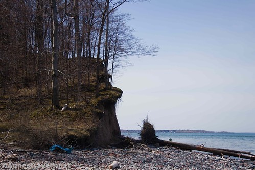
There are a few obstacles along the beach. Mostly they’re just trees that have been washed in from the lake during storms or that have fallen down from the bluffs above. You can usually either climb over them or duck underneath, whichever is easier for you.
The next point of interest is Juniper Pond at about mile 1.25. This is a great place to watch for wildlife, especially birds. The only wildlife I saw was some Canadian geese, but I didn’t stick around very long, either.
At the other end of Juniper pond, you have a choice: You can walk along the lakeshore along some more (and more impressive) bluffs, or you can turn left into the woods on a trail that bypasses the bluffs but is a nice little woodsy hike. For the moment, I continued along the lakeshore. I’ll talk about the woodsy trail later.
These bluffs (known as Sitts Bluff) start almost immediately after Juniper Pond and are much more impressive than the first set, rivaling Chimney Bluffs further west. After about 0.5 miles, the beach widens again to end at an ancient concrete fishing pier about mile 2.3. Scramble up the trail and turn right for a very nice view of the way you just came.
You can then scramble down to the pier if you don’t mind a little Class 2+ scrambling. It’s not too hard, but watch your feet and your balance. The pier is beginning to disintegrate at the end, but the views are great both of the lakeshore you’ve traveled, the bluffs, and west toward Fair Haven.
At this point, you could take the trail into Fair Haven State Park. I didn’t have the time to do so, so I turned back up the beach. But instead of going back along the lakeshore, shortly before the bluffs began I walked into the woods on a very defined trail.

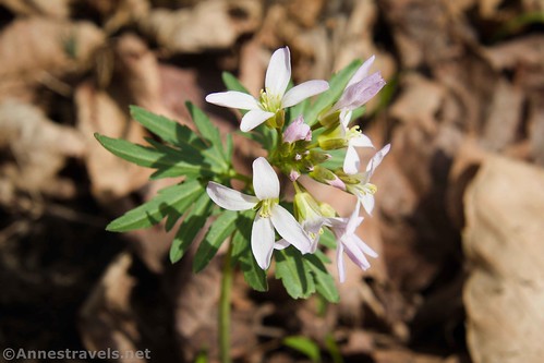
It turned out to be a great woodsy hike, more elevation gain than the lakeshore, but also easier walking. We saw an old ruin of a foundation as well as wildflowers. When the trail comes to a three-way junction, turn left – this is the end of Cooper Road. The left trail will take you back down to the lakeshore just below Juniper Pond.
At the end of the trail, turn right to walk northeast up the lakeshore back to the Lake Trail back up to the Sterling Nature Center.
Round Trip Trail Length: About 5 miles
Elevation Gain: 593ft.
Facilities: None
Fees: None if you park at the Sterling Nature Center. If you park at Fair Haven State Park there is a small fee.
Trail Notes: Lake stones do not make the easiest walking. Wear good shoes, preferably with ankle support, for this hike. Swimming in the lake is not allowed. If Lake Ontario is very high, you may find that the lakeshore underwater in some places (the lake is low right now). This route would be stunning in the fall, with the trees in color.
Trail 


Road 


Signs 


Scenery 


Would I go 100 miles out of my way for this? 


Overall Rating: 


GPS Coordinates for the Sterling Nature Center to Fair Haven State Park
Lake Trail Beginning: 43.3776333°, -076.6581167° (N43° 22.658′ W76° 39.487′) (296ft.) 0.0
Lakeshore: 43.3772833°, -076.6602000° (N43° 22.637′ W76° 39.612′) (244ft.) 0.14
Juniper Pond: 43.3648167°, -076.6704167° (N43° 21.889′ W76° 40.225′) (247ft.) 1.24
Viewpoint: 43.3537000°, -076.6826167° (N43° 21.222′ W76° 40.957′) (242ft.) 2.34
Pier: 43.3541000°, -076.6833333° (N43° 21.246′ W76° 41.000′) (229ft.) 2.41
West end of trail: 43.3560833°, -076.6801000° (N43° 21.365′ W76° 40.806′) (244ft.) 2.74
Trail/Cooper Road Junction: 43.3587500°, -076.6721833° (N43° 21.525′ W76° 40.331′) (254ft.) 3.29
East end of trail (approximate): 43.363131, -76.672940 (43°21.78786′, -076°40.37640′) (252ft.)
Head back up: 43.3772333°, -076.6600500° (N43° 22.634′ W76° 39.603′) (249ft.) 4.93
Almost end: 43.3774667°, -076.6584167° (N43° 22.648′ W76° 39.505′) (300ft.) 5.03
The gpx file for the lakeshore from Sterling Nature Center to Fair Haven State Park can be downloaded – please note that this and the GPS Coordinates are for reference only and should not be used as a sole resource when hiking this trail.
Download GPX File size: 88.3 KB Downloaded 129 times
(Note: I do my best to ensure that all downloads, the webpage, etc. are virus-free and accurate; however, I cannot be held responsible for any damage that might result, including but not limited to loss of data, damages to hardware, harm to users, from use of files, information, etc. from this website. Thanks!)
Getting to the Sterling Nature Center
From Hannibal, New York, drive on NY-3W/Church Street for about 0.7 miles. Turn left to stay on NY-3W for 2.1 miles, then turn right onto NY-104A E for another 1.2 miles. Take a sharp left onto Macneil Road for about 500ft., then take a sharp right to stay on Mcneil Road. After a mile, turn right onto Farden Road (County Rt. 98E) for another mile, then take a slight left onto Jenzvold Road. Take this road to its end at the Sterling Nature Center 8.0 miles later.
From Rochester, New York, take NY-104E about 41 miles from Rochester. Turn left onto Lawville Road. After 1.9 miles, the road will change names to Chapman Corners Road for another 1.7 miles. At the five-way intersection, take the left-ish-straight-ish option that is Caywood Road for 1.6 miles. Turn left onto NY-104A E for 2.6 miles, then keep left to continue on Old State Road for 3.2 miles. Turn left onto Macneil Road for 0.3 miles; turn left onto Farden Road for 1 mile, then take a slight left onto Jenzvold Road for 0.8 miles to the road’s end at the Sterling Nature Center.

Zoom map out to browse nearby hikes & places of interest
This Week’s Featured Product!
Check out more rock formations and geological wonders in western and central New York with this hiking guide! With over 80 places to explore, it’s a great resource for those who love rocks and rock formations.

