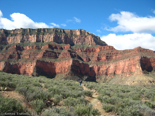
I love the Grand Canyon. It’s so awe-inspiring, so much bigger and more beautiful than any picture could portray. Over the years, I’ve hiked down into the canyon several times from both rims – from the first time I visited the park hiking 3 miles (4.8 km) down the Bright Angel Trail to hiking to the bottom of the canyon via the Lava Falls Trail at Tuweep. However, one of the most incredible experiences I’ve had in the canyon was when I took a section of the Tonto Trail. You’re on the rim of the inner canyon for most of the hike, so you get to look up at the formations most people only look down on from the rim, but you can still see the grandeur of it all. And it is grand! Steep red walls rising above you, steep drop-offs near enough to make you want to be careful, and views, views, views galore!
Note: The Tonto Trail actually transverses most of the canyon. However, I choose to hike the trail from the South Kaibab Trail to the Bright Angel Trail (about a 4.4 mile (7 km) section of the Tonto Trail and a 13.1-mile (21 km) RT loop). The Tonto Trail intersects the South Kaibab Trail 4.4 miles (7 km) from the South Kaibab Trailhead, after the Great Whites and near the “tip-off point” (primitive toilet, hitching rail, and emergency phone). I reached this junction about 8:15am and turned left down the Tonto Trail – the junction is fairly well-marked. You can read about my trek down the Tonto Trail here.
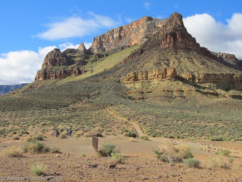
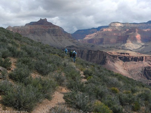
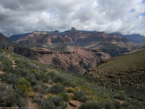
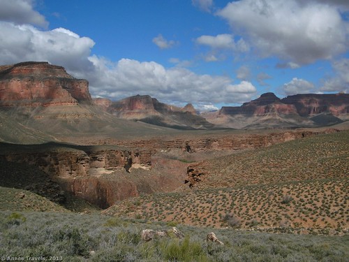
We stopped for a snack soon after turning onto the Tonto Trail. This is the most amazing part of the trail from my perspective. It’s also the section where the trail is the most grown-in. It’s hard to know whether to look at your feet to get around the bushes and rocks, or whether to look around you at the cliffs that seem to rise up to the sky. The buttes in the canyon are also jaw-dropping. We kept stopping to look and to take pictures. Also, from this section of the trail, you can see the Colorado River below you – very cool! At one section, you can also see some buildings below you near a river (someone told me that this was Phantom Ranch, but I’m not sure if this was true).
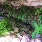
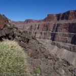
Sooner than I wished, the trail turned inland to go around a side canyon. Actually, the trail will wind this way in-and-out of side canyons for about 4.4 miles (7 km), all the way to the Bright Angel Trail. The views are better outside of the side canyons, but these canyons are also interesting if for nothing else than the canyon walls (which can be brightly colored). A couple of these side canyons have seasonal streams running through them; they shouldn’t be too difficult to cross, but you may have to use stepping stones. The steep canyons that you are skirting when you go into these side canyons are also impressive. In one side canyon the trail has to go quite a ways inland to avoid the steep drop-off. However, we couldn’t see the drop-off until we were on the other side, and it was pretty neat – multi-colored rocks and cliffs dropping steeply nearly to the river (I couldn’t see the river from there, but it sure looked like it!).
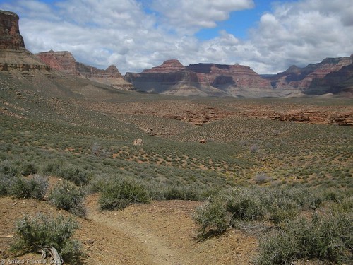
Eventually, after several side canyons, the trail will cross a kind of plateau. This was very pretty with the canyon walls rising above you. It was spectacular, but so different from the Tonto Trail near the South Kaibab Trail. This was another favorite part of the trail for me. The trail is better defined here, as well.
Not too long after this, the Tonto Trail T’s into the Bright Angel Trail just below Indian Gardens; turn left up the Bright Angel Trail to get to the gardens (a sign will direct the way). We arrived at Indian Gardens around noon, and it was very busy with people arriving, leaving, resting, using the primitive restrooms, getting water, camping in the campground, and generally trying to figure out where-to-from-here. (If you’re trying to decide how long it took us to hike the trail, realize that we stopped for a couple brakes along the trail – the longest of which was about an hour for lunch under and overhang about a mile (2 km) or so from the Tonto Trail/Bright Angel Trail junction.) We took a short rest at Indian Gardens, used the restrooms, filled our water bottles, and then headed up the trail again. However, the rest of the way up the Bright Angel Trail, I was still dreaming about the views I’d seen on the Tonto Trail. If you can do it, it’s an experience you’ll never forget.
As a side note, from other hikers, I had always heard that the Tonto Trail was grown-in, deserted, and the most boring part of hiking in the canyon. The trail is somewhat grown-in (by the well-worn standards of the South Kaibab and Bright Angel Trails), but it isn’t hard to follow, and it’s obviously used. I would recommend wearing pants in the first section because of the desert bushes on either side of the trail will reach out and scratch your legs if given the chance. We also met half a dozen people on the trail at least, and most people seemed to know what we were talking about when we described our route to them later, so I’d say it’s not always deserted. Lastly, the Tonto Trail is anything but boring (unless you define “boring” as the trail not being steep up- or downhill!). We found this to be one of the most spectacular parts of being in the canyon, with almost constant views of the Grand Canyon around us. It’s the sort of place that you could just sit down and drink in the view for a while.
Key GPS Coordinates for the Tonto Trail between the South Kaibab Trail and the Bright Angel Trail
South Kaibab Trail/Tonto Trail Junction: 36.089926N / -112.088856W (36N 5’ 23.733” / -112W 5’ 19.8816”)
Bright Angel Trail/Tonto Trail Junction: 36.081932N / -112.124543W (36N 4’ 54.9552” / -112W 7’ 28.3548”
Getting To the Tonto Trail
The problem with the Tonto Trail is that you have to take another trail down into the canyon to get to it. The Tonto Trail follows the rim of the inner canyon, and (to my knowledge) doesn’t touch the rim. If you do the trail like I did – South Kaibab Trail to the Tonto Trail to the Bright Angel Trail – you’ll end up at a different place than you started, but that’s ok because the shuttle buses will take you back to where you parked your vehicle (you likely won’t be able to park at the South Kaibab trailhead anyway; there is some parking but I think you have to have a permit to park there). This is a bit long for a dayhike (although that’s how I did it), so, though I can tell you it’s a possible dayhike, you’d likely be happier spending a couple days or more backpacking the trail.
Round Trip Trail Length: 13.1 miles (21 km) if you do the entire loop; this section of the Tonto Trail is only 4.4 miles (7 km) one-way.
Facilities: None on the Tonto Trail; there is a primitive restroom near where the Tonto Trail crosses the South Kaibab Trail; water and a primitive restroom are available at Indian Gardens not even a mile up the Bright Angel Trail from where the Bright Angel and Tonto Trails intersect.
Fees: $25 per private vehicles to enter Grand Canyon National park, valid 7 consecutive days to both the north and south rims of the national park. America the Beautiful (Interagency), Senior (Golden Age), Access (Golden Access), Volunteer, Military, and Grand Canyon Annual Passes also accepted
Trail 


Road 


Signs 


Scenery 


Would I go 100 miles out of my way for this? 


Overall Rating: 


This Week’s Featured Product!
This little book is more of a backpacker’s guide to the canyon than a dayhiker’s guide, but it still has some great trails in it. Experienced Grand Canyon hikers have enjoyed the book and note that the maps are adequate and the descriptions quite clear and accurate.

Pingback: Anne's Travels » How I Plan a Trip
Pingback: The 6 Best Day Hikes in Grand Canyon (South Rim)
Pingback: Alternate Views of Famous American Wilderness Areas
Pingback: 8 Epic Hikes in the Western US, Pt. 1 - Anne's Travels
Pingback: Celebrating 20 Years of Family Vacation - Anne's Travels
Pingback: The Grand Canyon and the Grandeur of God - Anne's Travels