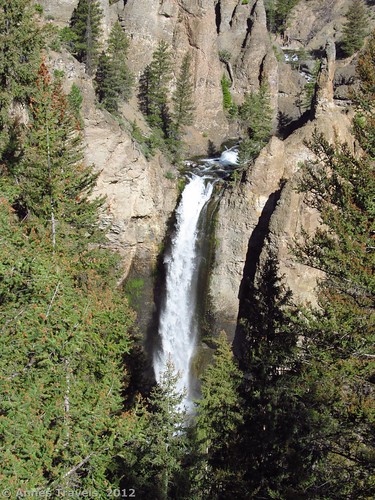
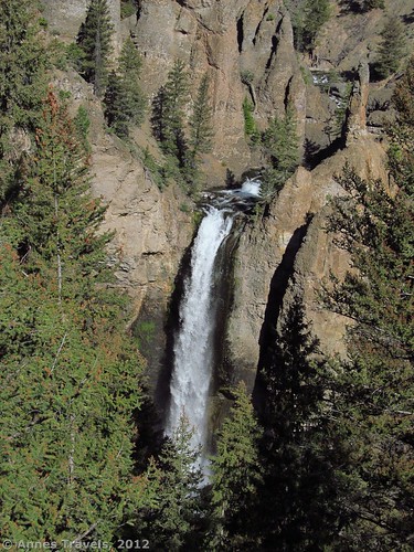
Usually I write about the best I’ve run across while traveling, but sometimes it’s good to include a few places I don’t recommend or only found marginally interesting. It’s not that I don’t recommend Tower Falls (and I’d highly recommend it if they fix the trail to it), but if you’re visiting Yellowstone National Park, there are better ways to spend your time. The trail to the viewing area is short and sweet, and if that’s all you want, great. However, if you want a really great view or a longer hike…look elsewhere. There used to be a really nice trail to the bottom of the falls which was terrific: you could stand at the bottom of the falls and look up at it; if the spring rains had swelled the falls, you’d get wet. However, on my most recent visit (July 2012) the park service had closed the trail to the base of the falls. You could still take the trail down to the Yellowstone River, but not to the falls. I’ll talk about the trail to the river, just in case anyone wants to do it.
Getting to Tower Falls
To get to Tower Falls, if you’re coming from the north, drive 2.2 miles (3.5 km) south from the Tower-Roosevelt ranger station/visitor center. The parking area should be on your left and is well-signed. If you’re coming from the south, from the Fishing Bridge, turn right onto US-20. A sign should point toward Tower-Roosevelt. Drive 31.4 miles (50.5 km) to the parking area on your right. Be forewarned, the parking area is fairly small and quite inadequate. I think the park service is working on adding more parking spaces. For the moment, wait until there’s a place to park. Near the parking area are restrooms, water fountains, and a gift shop/snack shop. A map of the park can be found at http://www.nps.gov/yell/planyourvisit/upload/YELLmap1.pdf.
From the parking area, walk past the store and the restrooms along the paved pathway. This path is wheelchair accessible all the way to the falls viewing area. However, there are a few sections that may be a bit steep, so assistance may be required for those on wheels. (You can read more about wheelchair accessible trails in Yellowstone at http://www.nps.gov/yell/planyourvisit/upload/yellaccess2010.pdf.) It’s not far to the viewing area; less than ¼ mile (0.4 km). This part of the trail can be very busy, so stay on your side of the trail and try not to step off of it—there are signs all over the place telling you not to walk on the vegetation.
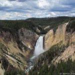
When you get to the viewing area for Tower Falls, go to the far end, near the signs, and look at the top of the falls. It’s quite impressive, but would be more so if you could see it all the way to the bottom. Enjoy it for a moment—maybe snap some pictures—and then move away so others can enjoy it…as you would expect with a crowed parking lot, there are plenty of people who want to get a glimpse of it.
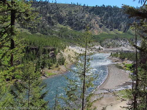
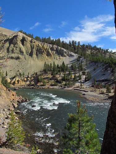
Now you have a choice to make. Over near where the trail widens into the viewing area, on the right side (as you walking towards the viewing area) there is a well-defined, well-maintained trail that heads downwards. When I was there, a sign informed me that the trail was closed part way down. In reality, the trail wasn’t closed until you were nearly at river level, and even at that point there was a viewing area (though not of the falls). If you want to get down to the Yellowstone River, this is a good trail to take. It’s also good if you want a short but very steep downhill and then uphill trek—the entire trail, from the parking area to the river, is 1 mile (1.6 km) round trip.
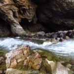
If you decide to take this trail, start down the trail. It switchbacks quickly downwards. The trail is quite dusty, but otherwise in very good condition. Eventually, you’ll come to a place where the trail used to go in two directions, left and right. The left fork is now closed with a fence across it. This led to the bottom of the falls. A sign says that the trail is closed for safety hazards, but I wonder if they’ll ever reopen it…I couldn’t see any sign of a trail! To the right is a viewing area where you can see the Yellowstone River, a stone’s throw away. If you treat this like a switchback and follow the well-defined social trail, you can get down to a pebbly beach on the river’s edge. Return by the way you came. The trail is fairly steep to climb back up, but it’s only about ¾ mile (1.2 km), so it doesn’t last forever…even if it feels like it on a hot summer day!
Round Trip Trail Length: ¼ mile to 1 mile (0.4 km to 1.6 km)
Facilities: Store, restrooms, snack bar, interpretive signs
Fees: $25 per vehicle, good 7 days and valid for entry to both Yellowstone and Grand Teton National Parks. Interagency (America the Beautiful), Senior (Golden Age), Access (Golden Access), Volunteer, Military, and Annual passes also accepted.
Trail 


Road 


Signs 


Scenery 


Would I go 100 miles out of my way for this? 


Overall Rating: 


This Week’s Featured Product!
Yellowstone is bear country. Although you’re not likely to run into a bear on the paved part of this trail, you could easily run into one closer to the river or on almost any of the less-crowded trails in the park. Be prepared; you can’t get this spray in hardware stores except near the park, and there, you’ll end up paying a pretty penny for it. Also, this comes with a hip holster – bears take only seconds to charge, so having it handy (in other words, on your hip instead of in a backpack) could mean survival. I don’t like being in bear country without it.

We’re a congregate of volunteers and opening a pristine proposal in our community. Your web site offered us with beneficial information. You’ve performed an impressive duty and our whole group will doubtless ensue thankful to you.
Thank you for this blog post, it was just what I was searching for. There is so much information here, so I thank you so much for enlightening my mind.