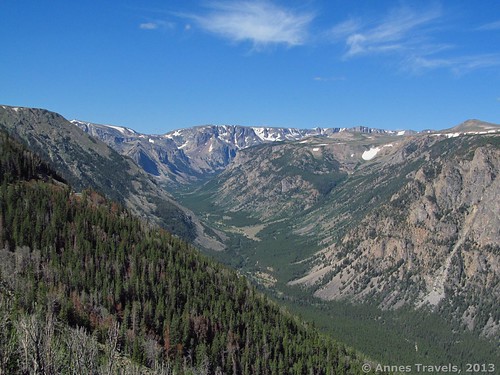
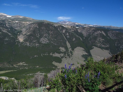
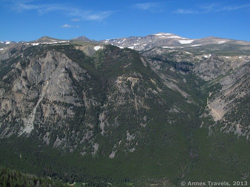
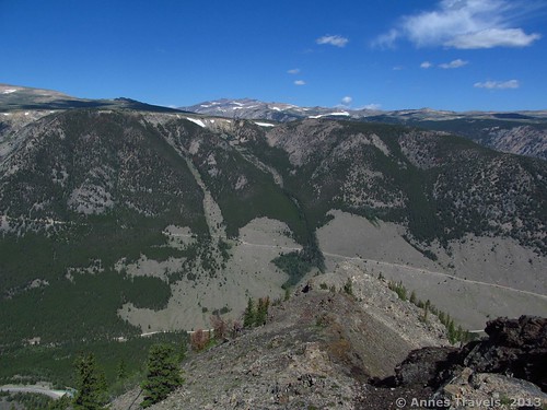
Vista Point, on the Beartooth Highway, is truly a great place to be. Especially if you’re coming from the east, this is your introduction to the Beartooth area, and it’s a great one! The views are spectacular—into the valley, across to the Hellroaring Plateau, and on to the mountains around Beartooth Pass. You can even see the road that accesses the Hellroaring area climbing the cliff on the other side of the valley. It looks exciting even from here, even though it’s much worse in real life. One of the best parts is that it’s not a long walk—in fact, you barely have to get out of your vehicle to get the nice views, although there is a wheelchair-accessible pathway that leads you out to the point itself. Still, the views from near the parking area are so good that we missed the path altogether the first time we visited!
Once you’ve arrived at the Vista Point parking area, the hardest thing will likely be to find somewhere to park. The good thing is that the trail isn’t long, so if the parking spaces are full, keep driving in circles for a minute or two, and one should open up. There are spaces along the edges for normal-sized vehicles, and several in the middle for over-sized vehicles (campers, for example, and vehicles with trailers). Find a parking spot, and then head over to the railing on the road side of the parking area (away from the restrooms). This is where you’ll get your first good view. As I said above, it was so good that the first time we visited, we didn’t realize that there was a trail to another viewing area! If you’re only up to this much, you won’t miss too much, because the view from the point itself is fairly similar.
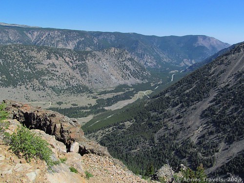
The view is quite awesome. You can see the road leading up to the Hellroaring Plateau and, over the ridge a bit, Mount Rearguard. (We’d climbed that the day before, so it was a bit exciting to us! If you’re planning on doing both, do Rearguard first, and then Vista Point—so you can gape at where you were the day before and ask, “Did I really do that?!?”) You can also see over towards the Beartooth Plateau, over to your left. To your right is the valley that leads towards Red Lodge. It’s also quite exciting to look down at the switchbacks you’ve just come up if you came from Red Lodge, or that you’ll be soon going down if you came from Yellowstone. We also saw a huge smiley face someone had made out of rocks on the floor of the valley—very cute! A river runs down the valley, so that’s pretty, too.
The path to Vista Point itself begins near the rest rooms, and isn’t long—less than 0.25 miles (0.5 km). It’s wheelchair accessible, so it’s also passible by strollers. The path tends to be fairly busy, with plenty of people heading out to the point. Although the views are very similar, the one thing you’ll see from the path that you won’t see from the parking area is the canyon that will be on your right as you walk. It’s not very exciting, but there is a pretty stream with a rip or waterfall in it. The viewpoint itself has nice, strong railings, because you’re a long way up, and the drops are nearly sheer.
Return to your vehicle the way you came. Vista Point may not be worth more than 15-30 minutes, but it’s still a great stop with some really nice views that I wouldn’t want to miss.
Key GPS Coordinates for Vista Point
Vista Point Parking Area: 45.043141 N / -109.407215 W (45N 2’ 35.307” / -109W 24’ 25.9734”)
Vista Point: 45.045306 N / -109.407628 W (45N 2’ 43.101” / -109W 24’ 27.4608”)
Getting to Vista Point
To get to Vista Point, from Red Lodge drive 20 miles west on US 212 (Beartooth Highway). You’ll ascend most of the initial switchbacks; the point is located on the end of one of these. There is a medium-size parking area that is usually full, as well as primitive restrooms. The Beartooth Highway is closed much of the year, so check before you go to make sure it’s open (usually in the later summer months). Vista Point is also located 4.5 miles east of the Montana-Wyoming boarder along US 212—note that if you’re coming from the west, the highway will cross from Wyoming to Montana, back into Wyoming, and then into Montana again. The mileage is from the last of these border crossings.
Round Trip Trail Length: 0-less than 0.5 miles (1 km)
Facilities: Primitive restrooms (these are the last you’ll see for quite a while…so you might want to use them…)
Fees: None
Trail 


Road 


Signs 


Scenery 


Would I go 100 miles out of my way for this? 


Overall Rating: 


This Week’s Featured Product!
Love scenic drives? Featuring well-known roads and some off-the-beaten-path roadtreks, this book showcases 300 scenic drives from all across the US (and the Beartooth Highway is included!). Detailed maps, photographs, and mile-by-mile commentary keep it interesting – from Maine to California.




Once you’ve arrived at the Vista Point parking area, the hardest thing will be…leaving. You’ll want to just stand there and gawk for the rest of the day
Hi Jaddis,
It’s so true! I’ve spent an hour or more looking at the view and the only thing that made me move on was that I had hikes planned further up the road.
Anne
Pingback: Beautiful Views atop Beartooth Highway
Pingback: 11 Amazing Trails of the West that are 1 Mile (or Less) in Length
Pingback: Top of the World Views on the Beartooth Highway