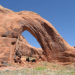
There’s no trail to Wildhorse Window in Utah’s San Rafael Swell. But it’s also not that difficult to find. If you follow the social trail/cairns/logic up to the arch, you’ll be treated to an alcove with a large hole in the roof, not to mention some nice views along the way. The entire route is only a couple of miles RT, but it seems longer, and you can easily tack on a mild adventure in Wildhorse Canyon if you want to.
Quick Stats
Our hike began in the afternoon. We’d driven down from Salt Lake City, ate lunch, and then parked on the top of the bluff. It’s a very scenic spot, and a few people were dispersed camping nearby.
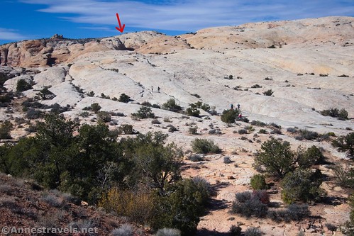
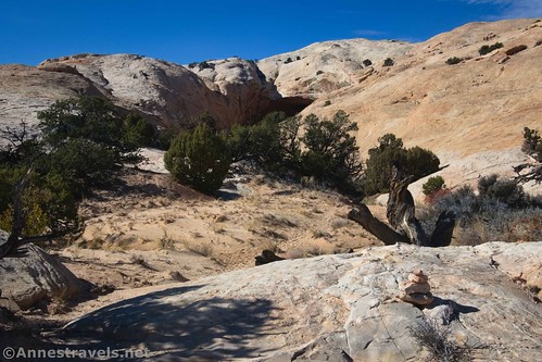
We found a reasonably obvious trail down and then up and over a desert rib in the desert, following sparsely-spaced cairns. I have no idea if these are official or just placed there by other hikers. Either way, between that and the trail (plus a knowledge of where windows like this usually hang out), we were able to make our way out to the slickrock.
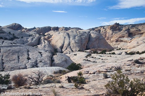
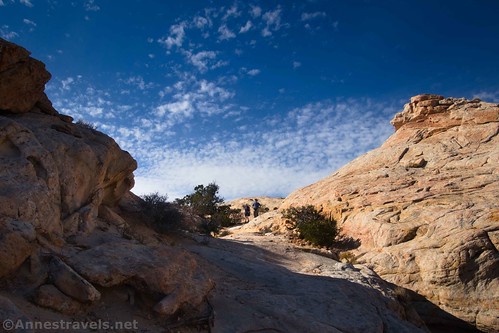
Once on the slickrock, you just have to know where you’re going. The terrain more or less takes you to the right place (the window is right above a watercourse). If in doubt, stay close to (but not right on top of) the rim of Wildhorse Canyon (on your left). Usually, there is a large rib of rock between you and the rim of the canyon.
As we climbed higher, we found some puddles in the watercourse. The reflections were very nice.
The watercourse twists a little through the walls of slickrock and finally deposits you in a small bowl below two alcoves. The one on the right houses Wildhorse Window.
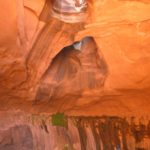
It’s a scramble (but not a hard one!) to get into the right alcove to stand below Wildhorse Window. The desert varnish is part of what makes this so impressive. Wow!
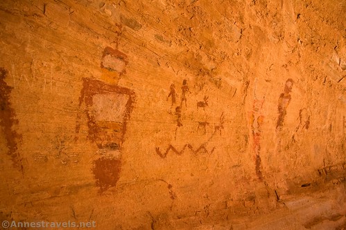
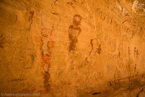
Over on the right side of the alcove (if you’re facing into the alcove), there is some rock art. I’ve heard that it was created by vandals in 2004, but I have no definite proof of this. Some people who visited in 2004 and before remember it not being there, but I’ve yet to see photographic evidence.
A couple of things are sure: 1) the colors and style are different from most of the artwork in the area, and 2) at the rate it is deteriorating, it’s very unlikely that it could have lasted several hundred years. So all that to say that it’s interesting, but make sure you don’t vandalize the rocks by making your own! (It’s illegal, in case you didn’t know…)
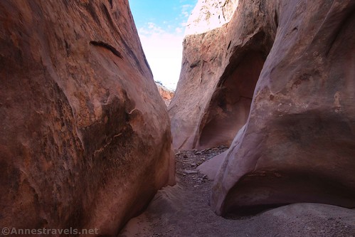
On our way back down, I decided to check out Wildhorse Canyon. This is not the same wash as the famous Little Wildhorse Canyon (which is further down the road). It’s also not as pretty as Little Wildhorse Canyon. But if you want an easy, not-too-narrow slot canyon experience with very few people, this is a good one to go for.
I took the path back from Wildhorse Window, then struck off right (down) shortly before the parking area. It took a couple of tries, but I was able to drop into Wildhorse Canyon – note that the further from the highway you get, the more sheer and taller the walls of Wildhorse Canyon become. So you’re better off straying toward the highway before trying to descend into the canyon.
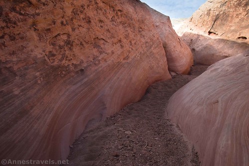
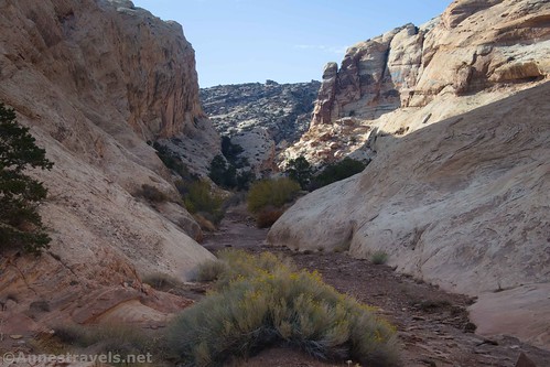
Once in the canyon bottom, walk upstream. Wildhorse Canyon has a few short sections of narrows and quite a few interesting sets of rocks.
Some of those narrows are definitely narrow! But they’re not long, and often the top (where your head would be) is a lot wider than where your feet are walking. Helpful hikers sometimes toss rocks into the low areas where water collects after rain.
I walked half a mile before turning around. I hear that the canyon is a total of 4.4 miles one way, but that the final mile is open to vehicles. There is also a slot along the way that will likely require an easy bypass on the left due to choke stones. If you make it to the upper canyon, be sure to look for a couple of arches.
And that’s it! With half a mile (total) in Wildhorse Canyon, the entire hike came to 3.5 miles RT. Not bad for a minor afternoon hike!

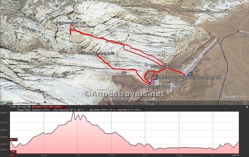
Round Trip Trail Length: 2.0 to Wildhorse Window and back. Adding in Wildhorse Canyon (for half a mile up and half a mile back), I went 3.5 miles.
Elevation Gain: 881ft. (5,192ft. to 5,592ft.) (I expect this is slightly inflated due to low GPS signal in the alcove below the arch.)
Facilities: None. You can free-range camp, though, as long as you stay in a site with a fire ring (no camping at the trailhead).
Fees: None as far as I can tell. The trailhead was added to Goblin Valley State Park in 2022, but the window is still on BLM land.
Trail Notes: There is no trail, nor is this a stroll in the park. You should be very used to navigating across slickrock and in the desert before you attempt this hike. Don’t try this hike if it’s raining (flash floods could come down the watercourse or down Wildhorse Canyon) or if rain is in the forecast. Be sure to leave everything as you found it!
Trail 


Road 


Signs 


Scenery 


Would I go 100 miles out of my way for this? 


Overall Rating: 


GPS Coordinates for Wildhorse Window & Wildhorse Canyon
TH: 38.6474980°, -110.6627790° (38°38.84988′, -110°39.76674′ / 38°38’50.9928″, -110°39’46.0044″) (5,285ft.) (0.0)
Trail Junction: 38.6484610°, -110.6649450° (38°38.90766′, -110°39.89670′ / 38°38’54.4596″, -110°39’53.8020″) (5,247ft.) (0.17)
Wildhorse Window: 38.6535080°, -110.6764980° (38°39.21048′, -110°40.58988′ / 38°39’12.6288″, -110°40’35.3928″) (5,627ft.) (1.00)
Return to the Trail Junction: 38.6484720°, -110.6648780° (38°38.90832′, -110°39.89268′ / 38°38’54.4992″, -110°39’53.5608″) (5,247ft.) (1.90)
Enter Wildhorse Canyon: 38.6468650°, -110.6670070° (38°38.81190′, -110°40.02042′ / 38°38’48.7140″, -110°40’01.2252″) (5,202ft.) (2.16)
Turn around: 38.6502000°, -110.6729760° (38°39.01200′, -110°40.37856′ / 38°39’00.7200″, -110°40’22.7136″) (5,233ft.) (2.63)
End: 38.6475110°, -110.6627590° (38°38.85066′, -110°39.76554′ / 38°38’51.0396″, -110°39’45.9324″) (5,285ft.) (3.48)
The gpx file for Wildhorse Window and Wildhorse Canyon can be downloaded – please note that this and the GPS Coordinates are for reference only and should not be used as a sole resource when hiking this trail.
Download GPX File size: 65.6 KB Downloaded 267 times
(Note: I do my best to ensure that all downloads, the webpage, etc. are virus-free and accurate; however, I cannot be held responsible for any damage that might result, including but not limited to loss of data, damages to hardware, harm to users, from use of files, information, etc. from this website. Thanks!)
Getting to Wildhorse Window & Wildhorse Canyon
From I-70, take Exit 149 and turn south onto UT-24W. Drive 24.1 miles and turn right, following the sign for Goblin Valley State Park. After 5.2 miles, turn left at a 4-way junction near a sign kiosk (only three of the four roads are paved). Mark your mileage carefully and go 0.4 miles to an unmarked road on the right that becomes dirt almost immediately (there are several roads like this in the area; thus why you want to mark your mileage carefully). Take this dirt road 0.3 miles to a dirt parking area on the rim of the canyon.
The turn toward Goblin Valley State Park is 19.6 miles north of Hanksville via UT-24E.
This Week’s Featured Book!
If you’re looking to explore the history and hikes and drives of the San Rafael Swell, this is the guidebook for you! It’s full of information and options when it comes to exploring. Buy your copy here!


