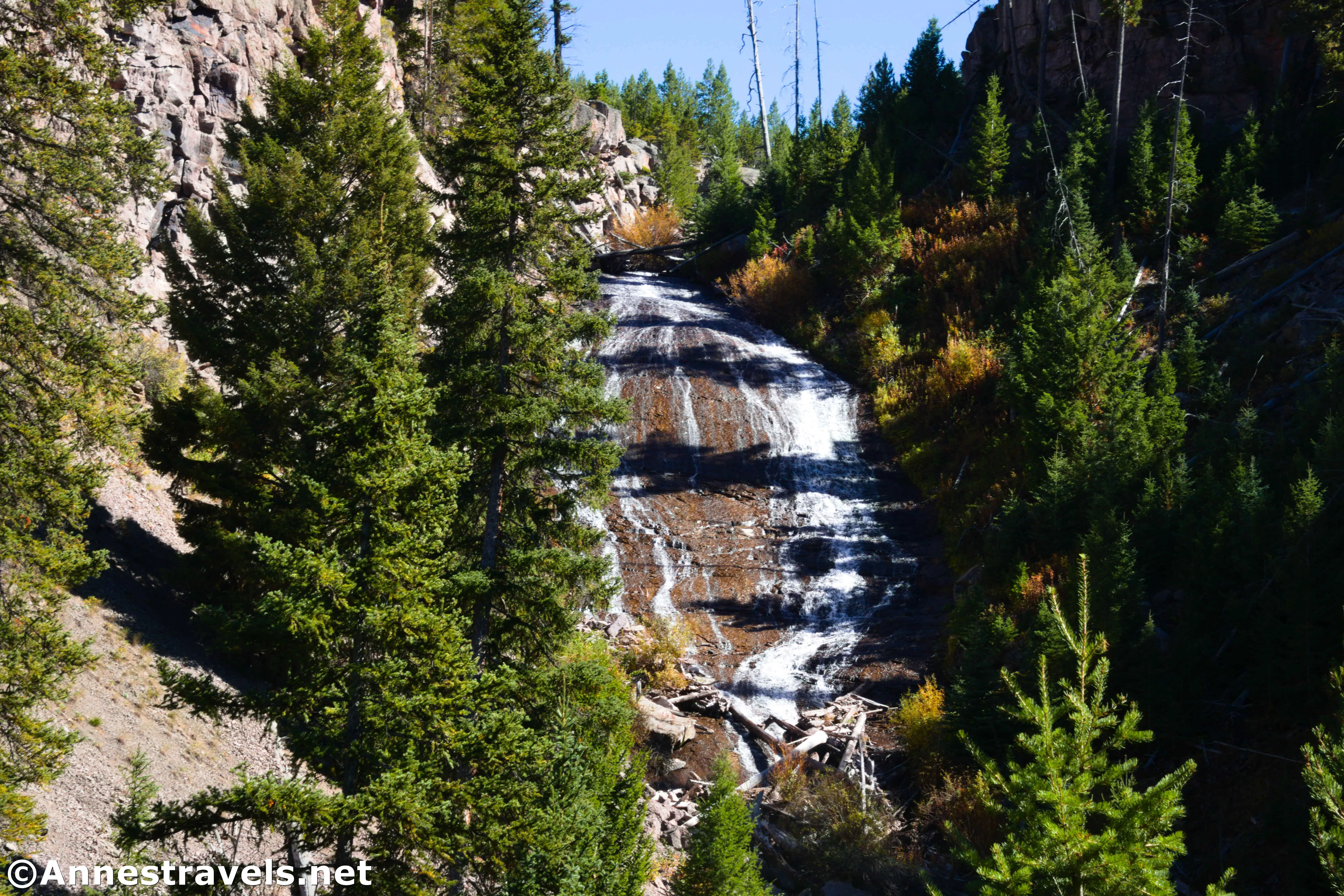
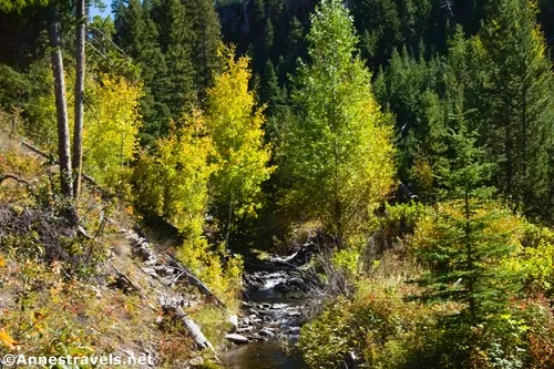
Wraith Falls in the northern part of Yellowstone National Park is a mostly-overlooked little gem. It’s not a very long hike, nor is the waterfall the most impressive in the park, but it is pretty and fairly un-hiked as trails in Yellowstone go. (Which means that you’ll probably see other visitors, but you might also have the viewpoint to yourself for 20+ minutes, even in the summer.) I was blessed to visit just as the first of the autumn colors were turning (typically early September) – which meant that the flow of the waterfall was low, but the colors made it extra special!
Quick Stats
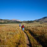
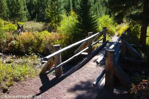
The trailhead is well-marked but fairly unassuming. Follow the path as it heads across the meadow and swings right through thin tree cover. After 0.3 miles, cross the creek on a sturdy bridge and begin a slow switchback up to the viewing area.
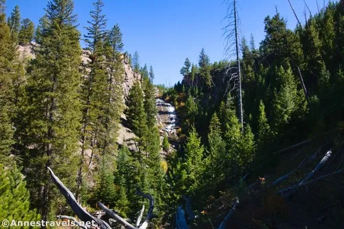
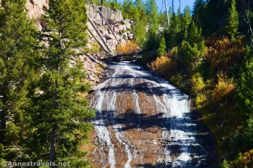
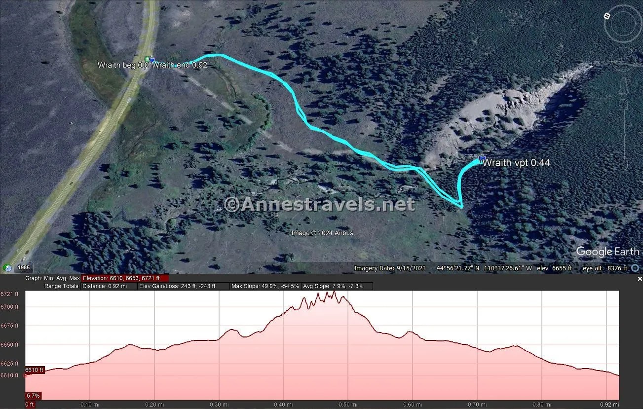
I was a little surprised to arrive so quickly at the end of the trail after 0.45 miles (it’s fenced in, so you’re not going to miss the end). You’re not as close to the waterfall as I would have expected. But you can get a pretty good view, especially if you’re tall (I will admit to scrambling up on rocks – behind the fence; there was nothing illegal about this – because I am not tall!) In mid-September, the flow was minimal but still lacy and pretty.
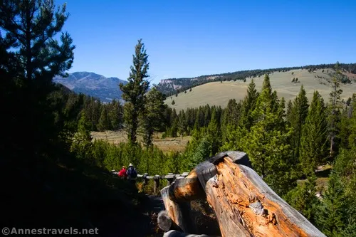
Look back down across the meadows, too. I’m a professional lover of meadows in general, and especially yellow meadows, so this was almost as beautiful to me as the waterfall! (And I love waterfalls, too!)
When you’ve enjoyed the view, retrace your steps to the parking area. It’s not a long trail, but if you happen to be driving the road anyway, it’s well worth a stop!
Round Trip Trail Length: 0.9 miles
Elevation Gain: 243ft. (6,610ft. to 6,721ft.)
Facilities: None
Fees: $35/vehicle, valid 7 days. America the Beautiful National Parks & Federal Lands Passes and Yellowstone Annual Passes are accepted.
Trail Notes: This is a fairly gentle trail, but I wouldn’t try it with a stroller. I’d guess the flow of the creek would be better in the early summer. Because of the angle of the falls, the lighting is probably best in the summer, closer to midday (I was almost too late in the mid-afternoon).
Trail 
![]()
Road ![]()
Signs ![]()
Scenery ![]()
![]()
![]()
Would I go 100 miles out of my way for this? ![]()
![]()
![]()
Overall Rating: ![]()
![]()
GPS Coordinates for Wraith Falls
TH: 44.9422750°, -110.6234520° (44°56.53650′, -110°37.40712′ / 44°56’32.1900″, -110°37’24.4272″) (6,611ft.) (0.0)
Wraith Falls Viewpoint: 44.9375200°, -110.6237600° (44°56.25120′, -110°37.42560′ / 44°56’15.0720″, -110°37’25.5360″) (6,711ft.) (0.44)
End at TH: 44.9422760°, -110.6234470° (44°56.53656′, -110°37.40682′ / 44°56’32.1936″, -110°37’24.4092″) (6,611ft.) (0.92)
The gpx file for the Wraith Falls Trail can be downloaded – please note that this and the GPS Coordinates are for reference only and should not be used as a sole resource when hiking this trail.
Download GPX File size: 17.5 KB Downloaded 65 times
(Note: I do my best to ensure that all downloads, the webpage, etc. are virus-free and accurate; however, I cannot be held responsible for any damage that might result, including but not limited to loss of data, damages to hardware, harm to users, from use of files, information, etc. from this website. Thanks!)
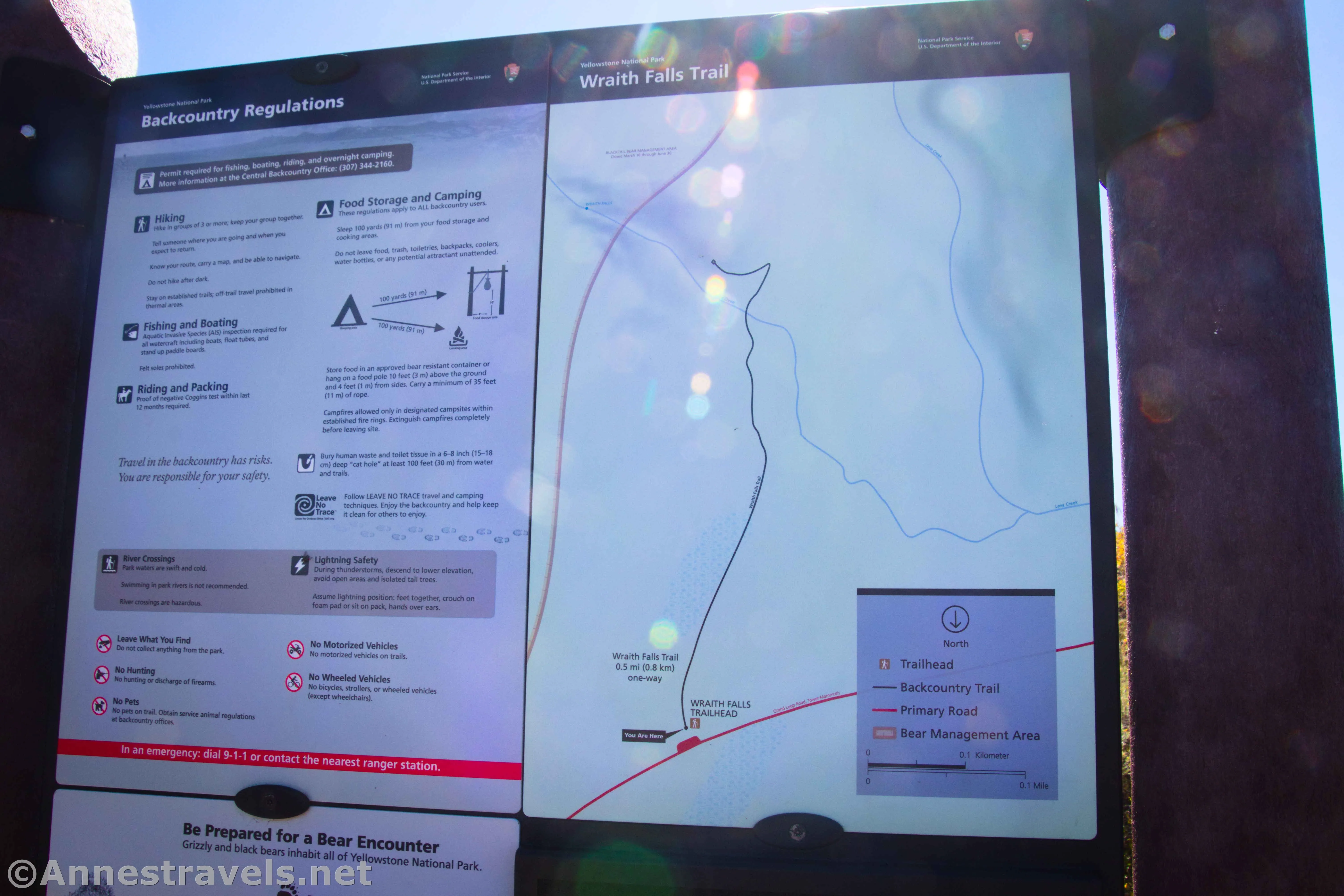
Getting to Wraith Falls Trailhead
From Mammoth, turn south onto Grand Loop Road (signed for Tower). Drive 4.9 miles to the trailhead, on the right.
Or from Tower Junction, head west on the Grand Loop Road (toward Mammoth). The trailhead will be on the left after 13.2 miles.
Today’s Featured Product!
Enjoy the easier hikes of Yellowstone without having to wade through the descriptions of backpacking trips! Even so, you won’t have to compromise on scenery – the trails listed here are some of the best in the park. Buy your copy here.