
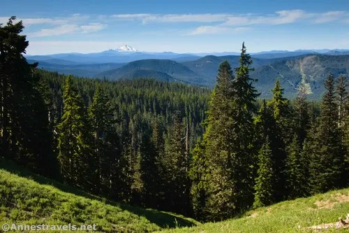
If you’re looking for a hike on the side of Mt. Hood that poses only minor challenges and you want a big reward at the end, I highly recommend the trail to the Zigzag Overlook. While views are limited on the trail to the overlook, you can get some pretty good vistas toward Mt. Jefferson and the Three Sisters to the south as you hike, and you’ll forget about all of those trees the moment your crest the ridgeline and look up Zigzag Canyon. Plus the road to the trailhead is paved. How great is that in a land where it seems most of the roads are unpaved in one capacity or another?
Quick Stats
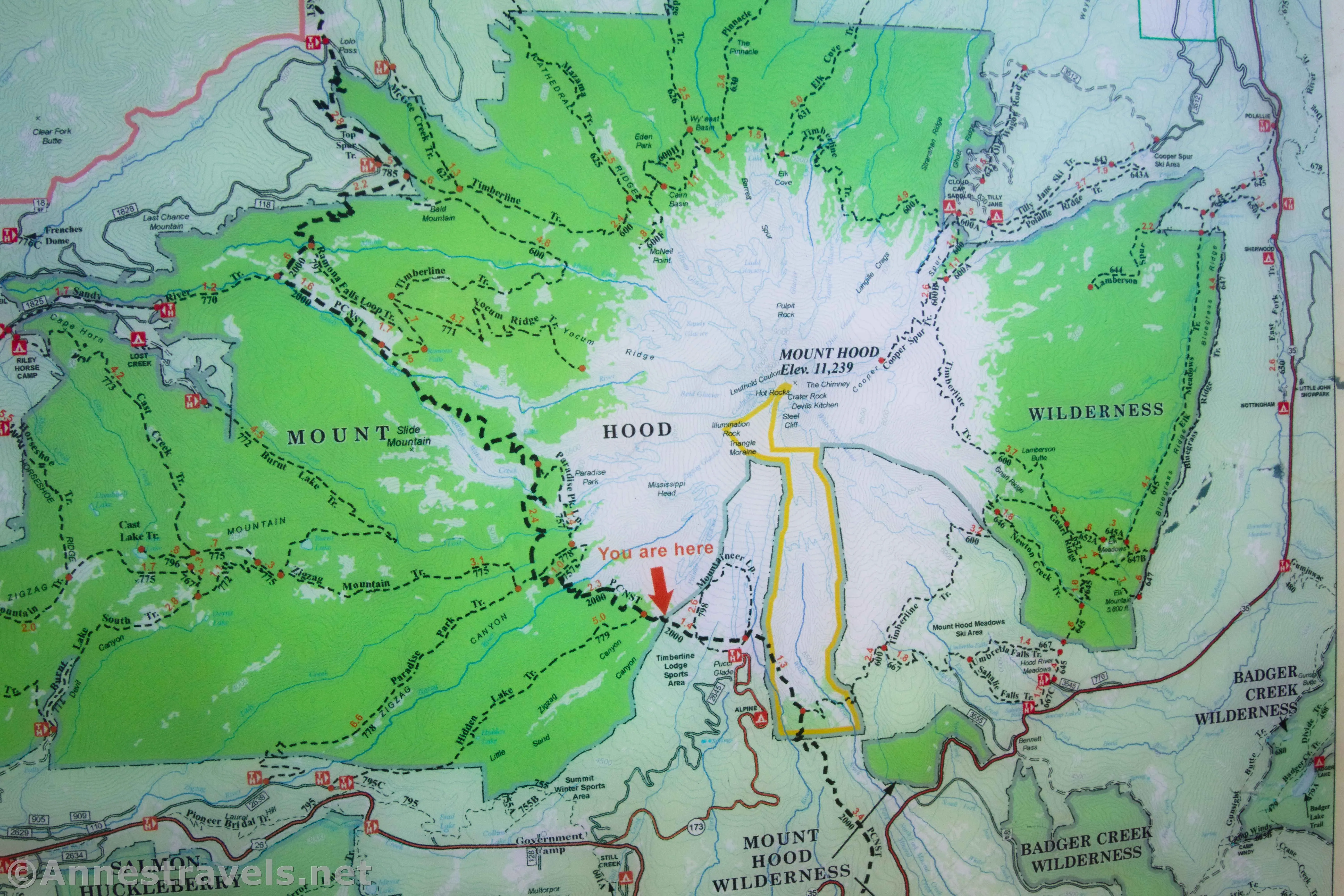
To get to the Zigzag Overlook, you’ll start at the Timberline Lodge and follow the Pacific Crest Trail, which at this point is also part of the Timberline Trail. I saw several people thru-hiking the Timberline and maybe one or two thru-hiking the PCT. The number of long-distance hikers you see will depend on the time of year, though the Timberline Trail is fairly popular year-round.
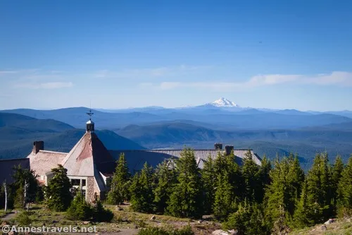
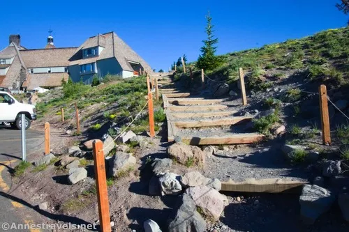
The trailhead is the PCT trailhead to the right of the Timberline Lodge. It’s not overtly advertised, but it’s also hard to miss. Head up the stairs, then don’t turn right, but instead continue straight up the path and then up the road. When the PCT leaves the road, it’s at a well-signed junction on the left. Breathe a sigh of relief – this is one of the most difficult areas to navigate simply due to the number of trails, roads, etc. that are very confusing.
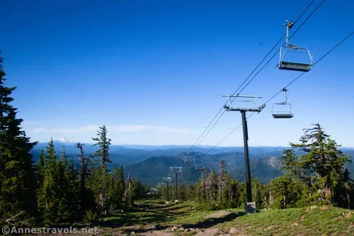
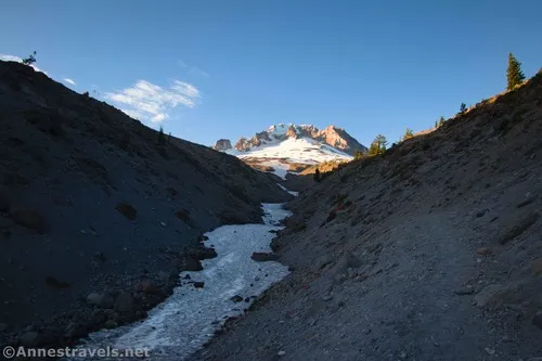
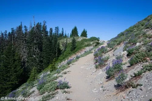
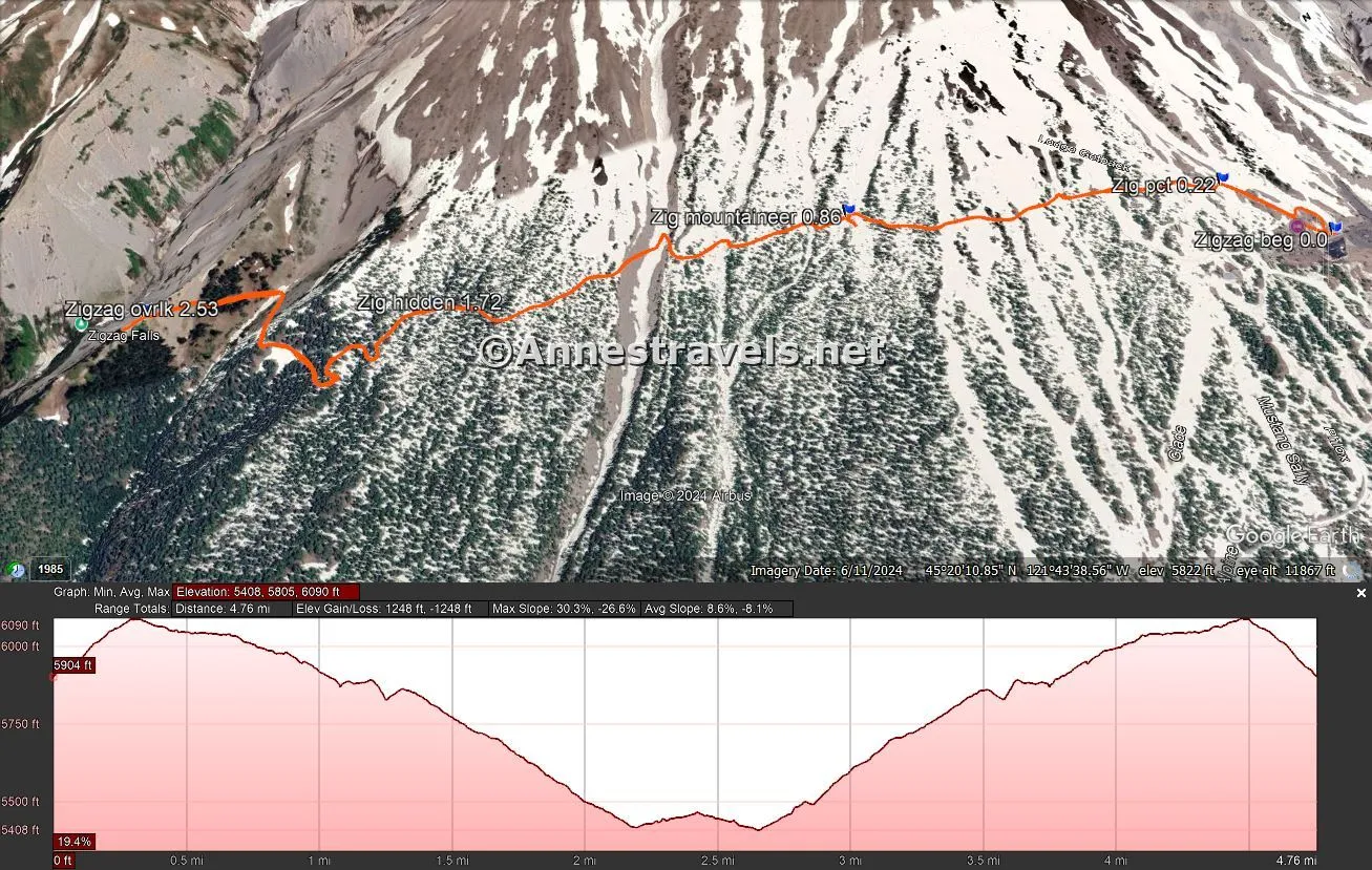
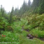
The path winds its way through stands of trees and alpine slopes, passing under two separate chair lifts. After this, the small gullies and deep forest can harbor snow late into the summer season – in mid-July, the snow this year was easily navigable in the few places where it still touched the trail. In heavy snow years, it’s not uncommon for the trail to still have snow in August. Pass by the Mountaineering Trail (No. 798) on the right and left at mile 0.8 (an old foundation is near here), drop down into Little Zigzag Canyon at mile 1.25, and then pass the Hidden Lake Trail on the left at mile 1.7. Be sure to sign in at the kiosk, too, for your free-but-required wilderness permit.
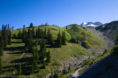
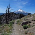
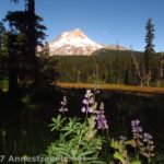
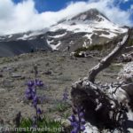
After this, the trail breaks out into a meadow where the trail is a ribbon along the hillside. It then rises up to the ridgeline that is the Zigzag Overlook at mile 2.5. The overlook is not marked, but it’s also pretty obvious, since the trail seems to split three ways – one goes right up the ridgeline (not the one you want), the other goes left and splits in two: the right path goes up a short distance to a small viewpoint (the views were better from below IMO), and left begins descending toward Zigzag Creek – if the trail begins to switchback steeply down the hillside in a thick forest, you know you’ve gone too far.
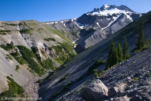
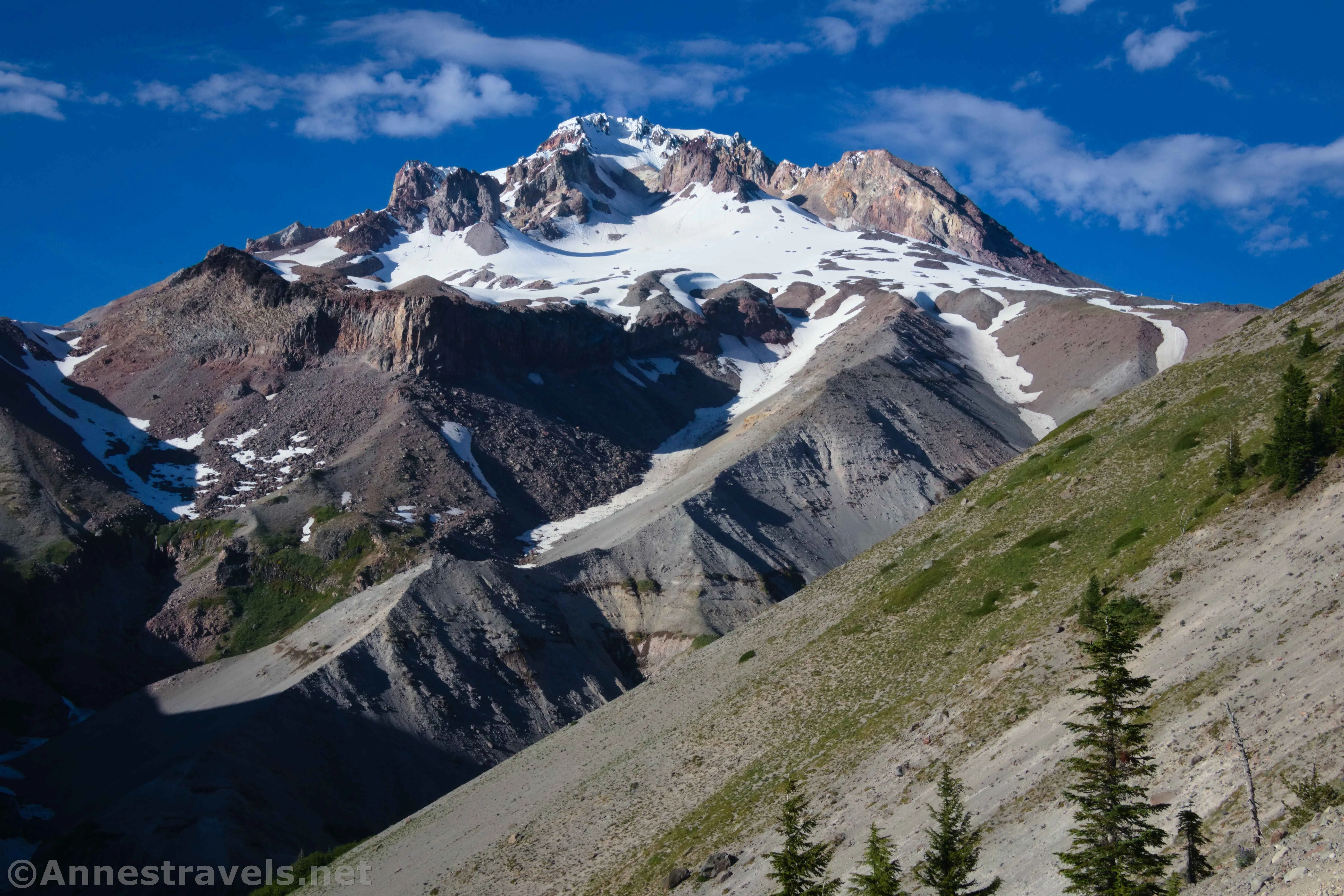
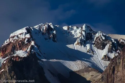
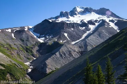
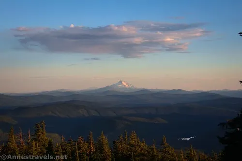
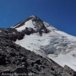
The views from the Zigzag Overlook are spectacular. I saw it in the (fairly) early morning and the (very) late afternoon (ok, it was undeniably evening even if we hadn’t eaten supper yet), and both hours had great lighting. So this is pretty much a fantastic place to visit no matter the time of day!
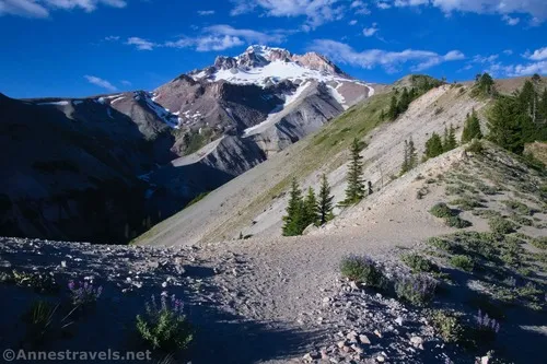
From this vantage point, you’re looking up Zigzag Canyon to the southwestern slopes of Mt. Hood. Different faces of Mt. Hood are more or less spectacular, and this was one of the best (though McNeil Point’s face is also quite nice). Before the… Oh, I think it was the 1960s… Zigzag Canyon had many more zigzags. Then a flood came through and washed out the canyon, making it much straighter than before.
When you’ve finished looking at the views, retrace your steps to the trailhead… or continue down the steep descent (and steep ascent) to Zigzag Creek or even all of the way to Paradise Park!
Round Trip Trail Length: 5.0 miles
Elevation Gain: 1,248ft. (5,408ft. to 6,090ft.)
Facilities: Restrooms in the ski lodge (it was open in the morning but not by the time we returned that evening). The ski lodge also has a snack bar and other amenities.
Fees: None
Trail Notes: Early in the season, be prepared for snow on the trail. The drop into Little Zigzag Canyon makes the path much more difficult than it would be otherwise. If I had to pick the “best” time of day, I’d say late afternoon or evening. Besides the western sun on Mt. Hood, the views south to Mt. Jefferson are amazing in the sunset. The Timberline Lodge parking area is quite large; be sure to follow any signs about hiker parking that might appear, especially if you’re parking overnight (camping in the parking lot – even in your vehicle – is not permitted).
Trail 
![]()
![]()
Road
Signs ![]()
Scenery
Would I go 100 miles out of my way for this? ![]()
Overall Rating: ![]()
GPS Coordinates for the Zigzag Overlook
TH: 45.3307610°, -121.7095770° (45°19.84566′, -121°42.57462′ / 45°19’50.7396″, -121°42’34.4772″) (5,905ft.) (0.0)
PCT: 45.3328520°, -121.7112740° (45°19.97112′, -121°42.67644′ / 45°19’58.2672″, -121°42’40.5864″) (6,043ft.) (0.22)
Mountaineering Trail: 45.3361590°, -121.7218830° (45°20.16954′, -121°43.31298′ / 45°20’10.1724″, -121°43’18.7788″) (5,984ft.) (0.86)
Hidden Lake Trail: 45.3386700°, -121.7338390° (45°20.32020′, -121°44.03034′ / 45°20’19.2120″, -121°44’01.8204″) (5,716ft.) (1.72)
Zigzag Canyon Overlook: 45.3422740°, -121.7411140° (45°20.53644′, -121°44.46684′ / 45°20’32.1864″, -121°44’28.0104″) (5,455ft.) (2.53)
The gpx file for the Zigzag Overlook can be downloaded – please note that this and the GPS Coordinates are for reference only and should not be used as a sole resource when hiking this trail.
Download GPX File size: 30.6 KB Downloaded 266 times
(Note: I do my best to ensure that all downloads, the webpage, etc. are virus-free and accurate; however, I cannot be held responsible for any damage that might result, including but not limited to loss of data, damages to hardware, harm to users, from use of files, information, etc. from this website. Thanks!)
Getting to the Zigzag Overlook Trailhead
From Government Camp, Oregon, head east on US-26. Take the first left after the rest area toward the Timberline Lodge. The road is steep but paved as it winds 4.9 miles up into the mountains. Near the lodge, turn left into the large parking area.
From the east, the turn right toward Timberline Lodge is 2.5 miles from where OR-35 merges with US-26 and/or 40.6 miles south and west (via OR-35 and US-26) of Hood River (I-84 Exit 64).
Today’s Featured Product!
This guide is a unique twist – instead of highlighting trails in a specific park, it goes after hiking opportunities within 60 miles of Porland, Oregon. This includes a generous section on Mt. Hood as well as the Columbia Gorge, the nearby coast, and Mt. St. Helens. Buy your copy here.


Pingback: Exploring Paradise Park and Beyond – Anne's Travels